Tocht Mountainbike Dallon - pays de ham - Photo
 alainwald
alainwald

Gebruiker

© OpenStreetMap contributors
Lengte
Lengte
56 km
Max. hoogte
Max. hoogte
98 m
Positief hoogteverschil
356 m
Km-Effort
Km-Effort  
61 km
Min. hoogte
Min. hoogte
58 m
Negatief hoogteverschil
357 m
Boucle
Boucle
Ja
Datum van aanmaak :
2021-07-11 12:31:51.101
Laatste wijziging :
2021-07-14 10:11:05.612

(0 Bericht)

Mountainbike
Mountainbike
4h21
Moeilijkheid : Heel gemakkelijk

Scan deze QR-code om de tocht te openen in de SityTrail-applicatie

Gratisgps-wandelapplicatie

Logo SityTrail SityTrail

IGN / Geografische instituten

SityTrail uit de App Store downloaden SityTrail uit Google Play downloaden

Logo SityTrail SityTrail World

De wereld gaat voor u open

SityTrail uit de App Store downloaden SityTrail uit Google Play downloaden SityTrail op Huawei AppGallery downloaden

Over ons

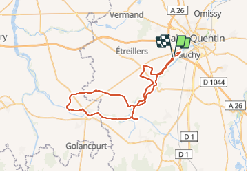
Tocht Mountainbike van 56 km beschikbaar op Hauts-de-France, Aisne, Dallon. Deze tocht wordt voorgesteld door alainwald.
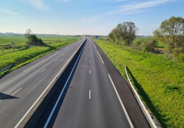
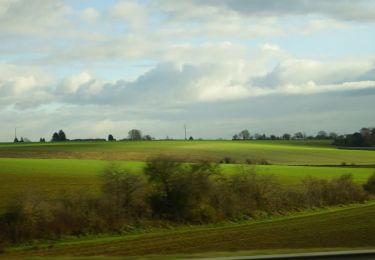
Beschrijving

plutôt plat.
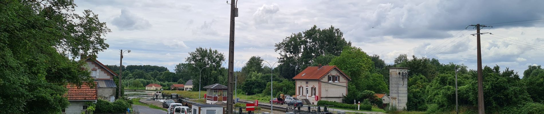
passage le long du canal de la D56 à Ham pour baroudeur uniquement. Pour les autres prendre la départementale jusque Dury.

Hoogteprofiel

Foto's

Plaatsbepaling

Land:
France
Regio :
Hauts-de-France
Departement/Provincie :
Aisne
Gemeente :
Dallon
Locatie:
Unknown
Vertrek:(UTM)
517587 ; 5518847 (31U) N.

Wandeltochten in de omgeving

Tocht Mountainbike Holnon - Les sentiers vermandois - Holnon - Photo
Mountainbike
tracegps

Mountainbike

Medium
(1)
Holnon, Hauts-de-France, Aisne, France
26 km | 30 km-effort
2h 19min
Ja
Tocht Mountainbike Castres - Parcours fontaines les clercs - Photo
Mountainbike
alainwald

Mountainbike

Gemakkelijk
Castres, Hauts-de-France, Aisne, France
52 km | 57 km-effort
4h 14min
Ja
Tocht Stappen Urvillers - parcours urvillers moy de l'aisne - Photo
Stappen
alainwald

Stappen

Gemakkelijk
Urvillers, Hauts-de-France, Aisne, France
21 km | 23 km-effort
3h 55min
Ja
Tocht Stappen Saint-Quentin - Le marais d'Isle - Photo
Stappen

Stappen

Heel gemakkelijk
Saint-Quentin, Hauts-de-France, Aisne, France
5,4 km | 6 km-effort
Onbekend
Ja
Tocht Stappen Saint-Quentin - Parc d'isle - Photo
Stappen
JJDOLLE

Stappen

Heel gemakkelijk
Saint-Quentin, Hauts-de-France, Aisne, France
5,9 km | 6,5 km-effort
1h 40min
Ja
Tocht Stappen Saint-Quentin - Du canal au chemin de fer - Saint-Quentin - Photo
Stappen
tracegps

Stappen

Medium
Saint-Quentin, Hauts-de-France, Aisne, France
7,2 km | 8,3 km-effort
2h 0min
Ja
Tocht Stappen Seraucourt-le-Grand - Fontaine - Photo
Stappen
tracegps

Stappen

Medium
Seraucourt-le-Grand, Hauts-de-France, Aisne, France
9,1 km | 9,9 km-effort
2h 30min
Ja
Tocht Stappen Saint-Quentin - La pâturelle - Photo
Stappen
tracegps

Stappen

Zeer moeilijk
Saint-Quentin, Hauts-de-France, Aisne, France
14,6 km | 16,4 km-effort
4h 0min
Ja
Tocht Stappen Saint-Quentin - Le marais d'Isle - Photo
Stappen
tracegps

Stappen

Gemakkelijk
Saint-Quentin, Hauts-de-France, Aisne, France
5,4 km | 6 km-effort
1h 30min
Ja


Sluiten
Mijn abonnementen