Tocht Mountainbike Virton - T2021-07-23-18-16 - Photo

T2021-07-23-18-16

 Pascal L
Pascal L

Gebruiker

© OpenStreetMap contributors
Lengte
Lengte
30 km
Max. hoogte
Max. hoogte
349 m
Positief hoogteverschil
439 m
Km-Effort
Km-Effort  
36 km
Min. hoogte
Min. hoogte
208 m
Negatief hoogteverschil
442 m
Boucle
Boucle
Ja
Datum van aanmaak :
2021-07-24 10:39:20.195
Laatste wijziging :
2022-09-02 08:45:14.109

(0 Bericht)

Mountainbike
Mountainbike
2h29
Moeilijkheid : Medium

Scan deze QR-code om de tocht te openen in de SityTrail-applicatie

Gratisgps-wandelapplicatie

Logo SityTrail SityTrail

IGN / Geografische instituten

SityTrail uit de App Store downloaden SityTrail uit Google Play downloaden

Logo SityTrail SityTrail World

De wereld gaat voor u open

SityTrail uit de App Store downloaden SityTrail uit Google Play downloaden SityTrail op Huawei AppGallery downloaden

Over ons

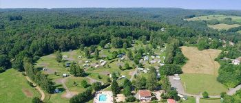
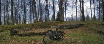
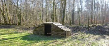
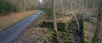
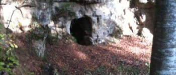
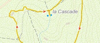
Tocht Mountainbike van 30 km beschikbaar op Wallonië, Luxemburg, Virton. Deze tocht wordt voorgesteld door Pascal L.

Beschrijving

Balade VTT - Rabais avec Terence Egor Vlad

Hoogteprofiel

Foto's

POI's

POI Virton - Camping la Colline - Photo
Pascal L
POI Virton - La Vierge Jacques - Photo
Pascal L
POI Virton - Château de Laclaireau - Photo
Pascal L
POI Virton - Croix Renson - Photo
Pascal L
VIRTON 
POI Virton - Le repaire des Zigomars - Photo
Pascal L
POI Virton - Trou des fées - Photo
Pascal L
POI Virton - grotte de montourdon - Photo
legaumais
POI Virton - Le Châtelet à Ethe - Photo
Pascal L
POI Virton - Ruisseau du Cron - Photo
Pascal L
POI Virton - Le Sentier des Songes - Photo
Pascal L

Plaatsbepaling

Land:
Belgium
Regio :
Wallonië
Departement/Provincie :
Luxemburg
Gemeente :
Virton
Locatie:
Virton
Vertrek:(UTM)
682892 ; 5494557 (31U) N.

Wandeltochten in de omgeving

Tocht Stappen Virton - RB-Lu-17_Ethe_via-var-1-et-2-et-3 - Photo
Stappen
PRO

Stappen

Heel gemakkelijk
(3)
Virton, Wallonië, Luxemburg, Belgium
29 km | 35 km-effort
7h 33min
Ja
Tocht Mountainbike Virton - T2019-06-16-16-47 - Photo
Mountainbike
Pascal L

Mountainbike

Gemakkelijk
(1)
Virton, Wallonië, Luxemburg, Belgium
21 km | 26 km-effort
1h 40min
Ja
Tocht Stappen Virton - GAUME Balade  naturelle et historique - Photo
Stappen
julucasi

Stappen

Heel gemakkelijk
(1)
Virton, Wallonië, Luxemburg, Belgium
5,2 km | 6,8 km-effort
1h 16min
Ja
Tocht Te voet Virton - La Bajocienne - Photo
Te voet
GUIDE+

Te voet

Gemakkelijk
(1)
Virton, Wallonië, Luxemburg, Belgium
11 km | 14,5 km-effort
3h 17min
Ja
Tocht Te voet Virton - Chenois-Latour - Agrarische wandeling -  dorpen, appels en klein fruit - Photo
Te voet
GUIDE
DUPONT Rita

Te voet

Gemakkelijk
Virton, Wallonië, Luxemburg, Belgium
6,4 km | 7,7 km-effort
1h 45min
Ja
Tocht Stappen Virton - RB-Lu-17_Ethe_via-racc - Photo
Stappen
PRO

Stappen

Heel gemakkelijk
Virton, Wallonië, Luxemburg, Belgium
15,6 km | 19,3 km-effort
4h 8min
Ja
Tocht Stappen Virton - RB-Lu-17_Ethe - Photo
Stappen
PRO

Stappen

Heel gemakkelijk
Virton, Wallonië, Luxemburg, Belgium
22 km | 28 km-effort
5h 55min
Ja
Tocht Mountainbike Virton - Autour de Tintigny  -  Balade_VTT_54Kms - Photo
Mountainbike
Pascal L

Mountainbike

Zeer moeilijk
Virton, Wallonië, Luxemburg, Belgium
54 km | 64 km-effort
4h 25min
Ja
Tocht Mountainbike Virton - Monquintin  -  Balade_VTT_22Kms - Photo
Mountainbike
Pascal L

Mountainbike

Medium
Virton, Wallonië, Luxemburg, Belgium
22 km | 26 km-effort
1h 48min
Ja


Sluiten
Mijn abonnementen