Tocht Mountainbike Épaney - Les chemins du Minerai - Epaney - Photo

Les chemins du Minerai - Epaney

 tracegps
tracegps

Gebruiker

© OpenStreetMap contributors
Lengte
Lengte
69 km
Max. hoogte
Max. hoogte
236 m
Positief hoogteverschil
842 m
Km-Effort
Km-Effort  
80 km
Min. hoogte
Min. hoogte
72 m
Negatief hoogteverschil
840 m
Boucle
Boucle
Ja
Datum van aanmaak :
2014-12-10 00:00:00.0
Laatste wijziging :
2014-12-10 00:00:00.0

(0 Bericht)

Mountainbike
Mountainbike
3h30
Moeilijkheid : Medium

Scan deze QR-code om de tocht te openen in de SityTrail-applicatie

Gratisgps-wandelapplicatie

Logo SityTrail SityTrail

IGN / Geografische instituten

SityTrail uit de App Store downloaden SityTrail uit Google Play downloaden

Logo SityTrail SityTrail World

De wereld gaat voor u open

SityTrail uit de App Store downloaden SityTrail uit Google Play downloaden SityTrail op Huawei AppGallery downloaden

Over ons

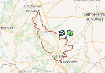
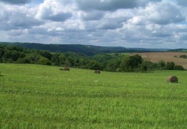
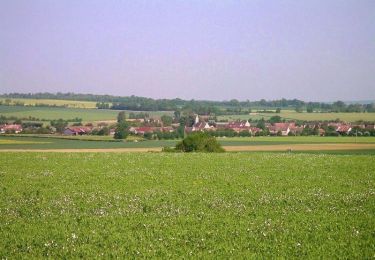
Tocht Mountainbike van 69 km beschikbaar op Normandië, Calvados, Épaney. Deze tocht wordt voorgesteld door tracegps.

Beschrijving

Parcours accessible à tous, au départ d'Epaney. Quelques passages en plaine après Potigny, pas très agréables à faire lorsque le vent est de face.

Hoogteprofiel

Foto's

Plaatsbepaling

Land:
France
Regio :
Normandië
Departement/Provincie :
Calvados
Gemeente :
Épaney
Locatie:
Unknown
Vertrek:(Dec)
Vertrek:(UTM)
707319 ; 5425541 (30U) N.

Wandeltochten in de omgeving

Tocht Te voet Potigny - Circuit de la Brèche au Diable - Photo
Te voet
PRO

Te voet

Gemakkelijk
Potigny, Normandië, Calvados, France
11,9 km | 14,5 km-effort
3h 18min
Ja
Tocht Te voet Épaney - Circuit des 4 Vents - Photo
Te voet
PRO

Te voet

Medium
Épaney, Normandië, Calvados, France
20 km | 23 km-effort
5h 16min
Ja
Tocht Te voet Versainville - Circuit des Orchidées - Photo
Te voet
PRO

Te voet

Gemakkelijk
Versainville, Normandië, Calvados, France
11,2 km | 13,2 km-effort
3h 0min
Ja
Tocht Mountainbike Épaney - 105 km au sud de Falaise - Epaney - Photo
Mountainbike
tracegps

Mountainbike

Moeilijk
Épaney, Normandië, Calvados, France
104 km | 127 km-effort
6h 0min
Ja
Tocht Te voet Épaney - Circuit du Lavoir - Photo
Te voet
PRO

Te voet

Gemakkelijk
Épaney, Normandië, Calvados, France
9,2 km | 10,4 km-effort
2h 21min
Ja
Tocht Te voet Soumont-Saint-Quentin - 2020-09-10_14h10m14_la breche au diable - Photo
Te voet
lepompi

Te voet

Gemakkelijk
(1)
Soumont-Saint-Quentin, Normandië, Calvados, France
9,1 km | 11,6 km-effort
Onbekend
Ja
Tocht Mountainbike Épaney - Sortie Marathon Rando Condé départ de Epaney - Photo
Mountainbike
tracegps

Mountainbike

Moeilijk
Épaney, Normandië, Calvados, France
132 km | 164 km-effort
7h 30min
Ja
Tocht Mountainbike Épaney -  La trace des Celtes - Epaney - Photo
Mountainbike
tracegps

Mountainbike

Medium
Épaney, Normandië, Calvados, France
59 km | 69 km-effort
3h 0min
Ja
Tocht Noords wandelen Épaney - 2022-07-17_22h58m17_Cirkwi-Le_Lavoir - Photo
Noords wandelen
phi14

Noords wandelen

Heel gemakkelijk
Épaney, Normandië, Calvados, France
9,3 km | 10,5 km-effort
Onbekend
Ja


Sluiten
Mijn abonnementen