Tocht Stappen Le Montsaugeonnais - Dans les Bois de Montanson - Vaux sous Aubigny - Photo

Dans les Bois de Montanson - Vaux sous Aubigny

 tracegps
tracegps

Gebruiker

© OpenStreetMap contributors
Lengte
Lengte
11,2 km
Max. hoogte
Max. hoogte
416 m
Positief hoogteverschil
291 m
Km-Effort
Km-Effort  
15,1 km
Min. hoogte
Min. hoogte
275 m
Negatief hoogteverschil
291 m
Boucle
Boucle
Ja
Datum van aanmaak :
2014-12-10 00:00:00.0
Laatste wijziging :
2014-12-10 00:00:00.0

(0 Bericht)

Stappen
Stappen
2h30
Moeilijkheid : Medium

Scan deze QR-code om de tocht te openen in de SityTrail-applicatie

Gratisgps-wandelapplicatie

Logo SityTrail SityTrail

IGN / Geografische instituten

SityTrail uit de App Store downloaden SityTrail uit Google Play downloaden

Logo SityTrail SityTrail World

De wereld gaat voor u open

SityTrail uit de App Store downloaden SityTrail uit Google Play downloaden SityTrail op Huawei AppGallery downloaden

Over ons

Tocht Stappen van 11,2 km beschikbaar op Grand Est, Haute-Marne, Le Montsaugeonnais. Deze tocht wordt voorgesteld door tracegps.

Beschrijving

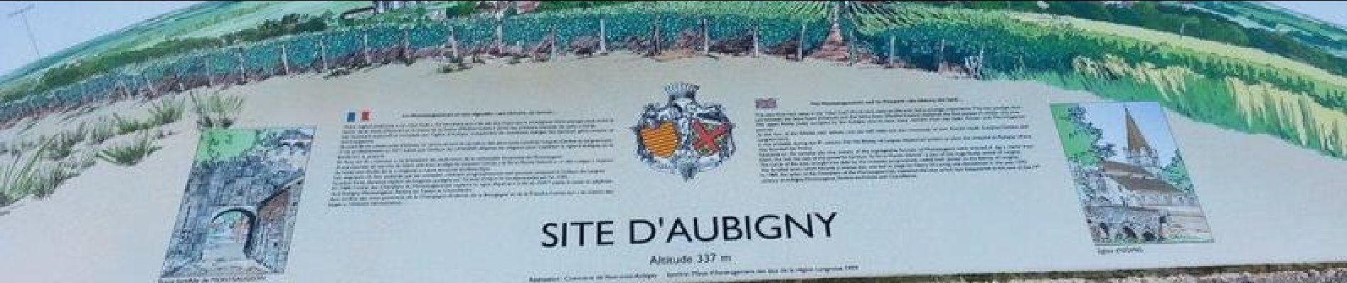
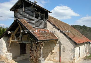
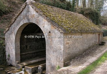
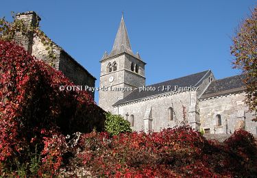
Circuit de marche nordique très varié avec une arrivée près de l'église d'Aubigny au dessus des vignobles du Muid Montsaugeonnais.

Hoogteprofiel

Foto's

Plaatsbepaling

Land:
France
Regio :
Grand Est
Departement/Provincie :
Haute-Marne
Gemeente :
Le Montsaugeonnais
Locatie:
Unknown
Vertrek:(Dec)
Vertrek:(UTM)
671518 ; 5280586 (31T) N.

Wandeltochten in de omgeving

Tocht Fiets Le Montsaugeonnais - De la Coulange au Badin - Vaux - sous - Aubigny - Photo
Fiets
tracegps

Fiets

Medium
Le Montsaugeonnais, Grand Est, Haute-Marne, France
30 km | 36 km-effort
2h 30min
Ja
Tocht Mountainbike Le Montsaugeonnais - Les Grandes Charmes - Photo
Mountainbike
tracegps

Mountainbike

Medium
Le Montsaugeonnais, Grand Est, Haute-Marne, France
16,2 km | 20 km-effort
2h 0min
Ja
Tocht Stappen Le Montsaugeonnais - Les Grandes Charmes - Photo
Stappen
tracegps

Stappen

Moeilijk
Le Montsaugeonnais, Grand Est, Haute-Marne, France
16,2 km | 20 km-effort
4h 0min
Ja
Tocht Mountainbike Dommarien - Le creux de la Chaudière - Dommarien - Chassigny - Photo
Mountainbike
tracegps

Mountainbike

Medium
Dommarien, Grand Est, Haute-Marne, France
13,1 km | 15,8 km-effort
1h 45min
Ja
Tocht Stappen Dommarien - Le creux de la Chaudière - Dommarien - Chassigny - Photo
Stappen
tracegps

Stappen

Moeilijk
Dommarien, Grand Est, Haute-Marne, France
13,1 km | 15,8 km-effort
4h 0min
Ja


Sluiten
Mijn abonnementen