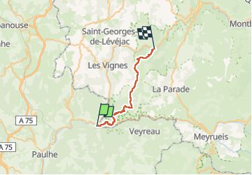
15,4 km | 24 km-effort
Causse et gorges au pays des vautours
nadinebondoux
Gebruiker GUIDE
Lengte
27 km
Max. hoogte
993 m
Positief hoogteverschil
1014 m
Km-Effort
40 km
Min. hoogte
409 m
Negatief hoogteverschil
971 m
Boucle
Neen
Datum van aanmaak :
2022-04-26 06:16:34.736
Laatste wijziging :
2022-04-30 19:15:32.416
7h48
Moeilijkheid : Moeilijk
Gratisgps-wandelapplicatie
Over ons
Tocht Stappen van 27 km beschikbaar op Occitanië, Lozère, Le Rozier. Deze tocht wordt voorgesteld door nadinebondoux.
Beschrijving
étape 2
Les Roziers à La Malène
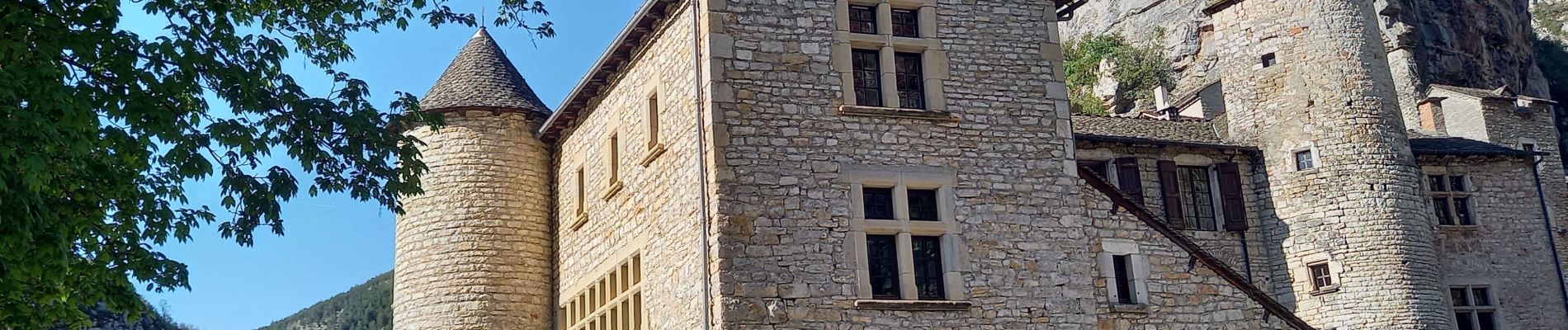
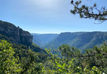
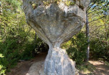
Plaatsbepaling
Land:
France
Regio :
Occitanië
Departement/Provincie :
Lozère
Gemeente :
Le Rozier
Locatie:
Unknown
Vertrek:(Dec)
Vertrek:(UTM)
516559 ; 4893241 (31T) N.
Opmerkingen
Wandeltochten in de omgeving
Cirque de Saint Marcellin - Mostuéjouls - Liaucous
Stappen
Medium
(1)
Mostuéjouls,
Occitanië,
Aveyron,
France
5h 0min
Ja
Cassagnes crête vallée Jonte et Tarn 12,2 km
Stappen
Medium
Saint-Pierre-des-Tripiers,
Occitanië,
Lozère,
France
12,6 km | 20 km-effort
5h 38min
Neen
J3 St Jean des Balmes Ermitage St Michel
Stappen
Gemakkelijk
(2)
Veyreau,
Occitanië,
Aveyron,
France
9,6 km | 13,9 km-effort
3h 18min
Ja
Les corniches du Méjean
Stappen
Medium
(3)
Saint-Pierre-des-Tripiers,
Occitanië,
Lozère,
France
6 km | 9,5 km-effort
2h 31min
Ja
LL34-Corniches du Méjean
Stappen
Moeilijk
(1)
Saint-Pierre-des-Tripiers,
Occitanië,
Lozère,
France
12,1 km | 25 km-effort
4h 51min
Ja
vautour
Stappen
Medium
(1)
Saint-Pierre-des-Tripiers,
Occitanië,
Lozère,
France
7,1 km | 12,3 km-effort
2h 59min
Ja
Sur Les Hauteurs De Peyreleau
Stappen
Moeilijk
(2)
Le Rozier,
Occitanië,
Lozère,
France
10,4 km | 18,2 km-effort
4h 0min
Ja
Le 815 - Peyreleau
Stappen
Gemakkelijk
(1)
Peyreleau,
Occitanië,
Aveyron,
France
5,5 km | 10,5 km-effort
2h 0min
Ja
Balcons du mejean
Stappen
Gemakkelijk
Le Rozier,
Occitanië,
Lozère,
France
10,7 km | 19,8 km-effort
4h 25min
Ja