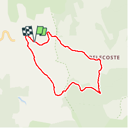
11,2 km | 14,8 km-effort
Cévennes Mas Camargues Pont du Tarn
HO49
Gebruiker
Lengte
7,4 km
Max. hoogte
1379 m
Positief hoogteverschil
89 m
Km-Effort
8,6 km
Min. hoogte
1326 m
Negatief hoogteverschil
85 m
Boucle
Ja
Datum van aanmaak :
2014-12-10 00:00:00.0
Laatste wijziging :
2014-12-10 00:00:00.0
2h07
Moeilijkheid : Gemakkelijk
Gratisgps-wandelapplicatie
Over ons
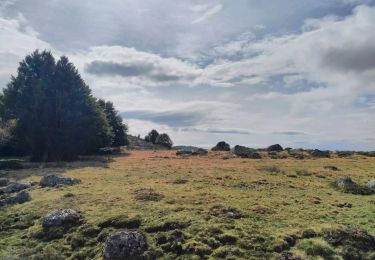
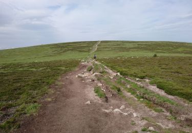
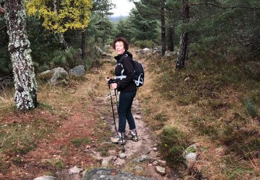
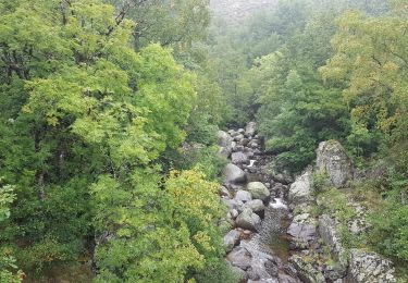
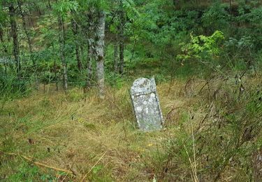
Tocht Stappen van 7,4 km beschikbaar op Occitanië, Lozère, Pont de Montvert - Sud Mont Lozère. Deze tocht wordt voorgesteld door HO49.
Plaatsbepaling
Land:
France
Regio :
Occitanië
Departement/Provincie :
Lozère
Gemeente :
Pont de Montvert - Sud Mont Lozère
Locatie:
Le Pont-de-Montvert
Vertrek:(Dec)
Vertrek:(UTM)
564688 ; 4915043 (31T) N.
Opmerkingen
Wandeltochten in de omgeving
Pic Cassini
Stappen
Medium
Pont de Montvert - Sud Mont Lozère,
Occitanië,
Lozère,
France
5h 11min
Ja
Sources du Tarn
Stappen
Medium
Pont de Montvert - Sud Mont Lozère,
Occitanië,
Lozère,
France
18,2 km | 24 km-effort
5h 41min
Ja
sources du tarn
Stappen
Medium
(1)
Mont Lozère et Goulet,
Occitanië,
Lozère,
France
13,3 km | 17,3 km-effort
3h 50min
Neen
Sentier de Mas Camargues
Te voet
Gemakkelijk
Pont de Montvert - Sud Mont Lozère,
Occitanië,
Lozère,
France
3,1 km | 3,9 km-effort
52min
Ja
210617 - Mont Lozère
Stappen
Gemakkelijk
Mont Lozère et Goulet,
Occitanië,
Lozère,
France
7,1 km | 9,3 km-effort
1h 22min
Ja
La Taillade bis
Stappen
Pont de Montvert - Sud Mont Lozère,
Occitanië,
Lozère,
France
5,1 km | 6,7 km-effort
1h 34min
Ja
Masméjean / le pont du Tarn
Stappen
Moeilijk
Pont de Montvert - Sud Mont Lozère,
Occitanië,
Lozère,
France
14 km | 18,2 km-effort
4h 21min
Ja
Le Pont de Montvert - Gasbiel
Stappen
Moeilijk
Pont de Montvert - Sud Mont Lozère,
Occitanië,
Lozère,
France
9,3 km | 14,3 km-effort
2h 58min
Ja
Masméjean - Pont du Tarn
Stappen
Zeer moeilijk
Pont de Montvert - Sud Mont Lozère,
Occitanië,
Lozère,
France
16,7 km | 24 km-effort
4h 57min
Neen
Magnifique !