Tocht Stappen Meix-devant-Virton - Gite-de-gaume : Entre France et Belgique  - Photo

Gite-de-gaume : Entre France et Belgique

 dragonchef
dragonchef

Gebruiker

© OpenStreetMap contributors
Lengte
Lengte
26 km
Max. hoogte
Max. hoogte
336 m
Positief hoogteverschil
467 m
Km-Effort
Km-Effort  
33 km
Min. hoogte
Min. hoogte
213 m
Negatief hoogteverschil
466 m
Boucle
Boucle
Ja
Datum van aanmaak :
2023-01-12 08:31:28.775
Laatste wijziging :
2023-01-14 09:57:04.1

(0 Bericht)

Stappen
Stappen
4h56
Moeilijkheid : Moeilijk

Scan deze QR-code om de tocht te openen in de SityTrail-applicatie

Gratisgps-wandelapplicatie

Logo SityTrail SityTrail

IGN / Geografische instituten

SityTrail uit de App Store downloaden SityTrail uit Google Play downloaden

Logo SityTrail SityTrail World

De wereld gaat voor u open

SityTrail uit de App Store downloaden SityTrail uit Google Play downloaden SityTrail op Huawei AppGallery downloaden

Over ons

Tocht Stappen van 26 km beschikbaar op Wallonië, Luxemburg, Meix-devant-Virton. Deze tocht wordt voorgesteld door dragonchef.

Beschrijving

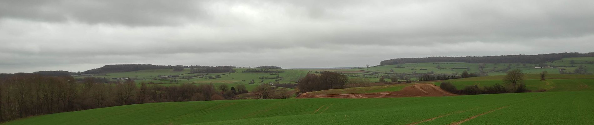
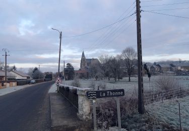
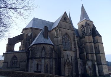
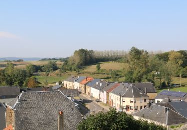
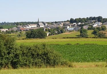
Au départ de Sommethonne, découvrez la frontière française, sillonnez le long du fossé frontière, à la découverte de la 3 eme cuesta, chemin des romais, le village typique de Breux, vue sur Avioth, aire de faulde, ....

Un parcours où vous allez effectuer un peu de hors piste
Il est utile de maîtriser les notions de base en cartographie.  

Hoogteprofiel

Foto's

25 fotos in totaal. Klik op een foto om ze allemaal in de galerij weer te geven.

POI's

POI Thonne-la-Long - frontière française  - Photo
dragonchef
THONNE-LA-LONG 

Plaatsbepaling

Land:
Belgium
Regio :
Wallonië
Departement/Provincie :
Luxemburg
Gemeente :
Meix-devant-Virton
Locatie:
Unknown
Vertrek:(UTM)
676960 ; 5494667 (31U) N.

Wandeltochten in de omgeving

Tocht Te voet Breux - La basilique des Champs - Photo
Te voet
PRO

Te voet

Gemakkelijk
Breux, Grand Est, Meuse, France
13,1 km | 16,4 km-effort
3h 42min
Ja
Tocht Te voet Breux - Boucle de promenade à Avioth 2, France - Photo
Te voet
PRO

Te voet

Gemakkelijk
Breux, Grand Est, Meuse, France
9,3 km | 11,3 km-effort
2h 33min
Ja
Tocht Te voet Avioth - Boucle de promenade à Avioth 1, France - Photo
Te voet
PRO

Te voet

Gemakkelijk
(1)
Avioth, Grand Est, Meuse, France
7,4 km | 9,2 km-effort
2h 4min
Ja
Tocht Te voet Meix-devant-Virton - de Sommethonne à Montquintin  - Photo
Te voet
dragonchef

Te voet

Zeer moeilijk
(1)
Meix-devant-Virton, Wallonië, Luxemburg, Belgium
13,8 km | 17,9 km-effort
Onbekend
Ja
Tocht Stappen Meix-devant-Virton - Gerouville 060723 - Photo
Stappen
guyernage25

Stappen

Medium
Meix-devant-Virton, Wallonië, Luxemburg, Belgium
17,9 km | 22 km-effort
4h 28min
Ja
Tocht Stappen Meix-devant-Virton - Gerouville - Photo
Stappen
BrigitteBertrand

Stappen

Zeer moeilijk
Meix-devant-Virton, Wallonië, Luxemburg, Belgium
22 km | 27 km-effort
6h 3min
Ja
Tocht Te voet Meix-devant-Virton - Balade aux creux des bois - Photo
Te voet
GUIDE+

Te voet

Gemakkelijk
Meix-devant-Virton, Wallonië, Luxemburg, Belgium
4,7 km | 5,9 km-effort
1h 19min
Ja
Tocht Stappen Meix-devant-Virton - Gerouville 1 - Photo
Stappen
walker50

Stappen

Medium
(1)
Meix-devant-Virton, Wallonië, Luxemburg, Belgium
7,6 km | 10,1 km-effort
2h 29min
Ja
Tocht Stappen Meix-devant-Virton - Gérouville et Limes au fil de l'eau - Photo
Stappen

Stappen

Medium
Meix-devant-Virton, Wallonië, Luxemburg, Belgium
6,8 km | 8,4 km-effort
1h 53min
Ja


Sluiten
Mijn abonnementen