


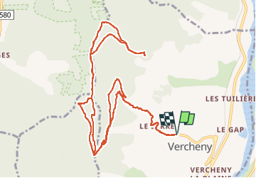
Vercheny-chateau de Barry

ajd26
Gebruiker


4h26
Moeilijkheid : Medium

Gratisgps-wandelapplicatie
 SityTrail
IGN / Geografische instituten
SityTrail Plus
De wereld gaat voor u open
Over ons
Tocht Stappen van 15,8 km beschikbaar op Auvergne-Rhône-Alpes, Drôme, Vercheny. Deze tocht wordt voorgesteld door ajd26.
Beschrijving
beaux panoramas tout au long du parcours
attention au passage sur les crêtes de Gaudichart à partir du km 9,5, le sentier est très peu marqué et la progression est délicate (beaucoup de rochers) mais pas dangereuse
Plaatsbepaling
Opmerkingen