Tocht Stappen Montpeyroux - Le château du Bousquet - Photo

Le château du Bousquet

 Lacaze
Lacaze

Gebruiker

© OpenStreetMap contributors
Lengte
Lengte
7,8 km
Max. hoogte
Max. hoogte
964 m
Positief hoogteverschil
202 m
Km-Effort
Km-Effort  
10,5 km
Min. hoogte
Min. hoogte
870 m
Negatief hoogteverschil
201 m
Boucle
Boucle
Ja
Datum van aanmaak :
2014-12-10 00:00:00.0
Laatste wijziging :
2014-12-10 00:00:00.0

(1 Bericht)

Stappen
Stappen
2h13
Moeilijkheid : Medium

Scan deze QR-code om de tocht te openen in de SityTrail-applicatie

Gratisgps-wandelapplicatie

Logo SityTrail SityTrail

IGN / Geografische instituten

SityTrail uit de App Store downloaden SityTrail uit Google Play downloaden

Logo SityTrail SityTrail World

De wereld gaat voor u open

SityTrail uit de App Store downloaden SityTrail uit Google Play downloaden SityTrail op Huawei AppGallery downloaden

Over ons

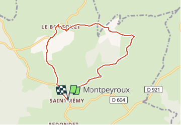
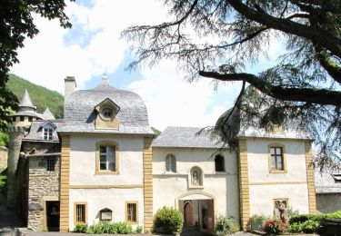
Tocht Stappen van 7,8 km beschikbaar op Occitanië, Aveyron, Montpeyroux. Deze tocht wordt voorgesteld door Lacaze.

Beschrijving

Départ de St-Remy de Bedène.
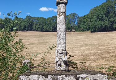
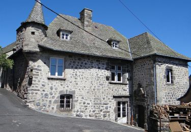
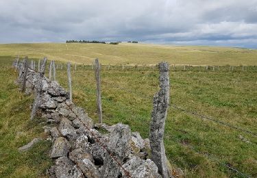
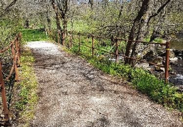
A voir le château après le Bousquet le chemin pour monter à Pinsonnac beaucoup d'eau.De bonnes chaussures sont nécessaires.

Hoogteprofiel

Plaatsbepaling

Land:
France
Regio :
Occitanië
Departement/Provincie :
Aveyron
Gemeente :
Montpeyroux
Locatie:
Unknown
Vertrek:(Dec)
Vertrek:(UTM)
484997 ; 4942855 (31T) N.

Opmerkingen

Gelieve in te loggen om een commentaar of een beoordeling achter te laten


Wandeltochten in de omgeving

Tocht Stappen Laguiole - Laguiole Pigasse  - Photo
Stappen
Galoche

Stappen

Gemakkelijk
Laguiole, Occitanië, Aveyron, France
6,2 km | 8,4 km-effort
1h 47min
Ja
Tocht Stappen Curières - la croix du Pal - Photo
Stappen
bidetarou

Stappen

Medium
Curières, Occitanië, Aveyron, France
15,2 km | 22 km-effort
4h 29min
Ja
Tocht Te voet Laguiole - Laguiole PR-5 - Photo
Te voet
PRO

Te voet

Gemakkelijk
Laguiole, Occitanië, Aveyron, France
6,3 km | 8,8 km-effort
1h 59min
Neen
Tocht Te voet Condom-d'Aubrac - Sentier Aubrac - Abbaye de Bonneval - Espalion - Photo
Te voet
PRO

Te voet

Gemakkelijk
Condom-d'Aubrac, Occitanië, Aveyron, France
12,8 km | 19,2 km-effort
4h 21min
Neen
Tocht Stappen Laguiole - Tour de l'Aubrac 4 - Photo
Stappen
phimar_2612

Stappen

Medium
Laguiole, Occitanië, Aveyron, France
16,9 km | 22 km-effort
4h 42min
Neen
Tocht Stappen Laguiole - laguiole le Bousquet soulages - Photo
Stappen
jeanfcd

Stappen

Medium
Laguiole, Occitanië, Aveyron, France
20 km | 26 km-effort
5h 11min
Ja
Tocht Mountainbike Condom-d'Aubrac - Site VTT FFC Aubrac - Vallée du Lot - Circuit n°5 - Les Enguilhens - Photo
Mountainbike
tracegps

Mountainbike

Moeilijk
(1)
Condom-d'Aubrac, Occitanië, Aveyron, France
20 km | 26 km-effort
1h 40min
Ja
Tocht Stappen Laguiole - 2023-08-03_20h34m40_Cirkwi-Le_roc_des_Cabres - Photo
Stappen
neoroll44

Stappen

Medium
Laguiole, Occitanië, Aveyron, France
12,8 km | 16,9 km-effort
4h 0min
Ja
Tocht Stappen Curières - 2023-08-01_14h05m13_Cirkwi-La_croix_du_Pal - Photo
Stappen
neoroll44

Stappen

Medium
Curières, Occitanië, Aveyron, France
14,8 km | 21 km-effort
4h 50min
Ja


Sluiten
Mijn abonnementen