Tocht Stappen Bitschwiller-lès-Thann - Bitschwiller- Molkenrain- copains jeudi-05/07 - Photo

Bitschwiller- Molkenrain- copains jeudi-05/07

 chantalwaltzer
chantalwaltzer

Gebruiker

© OpenStreetMap contributors
Lengte
Lengte
21 km
Max. hoogte
Max. hoogte
1091 m
Positief hoogteverschil
978 m
Km-Effort
Km-Effort  
34 km
Min. hoogte
Min. hoogte
355 m
Negatief hoogteverschil
977 m
Boucle
Boucle
Ja
Datum van aanmaak :
2023-07-06 06:36:08.0
Laatste wijziging :
2023-07-06 14:13:20.883

(0 Bericht)

Stappen
Stappen
7h35
Moeilijkheid : Onbekend

Scan deze QR-code om de tocht te openen in de SityTrail-applicatie

Gratisgps-wandelapplicatie

Logo SityTrail SityTrail

IGN / Geografische instituten

SityTrail uit de App Store downloaden SityTrail uit Google Play downloaden

Logo SityTrail SityTrail World

De wereld gaat voor u open

SityTrail uit de App Store downloaden SityTrail uit Google Play downloaden SityTrail op Huawei AppGallery downloaden

Over ons

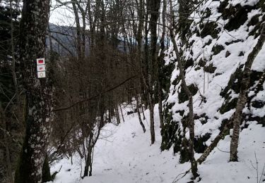
Tocht Stappen van 21 km beschikbaar op Grand Est, Haut-Rhin, Bitschwiller-lès-Thann. Deze tocht wordt voorgesteld door chantalwaltzer.

Beschrijving

Joli

Hoogteprofiel

Plaatsbepaling

Land:
France
Regio :
Grand Est
Departement/Provincie :
Haut-Rhin
Gemeente :
Bitschwiller-lès-Thann
Locatie:
Unknown
Vertrek:(Dec)
Vertrek:(UTM)
356472 ; 5299213 (32T) N.

Wandeltochten in de omgeving

Tocht Stappen Soultz-Haut-Rhin - Hartmannswillerkopf - Circuit anneau bleu - Photo
Stappen
VacheKiri67

Stappen

Medium
(1)
Soultz-Haut-Rhin, Grand Est, Haut-Rhin, France
3,7 km | 5,9 km-effort
1h 37min
Ja
Tocht Andere activiteiten Steinbach - lac du ballon - Photo
Andere activiteiten
rodabruna

Andere activiteiten

Heel gemakkelijk
(1)
Steinbach, Grand Est, Haut-Rhin, France
33 km | 64 km-effort
5h 1min
Neen
Tocht Stappen Bourbach-le-Haut - 2024-01-12_14h17m14_239006910 - Photo
Stappen
GUIDE
mumu.larandonneuse

Stappen

Moeilijk
Bourbach-le-Haut, Grand Est, Haut-Rhin, France
11,4 km | 18,5 km-effort
4h 12min
Ja
Tocht Trail Wattwiller - The History Ultra - stage 1 - Photo
Trail
Olivier Houette

Trail

Heel gemakkelijk
(1)
Wattwiller, Grand Est, Haut-Rhin, France
28 km | 48 km-effort
Onbekend
Neen
Tocht Stappen Thann - SityTrail - 2489713 - thann-roche--albert--grumbachkopf - Photo
Stappen
argonneuweg

Stappen

Medium
(1)
Thann, Grand Est, Haut-Rhin, France
7,6 km | 12 km-effort
2h 28min
Ja
Tocht Te voet Bitschwiller-lès-Thann - Bitschwiller les Thann - Rehbrunnel - Abri du Becherkopf - Roche Albert - Photo
Te voet
patrickbeyrath

Te voet

Medium
(1)
Bitschwiller-lès-Thann, Grand Est, Haut-Rhin, France
10,3 km | 16,4 km-effort
Onbekend
Ja
Tocht Stappen Bitschwiller-lès-Thann - 68 Col du Hundsrück  - FA Gsang - retour ThannerHubel - Photo
Stappen

Stappen

Medium
(1)
Bitschwiller-lès-Thann, Grand Est, Haut-Rhin, France
11,2 km | 18,4 km-effort
3h 48min
Ja
Tocht Stappen Moosch - Moosch Haag - Photo
Stappen
Estelle Handschin

Stappen

Moeilijk
(1)
Moosch, Grand Est, Haut-Rhin, France
21 km | 0 m-effort
5h 27min
Ja
Tocht Sneeuwschoenen Soultz-Haut-Rhin - Raquettes au Molkenrain - Photo
Sneeuwschoenen
helmut68

Sneeuwschoenen

Medium
Soultz-Haut-Rhin, Grand Est, Haut-Rhin, France
7,1 km | 12,1 km-effort
2h 28min
Ja


Sluiten
Mijn abonnementen