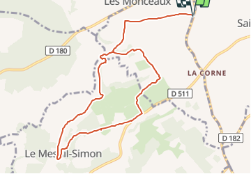
Tocht Stappen Les Monceaux - Les Monceaux - Photo
 phi14
phi14

Gebruiker

© OpenStreetMap contributors
Lengte
Lengte
10,5 km
Max. hoogte
Max. hoogte
172 m
Positief hoogteverschil
167 m
Km-Effort
Km-Effort  
12,7 km
Min. hoogte
Min. hoogte
75 m
Negatief hoogteverschil
167 m
Boucle
Boucle
Ja
Datum van aanmaak :
12/10/2023 12:23
Laatste wijziging :
17/10/2023 16:56

(0 Bericht)

Stappen
Stappen
2h53
Moeilijkheid : Moeilijk

Scan deze QR-code om de tocht te openen in de SityTrail-applicatie

Gratisgps-wandelapplicatie

Logo SityTrail SityTrail

IGN / Geografische instituten

SityTrail uit de App Store downloaden SityTrail uit Google Play downloaden

Logo SityTrail SityTrail Plus

De wereld gaat voor u open

SityTrail uit de App Store downloaden SityTrail uit Google Play downloaden SityTrail op Huawei AppGallery downloaden

Over ons

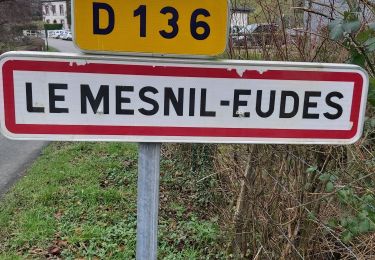
Tocht Stappen van 10,5 km beschikbaar op Normandië, Calvados, Les Monceaux. Deze tocht wordt voorgesteld door phi14.

Hoogteprofiel

Plaatsbepaling

Land:
France
Regio :
Normandië
Departement/Provincie :
Calvados
Gemeente :
Les Monceaux
Locatie:
Unknown
Vertrek:(Dec)
Vertrek:(UTM)
291203 ; 5444096 (31U) N.


Sluiten
Mijn abonnementen