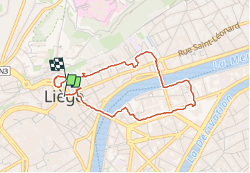


4,2 km | 6 km-effort

Gebruiker GUIDE


Gratisgps-wandelapplicatie
 SityTrail
IGN / Geografische instituten
SityTrail World
De wereld gaat voor u open
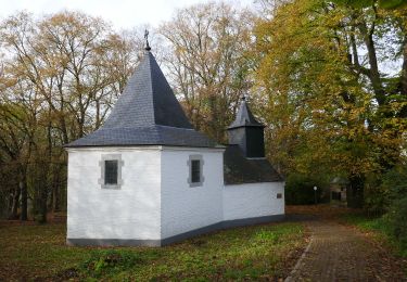
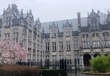
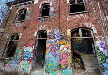
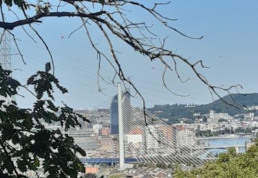
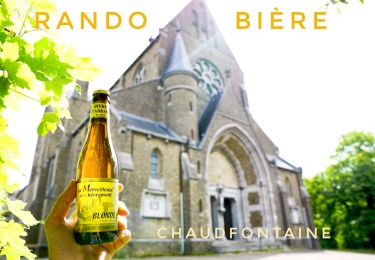
Tocht Stappen van 3,9 km beschikbaar op Wallonië, Luik, Luik. Deze tocht wordt voorgesteld door pierreh01.
Dimanche 29 octobre 2023 : TOTEMUS Liège " De Notger au Palais provincial en passant par le B3 "
Chasse effectuée la même journée que la chasse Totemus LIEGE "Les coteaux, naturellement riches"
Une fois de plus, belle découverte, même s'il y a quelques redondances avec la chasse précédent; et malgré les sempiternels travaux liégeois.
Distance mesurée avec Sity Trail, semblant plus proche de la réalité.
 "
data-pinterest-text="Pin it"
data-tweet-text="share on twitter"
data-facebook-share-url="https://www.sitytrail.com/nl/trails/3853511-luik--20231029-x-totemus-liege-x-de-notger-au-palais-provincial-en-passant-par-la-b3-x-3x9-km/?photo=1#lg=1&slide=1"
data-twitter-share-url="https://www.sitytrail.com/nl/trails/3853511-luik--20231029-x-totemus-liege-x-de-notger-au-palais-provincial-en-passant-par-la-b3-x-3x9-km/?photo=1#lg=1&slide=1"
data-googleplus-share-url="https://www.sitytrail.com/nl/trails/3853511-luik--20231029-x-totemus-liege-x-de-notger-au-palais-provincial-en-passant-par-la-b3-x-3x9-km/?photo=1#lg=1&slide=1"
data-pinterest-share-url="https://www.sitytrail.com/nl/trails/3853511-luik--20231029-x-totemus-liege-x-de-notger-au-palais-provincial-en-passant-par-la-b3-x-3x9-km/?photo=1#lg=1&slide=1">
"
data-pinterest-text="Pin it"
data-tweet-text="share on twitter"
data-facebook-share-url="https://www.sitytrail.com/nl/trails/3853511-luik--20231029-x-totemus-liege-x-de-notger-au-palais-provincial-en-passant-par-la-b3-x-3x9-km/?photo=1#lg=1&slide=1"
data-twitter-share-url="https://www.sitytrail.com/nl/trails/3853511-luik--20231029-x-totemus-liege-x-de-notger-au-palais-provincial-en-passant-par-la-b3-x-3x9-km/?photo=1#lg=1&slide=1"
data-googleplus-share-url="https://www.sitytrail.com/nl/trails/3853511-luik--20231029-x-totemus-liege-x-de-notger-au-palais-provincial-en-passant-par-la-b3-x-3x9-km/?photo=1#lg=1&slide=1"
data-pinterest-share-url="https://www.sitytrail.com/nl/trails/3853511-luik--20231029-x-totemus-liege-x-de-notger-au-palais-provincial-en-passant-par-la-b3-x-3x9-km/?photo=1#lg=1&slide=1">
 "
data-pinterest-text="Pin it"
data-tweet-text="share on twitter"
data-facebook-share-url="https://www.sitytrail.com/nl/trails/3853511-luik--20231029-x-totemus-liege-x-de-notger-au-palais-provincial-en-passant-par-la-b3-x-3x9-km/?photo=2#lg=1&slide=2"
data-twitter-share-url="https://www.sitytrail.com/nl/trails/3853511-luik--20231029-x-totemus-liege-x-de-notger-au-palais-provincial-en-passant-par-la-b3-x-3x9-km/?photo=2#lg=1&slide=2"
data-googleplus-share-url="https://www.sitytrail.com/nl/trails/3853511-luik--20231029-x-totemus-liege-x-de-notger-au-palais-provincial-en-passant-par-la-b3-x-3x9-km/?photo=2#lg=1&slide=2"
data-pinterest-share-url="https://www.sitytrail.com/nl/trails/3853511-luik--20231029-x-totemus-liege-x-de-notger-au-palais-provincial-en-passant-par-la-b3-x-3x9-km/?photo=2#lg=1&slide=2">
"
data-pinterest-text="Pin it"
data-tweet-text="share on twitter"
data-facebook-share-url="https://www.sitytrail.com/nl/trails/3853511-luik--20231029-x-totemus-liege-x-de-notger-au-palais-provincial-en-passant-par-la-b3-x-3x9-km/?photo=2#lg=1&slide=2"
data-twitter-share-url="https://www.sitytrail.com/nl/trails/3853511-luik--20231029-x-totemus-liege-x-de-notger-au-palais-provincial-en-passant-par-la-b3-x-3x9-km/?photo=2#lg=1&slide=2"
data-googleplus-share-url="https://www.sitytrail.com/nl/trails/3853511-luik--20231029-x-totemus-liege-x-de-notger-au-palais-provincial-en-passant-par-la-b3-x-3x9-km/?photo=2#lg=1&slide=2"
data-pinterest-share-url="https://www.sitytrail.com/nl/trails/3853511-luik--20231029-x-totemus-liege-x-de-notger-au-palais-provincial-en-passant-par-la-b3-x-3x9-km/?photo=2#lg=1&slide=2">
 "
data-pinterest-text="Pin it"
data-tweet-text="share on twitter"
data-facebook-share-url="https://www.sitytrail.com/nl/trails/3853511-luik--20231029-x-totemus-liege-x-de-notger-au-palais-provincial-en-passant-par-la-b3-x-3x9-km/?photo=3#lg=1&slide=3"
data-twitter-share-url="https://www.sitytrail.com/nl/trails/3853511-luik--20231029-x-totemus-liege-x-de-notger-au-palais-provincial-en-passant-par-la-b3-x-3x9-km/?photo=3#lg=1&slide=3"
data-googleplus-share-url="https://www.sitytrail.com/nl/trails/3853511-luik--20231029-x-totemus-liege-x-de-notger-au-palais-provincial-en-passant-par-la-b3-x-3x9-km/?photo=3#lg=1&slide=3"
data-pinterest-share-url="https://www.sitytrail.com/nl/trails/3853511-luik--20231029-x-totemus-liege-x-de-notger-au-palais-provincial-en-passant-par-la-b3-x-3x9-km/?photo=3#lg=1&slide=3">
"
data-pinterest-text="Pin it"
data-tweet-text="share on twitter"
data-facebook-share-url="https://www.sitytrail.com/nl/trails/3853511-luik--20231029-x-totemus-liege-x-de-notger-au-palais-provincial-en-passant-par-la-b3-x-3x9-km/?photo=3#lg=1&slide=3"
data-twitter-share-url="https://www.sitytrail.com/nl/trails/3853511-luik--20231029-x-totemus-liege-x-de-notger-au-palais-provincial-en-passant-par-la-b3-x-3x9-km/?photo=3#lg=1&slide=3"
data-googleplus-share-url="https://www.sitytrail.com/nl/trails/3853511-luik--20231029-x-totemus-liege-x-de-notger-au-palais-provincial-en-passant-par-la-b3-x-3x9-km/?photo=3#lg=1&slide=3"
data-pinterest-share-url="https://www.sitytrail.com/nl/trails/3853511-luik--20231029-x-totemus-liege-x-de-notger-au-palais-provincial-en-passant-par-la-b3-x-3x9-km/?photo=3#lg=1&slide=3">
 "
data-pinterest-text="Pin it"
data-tweet-text="share on twitter"
data-facebook-share-url="https://www.sitytrail.com/nl/trails/3853511-luik--20231029-x-totemus-liege-x-de-notger-au-palais-provincial-en-passant-par-la-b3-x-3x9-km/?photo=4#lg=1&slide=4"
data-twitter-share-url="https://www.sitytrail.com/nl/trails/3853511-luik--20231029-x-totemus-liege-x-de-notger-au-palais-provincial-en-passant-par-la-b3-x-3x9-km/?photo=4#lg=1&slide=4"
data-googleplus-share-url="https://www.sitytrail.com/nl/trails/3853511-luik--20231029-x-totemus-liege-x-de-notger-au-palais-provincial-en-passant-par-la-b3-x-3x9-km/?photo=4#lg=1&slide=4"
data-pinterest-share-url="https://www.sitytrail.com/nl/trails/3853511-luik--20231029-x-totemus-liege-x-de-notger-au-palais-provincial-en-passant-par-la-b3-x-3x9-km/?photo=4#lg=1&slide=4">
"
data-pinterest-text="Pin it"
data-tweet-text="share on twitter"
data-facebook-share-url="https://www.sitytrail.com/nl/trails/3853511-luik--20231029-x-totemus-liege-x-de-notger-au-palais-provincial-en-passant-par-la-b3-x-3x9-km/?photo=4#lg=1&slide=4"
data-twitter-share-url="https://www.sitytrail.com/nl/trails/3853511-luik--20231029-x-totemus-liege-x-de-notger-au-palais-provincial-en-passant-par-la-b3-x-3x9-km/?photo=4#lg=1&slide=4"
data-googleplus-share-url="https://www.sitytrail.com/nl/trails/3853511-luik--20231029-x-totemus-liege-x-de-notger-au-palais-provincial-en-passant-par-la-b3-x-3x9-km/?photo=4#lg=1&slide=4"
data-pinterest-share-url="https://www.sitytrail.com/nl/trails/3853511-luik--20231029-x-totemus-liege-x-de-notger-au-palais-provincial-en-passant-par-la-b3-x-3x9-km/?photo=4#lg=1&slide=4">
 "
data-pinterest-text="Pin it"
data-tweet-text="share on twitter"
data-facebook-share-url="https://www.sitytrail.com/nl/trails/3853511-luik--20231029-x-totemus-liege-x-de-notger-au-palais-provincial-en-passant-par-la-b3-x-3x9-km/?photo=5#lg=1&slide=5"
data-twitter-share-url="https://www.sitytrail.com/nl/trails/3853511-luik--20231029-x-totemus-liege-x-de-notger-au-palais-provincial-en-passant-par-la-b3-x-3x9-km/?photo=5#lg=1&slide=5"
data-googleplus-share-url="https://www.sitytrail.com/nl/trails/3853511-luik--20231029-x-totemus-liege-x-de-notger-au-palais-provincial-en-passant-par-la-b3-x-3x9-km/?photo=5#lg=1&slide=5"
data-pinterest-share-url="https://www.sitytrail.com/nl/trails/3853511-luik--20231029-x-totemus-liege-x-de-notger-au-palais-provincial-en-passant-par-la-b3-x-3x9-km/?photo=5#lg=1&slide=5">
"
data-pinterest-text="Pin it"
data-tweet-text="share on twitter"
data-facebook-share-url="https://www.sitytrail.com/nl/trails/3853511-luik--20231029-x-totemus-liege-x-de-notger-au-palais-provincial-en-passant-par-la-b3-x-3x9-km/?photo=5#lg=1&slide=5"
data-twitter-share-url="https://www.sitytrail.com/nl/trails/3853511-luik--20231029-x-totemus-liege-x-de-notger-au-palais-provincial-en-passant-par-la-b3-x-3x9-km/?photo=5#lg=1&slide=5"
data-googleplus-share-url="https://www.sitytrail.com/nl/trails/3853511-luik--20231029-x-totemus-liege-x-de-notger-au-palais-provincial-en-passant-par-la-b3-x-3x9-km/?photo=5#lg=1&slide=5"
data-pinterest-share-url="https://www.sitytrail.com/nl/trails/3853511-luik--20231029-x-totemus-liege-x-de-notger-au-palais-provincial-en-passant-par-la-b3-x-3x9-km/?photo=5#lg=1&slide=5">
 "
data-pinterest-text="Pin it"
data-tweet-text="share on twitter"
data-facebook-share-url="https://www.sitytrail.com/nl/trails/3853511-luik--20231029-x-totemus-liege-x-de-notger-au-palais-provincial-en-passant-par-la-b3-x-3x9-km/?photo=6#lg=1&slide=6"
data-twitter-share-url="https://www.sitytrail.com/nl/trails/3853511-luik--20231029-x-totemus-liege-x-de-notger-au-palais-provincial-en-passant-par-la-b3-x-3x9-km/?photo=6#lg=1&slide=6"
data-googleplus-share-url="https://www.sitytrail.com/nl/trails/3853511-luik--20231029-x-totemus-liege-x-de-notger-au-palais-provincial-en-passant-par-la-b3-x-3x9-km/?photo=6#lg=1&slide=6"
data-pinterest-share-url="https://www.sitytrail.com/nl/trails/3853511-luik--20231029-x-totemus-liege-x-de-notger-au-palais-provincial-en-passant-par-la-b3-x-3x9-km/?photo=6#lg=1&slide=6">
"
data-pinterest-text="Pin it"
data-tweet-text="share on twitter"
data-facebook-share-url="https://www.sitytrail.com/nl/trails/3853511-luik--20231029-x-totemus-liege-x-de-notger-au-palais-provincial-en-passant-par-la-b3-x-3x9-km/?photo=6#lg=1&slide=6"
data-twitter-share-url="https://www.sitytrail.com/nl/trails/3853511-luik--20231029-x-totemus-liege-x-de-notger-au-palais-provincial-en-passant-par-la-b3-x-3x9-km/?photo=6#lg=1&slide=6"
data-googleplus-share-url="https://www.sitytrail.com/nl/trails/3853511-luik--20231029-x-totemus-liege-x-de-notger-au-palais-provincial-en-passant-par-la-b3-x-3x9-km/?photo=6#lg=1&slide=6"
data-pinterest-share-url="https://www.sitytrail.com/nl/trails/3853511-luik--20231029-x-totemus-liege-x-de-notger-au-palais-provincial-en-passant-par-la-b3-x-3x9-km/?photo=6#lg=1&slide=6">
 "
data-pinterest-text="Pin it"
data-tweet-text="share on twitter"
data-facebook-share-url="https://www.sitytrail.com/nl/trails/3853511-luik--20231029-x-totemus-liege-x-de-notger-au-palais-provincial-en-passant-par-la-b3-x-3x9-km/?photo=7#lg=1&slide=7"
data-twitter-share-url="https://www.sitytrail.com/nl/trails/3853511-luik--20231029-x-totemus-liege-x-de-notger-au-palais-provincial-en-passant-par-la-b3-x-3x9-km/?photo=7#lg=1&slide=7"
data-googleplus-share-url="https://www.sitytrail.com/nl/trails/3853511-luik--20231029-x-totemus-liege-x-de-notger-au-palais-provincial-en-passant-par-la-b3-x-3x9-km/?photo=7#lg=1&slide=7"
data-pinterest-share-url="https://www.sitytrail.com/nl/trails/3853511-luik--20231029-x-totemus-liege-x-de-notger-au-palais-provincial-en-passant-par-la-b3-x-3x9-km/?photo=7#lg=1&slide=7">
"
data-pinterest-text="Pin it"
data-tweet-text="share on twitter"
data-facebook-share-url="https://www.sitytrail.com/nl/trails/3853511-luik--20231029-x-totemus-liege-x-de-notger-au-palais-provincial-en-passant-par-la-b3-x-3x9-km/?photo=7#lg=1&slide=7"
data-twitter-share-url="https://www.sitytrail.com/nl/trails/3853511-luik--20231029-x-totemus-liege-x-de-notger-au-palais-provincial-en-passant-par-la-b3-x-3x9-km/?photo=7#lg=1&slide=7"
data-googleplus-share-url="https://www.sitytrail.com/nl/trails/3853511-luik--20231029-x-totemus-liege-x-de-notger-au-palais-provincial-en-passant-par-la-b3-x-3x9-km/?photo=7#lg=1&slide=7"
data-pinterest-share-url="https://www.sitytrail.com/nl/trails/3853511-luik--20231029-x-totemus-liege-x-de-notger-au-palais-provincial-en-passant-par-la-b3-x-3x9-km/?photo=7#lg=1&slide=7">
 "
data-pinterest-text="Pin it"
data-tweet-text="share on twitter"
data-facebook-share-url="https://www.sitytrail.com/nl/trails/3853511-luik--20231029-x-totemus-liege-x-de-notger-au-palais-provincial-en-passant-par-la-b3-x-3x9-km/?photo=8#lg=1&slide=8"
data-twitter-share-url="https://www.sitytrail.com/nl/trails/3853511-luik--20231029-x-totemus-liege-x-de-notger-au-palais-provincial-en-passant-par-la-b3-x-3x9-km/?photo=8#lg=1&slide=8"
data-googleplus-share-url="https://www.sitytrail.com/nl/trails/3853511-luik--20231029-x-totemus-liege-x-de-notger-au-palais-provincial-en-passant-par-la-b3-x-3x9-km/?photo=8#lg=1&slide=8"
data-pinterest-share-url="https://www.sitytrail.com/nl/trails/3853511-luik--20231029-x-totemus-liege-x-de-notger-au-palais-provincial-en-passant-par-la-b3-x-3x9-km/?photo=8#lg=1&slide=8">
"
data-pinterest-text="Pin it"
data-tweet-text="share on twitter"
data-facebook-share-url="https://www.sitytrail.com/nl/trails/3853511-luik--20231029-x-totemus-liege-x-de-notger-au-palais-provincial-en-passant-par-la-b3-x-3x9-km/?photo=8#lg=1&slide=8"
data-twitter-share-url="https://www.sitytrail.com/nl/trails/3853511-luik--20231029-x-totemus-liege-x-de-notger-au-palais-provincial-en-passant-par-la-b3-x-3x9-km/?photo=8#lg=1&slide=8"
data-googleplus-share-url="https://www.sitytrail.com/nl/trails/3853511-luik--20231029-x-totemus-liege-x-de-notger-au-palais-provincial-en-passant-par-la-b3-x-3x9-km/?photo=8#lg=1&slide=8"
data-pinterest-share-url="https://www.sitytrail.com/nl/trails/3853511-luik--20231029-x-totemus-liege-x-de-notger-au-palais-provincial-en-passant-par-la-b3-x-3x9-km/?photo=8#lg=1&slide=8">
 "
data-pinterest-text="Pin it"
data-tweet-text="share on twitter"
data-facebook-share-url="https://www.sitytrail.com/nl/trails/3853511-luik--20231029-x-totemus-liege-x-de-notger-au-palais-provincial-en-passant-par-la-b3-x-3x9-km/?photo=9#lg=1&slide=9"
data-twitter-share-url="https://www.sitytrail.com/nl/trails/3853511-luik--20231029-x-totemus-liege-x-de-notger-au-palais-provincial-en-passant-par-la-b3-x-3x9-km/?photo=9#lg=1&slide=9"
data-googleplus-share-url="https://www.sitytrail.com/nl/trails/3853511-luik--20231029-x-totemus-liege-x-de-notger-au-palais-provincial-en-passant-par-la-b3-x-3x9-km/?photo=9#lg=1&slide=9"
data-pinterest-share-url="https://www.sitytrail.com/nl/trails/3853511-luik--20231029-x-totemus-liege-x-de-notger-au-palais-provincial-en-passant-par-la-b3-x-3x9-km/?photo=9#lg=1&slide=9">
"
data-pinterest-text="Pin it"
data-tweet-text="share on twitter"
data-facebook-share-url="https://www.sitytrail.com/nl/trails/3853511-luik--20231029-x-totemus-liege-x-de-notger-au-palais-provincial-en-passant-par-la-b3-x-3x9-km/?photo=9#lg=1&slide=9"
data-twitter-share-url="https://www.sitytrail.com/nl/trails/3853511-luik--20231029-x-totemus-liege-x-de-notger-au-palais-provincial-en-passant-par-la-b3-x-3x9-km/?photo=9#lg=1&slide=9"
data-googleplus-share-url="https://www.sitytrail.com/nl/trails/3853511-luik--20231029-x-totemus-liege-x-de-notger-au-palais-provincial-en-passant-par-la-b3-x-3x9-km/?photo=9#lg=1&slide=9"
data-pinterest-share-url="https://www.sitytrail.com/nl/trails/3853511-luik--20231029-x-totemus-liege-x-de-notger-au-palais-provincial-en-passant-par-la-b3-x-3x9-km/?photo=9#lg=1&slide=9">
 "
data-pinterest-text="Pin it"
data-tweet-text="share on twitter"
data-facebook-share-url="https://www.sitytrail.com/nl/trails/3853511-luik--20231029-x-totemus-liege-x-de-notger-au-palais-provincial-en-passant-par-la-b3-x-3x9-km/?photo=10#lg=1&slide=10"
data-twitter-share-url="https://www.sitytrail.com/nl/trails/3853511-luik--20231029-x-totemus-liege-x-de-notger-au-palais-provincial-en-passant-par-la-b3-x-3x9-km/?photo=10#lg=1&slide=10"
data-googleplus-share-url="https://www.sitytrail.com/nl/trails/3853511-luik--20231029-x-totemus-liege-x-de-notger-au-palais-provincial-en-passant-par-la-b3-x-3x9-km/?photo=10#lg=1&slide=10"
data-pinterest-share-url="https://www.sitytrail.com/nl/trails/3853511-luik--20231029-x-totemus-liege-x-de-notger-au-palais-provincial-en-passant-par-la-b3-x-3x9-km/?photo=10#lg=1&slide=10">
"
data-pinterest-text="Pin it"
data-tweet-text="share on twitter"
data-facebook-share-url="https://www.sitytrail.com/nl/trails/3853511-luik--20231029-x-totemus-liege-x-de-notger-au-palais-provincial-en-passant-par-la-b3-x-3x9-km/?photo=10#lg=1&slide=10"
data-twitter-share-url="https://www.sitytrail.com/nl/trails/3853511-luik--20231029-x-totemus-liege-x-de-notger-au-palais-provincial-en-passant-par-la-b3-x-3x9-km/?photo=10#lg=1&slide=10"
data-googleplus-share-url="https://www.sitytrail.com/nl/trails/3853511-luik--20231029-x-totemus-liege-x-de-notger-au-palais-provincial-en-passant-par-la-b3-x-3x9-km/?photo=10#lg=1&slide=10"
data-pinterest-share-url="https://www.sitytrail.com/nl/trails/3853511-luik--20231029-x-totemus-liege-x-de-notger-au-palais-provincial-en-passant-par-la-b3-x-3x9-km/?photo=10#lg=1&slide=10">
 "
data-pinterest-text="Pin it"
data-tweet-text="share on twitter"
data-facebook-share-url="https://www.sitytrail.com/nl/trails/3853511-luik--20231029-x-totemus-liege-x-de-notger-au-palais-provincial-en-passant-par-la-b3-x-3x9-km/?photo=11#lg=1&slide=11"
data-twitter-share-url="https://www.sitytrail.com/nl/trails/3853511-luik--20231029-x-totemus-liege-x-de-notger-au-palais-provincial-en-passant-par-la-b3-x-3x9-km/?photo=11#lg=1&slide=11"
data-googleplus-share-url="https://www.sitytrail.com/nl/trails/3853511-luik--20231029-x-totemus-liege-x-de-notger-au-palais-provincial-en-passant-par-la-b3-x-3x9-km/?photo=11#lg=1&slide=11"
data-pinterest-share-url="https://www.sitytrail.com/nl/trails/3853511-luik--20231029-x-totemus-liege-x-de-notger-au-palais-provincial-en-passant-par-la-b3-x-3x9-km/?photo=11#lg=1&slide=11">
"
data-pinterest-text="Pin it"
data-tweet-text="share on twitter"
data-facebook-share-url="https://www.sitytrail.com/nl/trails/3853511-luik--20231029-x-totemus-liege-x-de-notger-au-palais-provincial-en-passant-par-la-b3-x-3x9-km/?photo=11#lg=1&slide=11"
data-twitter-share-url="https://www.sitytrail.com/nl/trails/3853511-luik--20231029-x-totemus-liege-x-de-notger-au-palais-provincial-en-passant-par-la-b3-x-3x9-km/?photo=11#lg=1&slide=11"
data-googleplus-share-url="https://www.sitytrail.com/nl/trails/3853511-luik--20231029-x-totemus-liege-x-de-notger-au-palais-provincial-en-passant-par-la-b3-x-3x9-km/?photo=11#lg=1&slide=11"
data-pinterest-share-url="https://www.sitytrail.com/nl/trails/3853511-luik--20231029-x-totemus-liege-x-de-notger-au-palais-provincial-en-passant-par-la-b3-x-3x9-km/?photo=11#lg=1&slide=11">
 "
data-pinterest-text="Pin it"
data-tweet-text="share on twitter"
data-facebook-share-url="https://www.sitytrail.com/nl/trails/3853511-luik--20231029-x-totemus-liege-x-de-notger-au-palais-provincial-en-passant-par-la-b3-x-3x9-km/?photo=12#lg=1&slide=12"
data-twitter-share-url="https://www.sitytrail.com/nl/trails/3853511-luik--20231029-x-totemus-liege-x-de-notger-au-palais-provincial-en-passant-par-la-b3-x-3x9-km/?photo=12#lg=1&slide=12"
data-googleplus-share-url="https://www.sitytrail.com/nl/trails/3853511-luik--20231029-x-totemus-liege-x-de-notger-au-palais-provincial-en-passant-par-la-b3-x-3x9-km/?photo=12#lg=1&slide=12"
data-pinterest-share-url="https://www.sitytrail.com/nl/trails/3853511-luik--20231029-x-totemus-liege-x-de-notger-au-palais-provincial-en-passant-par-la-b3-x-3x9-km/?photo=12#lg=1&slide=12">
"
data-pinterest-text="Pin it"
data-tweet-text="share on twitter"
data-facebook-share-url="https://www.sitytrail.com/nl/trails/3853511-luik--20231029-x-totemus-liege-x-de-notger-au-palais-provincial-en-passant-par-la-b3-x-3x9-km/?photo=12#lg=1&slide=12"
data-twitter-share-url="https://www.sitytrail.com/nl/trails/3853511-luik--20231029-x-totemus-liege-x-de-notger-au-palais-provincial-en-passant-par-la-b3-x-3x9-km/?photo=12#lg=1&slide=12"
data-googleplus-share-url="https://www.sitytrail.com/nl/trails/3853511-luik--20231029-x-totemus-liege-x-de-notger-au-palais-provincial-en-passant-par-la-b3-x-3x9-km/?photo=12#lg=1&slide=12"
data-pinterest-share-url="https://www.sitytrail.com/nl/trails/3853511-luik--20231029-x-totemus-liege-x-de-notger-au-palais-provincial-en-passant-par-la-b3-x-3x9-km/?photo=12#lg=1&slide=12">
 "
data-pinterest-text="Pin it"
data-tweet-text="share on twitter"
data-facebook-share-url="https://www.sitytrail.com/nl/trails/3853511-luik--20231029-x-totemus-liege-x-de-notger-au-palais-provincial-en-passant-par-la-b3-x-3x9-km/?photo=13#lg=1&slide=13"
data-twitter-share-url="https://www.sitytrail.com/nl/trails/3853511-luik--20231029-x-totemus-liege-x-de-notger-au-palais-provincial-en-passant-par-la-b3-x-3x9-km/?photo=13#lg=1&slide=13"
data-googleplus-share-url="https://www.sitytrail.com/nl/trails/3853511-luik--20231029-x-totemus-liege-x-de-notger-au-palais-provincial-en-passant-par-la-b3-x-3x9-km/?photo=13#lg=1&slide=13"
data-pinterest-share-url="https://www.sitytrail.com/nl/trails/3853511-luik--20231029-x-totemus-liege-x-de-notger-au-palais-provincial-en-passant-par-la-b3-x-3x9-km/?photo=13#lg=1&slide=13">
"
data-pinterest-text="Pin it"
data-tweet-text="share on twitter"
data-facebook-share-url="https://www.sitytrail.com/nl/trails/3853511-luik--20231029-x-totemus-liege-x-de-notger-au-palais-provincial-en-passant-par-la-b3-x-3x9-km/?photo=13#lg=1&slide=13"
data-twitter-share-url="https://www.sitytrail.com/nl/trails/3853511-luik--20231029-x-totemus-liege-x-de-notger-au-palais-provincial-en-passant-par-la-b3-x-3x9-km/?photo=13#lg=1&slide=13"
data-googleplus-share-url="https://www.sitytrail.com/nl/trails/3853511-luik--20231029-x-totemus-liege-x-de-notger-au-palais-provincial-en-passant-par-la-b3-x-3x9-km/?photo=13#lg=1&slide=13"
data-pinterest-share-url="https://www.sitytrail.com/nl/trails/3853511-luik--20231029-x-totemus-liege-x-de-notger-au-palais-provincial-en-passant-par-la-b3-x-3x9-km/?photo=13#lg=1&slide=13">
 "
data-pinterest-text="Pin it"
data-tweet-text="share on twitter"
data-facebook-share-url="https://www.sitytrail.com/nl/trails/3853511-luik--20231029-x-totemus-liege-x-de-notger-au-palais-provincial-en-passant-par-la-b3-x-3x9-km/?photo=14#lg=1&slide=14"
data-twitter-share-url="https://www.sitytrail.com/nl/trails/3853511-luik--20231029-x-totemus-liege-x-de-notger-au-palais-provincial-en-passant-par-la-b3-x-3x9-km/?photo=14#lg=1&slide=14"
data-googleplus-share-url="https://www.sitytrail.com/nl/trails/3853511-luik--20231029-x-totemus-liege-x-de-notger-au-palais-provincial-en-passant-par-la-b3-x-3x9-km/?photo=14#lg=1&slide=14"
data-pinterest-share-url="https://www.sitytrail.com/nl/trails/3853511-luik--20231029-x-totemus-liege-x-de-notger-au-palais-provincial-en-passant-par-la-b3-x-3x9-km/?photo=14#lg=1&slide=14">
"
data-pinterest-text="Pin it"
data-tweet-text="share on twitter"
data-facebook-share-url="https://www.sitytrail.com/nl/trails/3853511-luik--20231029-x-totemus-liege-x-de-notger-au-palais-provincial-en-passant-par-la-b3-x-3x9-km/?photo=14#lg=1&slide=14"
data-twitter-share-url="https://www.sitytrail.com/nl/trails/3853511-luik--20231029-x-totemus-liege-x-de-notger-au-palais-provincial-en-passant-par-la-b3-x-3x9-km/?photo=14#lg=1&slide=14"
data-googleplus-share-url="https://www.sitytrail.com/nl/trails/3853511-luik--20231029-x-totemus-liege-x-de-notger-au-palais-provincial-en-passant-par-la-b3-x-3x9-km/?photo=14#lg=1&slide=14"
data-pinterest-share-url="https://www.sitytrail.com/nl/trails/3853511-luik--20231029-x-totemus-liege-x-de-notger-au-palais-provincial-en-passant-par-la-b3-x-3x9-km/?photo=14#lg=1&slide=14">
 "
data-pinterest-text="Pin it"
data-tweet-text="share on twitter"
data-facebook-share-url="https://www.sitytrail.com/nl/trails/3853511-luik--20231029-x-totemus-liege-x-de-notger-au-palais-provincial-en-passant-par-la-b3-x-3x9-km/?photo=15#lg=1&slide=15"
data-twitter-share-url="https://www.sitytrail.com/nl/trails/3853511-luik--20231029-x-totemus-liege-x-de-notger-au-palais-provincial-en-passant-par-la-b3-x-3x9-km/?photo=15#lg=1&slide=15"
data-googleplus-share-url="https://www.sitytrail.com/nl/trails/3853511-luik--20231029-x-totemus-liege-x-de-notger-au-palais-provincial-en-passant-par-la-b3-x-3x9-km/?photo=15#lg=1&slide=15"
data-pinterest-share-url="https://www.sitytrail.com/nl/trails/3853511-luik--20231029-x-totemus-liege-x-de-notger-au-palais-provincial-en-passant-par-la-b3-x-3x9-km/?photo=15#lg=1&slide=15">
"
data-pinterest-text="Pin it"
data-tweet-text="share on twitter"
data-facebook-share-url="https://www.sitytrail.com/nl/trails/3853511-luik--20231029-x-totemus-liege-x-de-notger-au-palais-provincial-en-passant-par-la-b3-x-3x9-km/?photo=15#lg=1&slide=15"
data-twitter-share-url="https://www.sitytrail.com/nl/trails/3853511-luik--20231029-x-totemus-liege-x-de-notger-au-palais-provincial-en-passant-par-la-b3-x-3x9-km/?photo=15#lg=1&slide=15"
data-googleplus-share-url="https://www.sitytrail.com/nl/trails/3853511-luik--20231029-x-totemus-liege-x-de-notger-au-palais-provincial-en-passant-par-la-b3-x-3x9-km/?photo=15#lg=1&slide=15"
data-pinterest-share-url="https://www.sitytrail.com/nl/trails/3853511-luik--20231029-x-totemus-liege-x-de-notger-au-palais-provincial-en-passant-par-la-b3-x-3x9-km/?photo=15#lg=1&slide=15">
 "
data-pinterest-text="Pin it"
data-tweet-text="share on twitter"
data-facebook-share-url="https://www.sitytrail.com/nl/trails/3853511-luik--20231029-x-totemus-liege-x-de-notger-au-palais-provincial-en-passant-par-la-b3-x-3x9-km/?photo=16#lg=1&slide=16"
data-twitter-share-url="https://www.sitytrail.com/nl/trails/3853511-luik--20231029-x-totemus-liege-x-de-notger-au-palais-provincial-en-passant-par-la-b3-x-3x9-km/?photo=16#lg=1&slide=16"
data-googleplus-share-url="https://www.sitytrail.com/nl/trails/3853511-luik--20231029-x-totemus-liege-x-de-notger-au-palais-provincial-en-passant-par-la-b3-x-3x9-km/?photo=16#lg=1&slide=16"
data-pinterest-share-url="https://www.sitytrail.com/nl/trails/3853511-luik--20231029-x-totemus-liege-x-de-notger-au-palais-provincial-en-passant-par-la-b3-x-3x9-km/?photo=16#lg=1&slide=16">
"
data-pinterest-text="Pin it"
data-tweet-text="share on twitter"
data-facebook-share-url="https://www.sitytrail.com/nl/trails/3853511-luik--20231029-x-totemus-liege-x-de-notger-au-palais-provincial-en-passant-par-la-b3-x-3x9-km/?photo=16#lg=1&slide=16"
data-twitter-share-url="https://www.sitytrail.com/nl/trails/3853511-luik--20231029-x-totemus-liege-x-de-notger-au-palais-provincial-en-passant-par-la-b3-x-3x9-km/?photo=16#lg=1&slide=16"
data-googleplus-share-url="https://www.sitytrail.com/nl/trails/3853511-luik--20231029-x-totemus-liege-x-de-notger-au-palais-provincial-en-passant-par-la-b3-x-3x9-km/?photo=16#lg=1&slide=16"
data-pinterest-share-url="https://www.sitytrail.com/nl/trails/3853511-luik--20231029-x-totemus-liege-x-de-notger-au-palais-provincial-en-passant-par-la-b3-x-3x9-km/?photo=16#lg=1&slide=16">
 "
data-pinterest-text="Pin it"
data-tweet-text="share on twitter"
data-facebook-share-url="https://www.sitytrail.com/nl/trails/3853511-luik--20231029-x-totemus-liege-x-de-notger-au-palais-provincial-en-passant-par-la-b3-x-3x9-km/?photo=17#lg=1&slide=17"
data-twitter-share-url="https://www.sitytrail.com/nl/trails/3853511-luik--20231029-x-totemus-liege-x-de-notger-au-palais-provincial-en-passant-par-la-b3-x-3x9-km/?photo=17#lg=1&slide=17"
data-googleplus-share-url="https://www.sitytrail.com/nl/trails/3853511-luik--20231029-x-totemus-liege-x-de-notger-au-palais-provincial-en-passant-par-la-b3-x-3x9-km/?photo=17#lg=1&slide=17"
data-pinterest-share-url="https://www.sitytrail.com/nl/trails/3853511-luik--20231029-x-totemus-liege-x-de-notger-au-palais-provincial-en-passant-par-la-b3-x-3x9-km/?photo=17#lg=1&slide=17">
"
data-pinterest-text="Pin it"
data-tweet-text="share on twitter"
data-facebook-share-url="https://www.sitytrail.com/nl/trails/3853511-luik--20231029-x-totemus-liege-x-de-notger-au-palais-provincial-en-passant-par-la-b3-x-3x9-km/?photo=17#lg=1&slide=17"
data-twitter-share-url="https://www.sitytrail.com/nl/trails/3853511-luik--20231029-x-totemus-liege-x-de-notger-au-palais-provincial-en-passant-par-la-b3-x-3x9-km/?photo=17#lg=1&slide=17"
data-googleplus-share-url="https://www.sitytrail.com/nl/trails/3853511-luik--20231029-x-totemus-liege-x-de-notger-au-palais-provincial-en-passant-par-la-b3-x-3x9-km/?photo=17#lg=1&slide=17"
data-pinterest-share-url="https://www.sitytrail.com/nl/trails/3853511-luik--20231029-x-totemus-liege-x-de-notger-au-palais-provincial-en-passant-par-la-b3-x-3x9-km/?photo=17#lg=1&slide=17">
 "
data-pinterest-text="Pin it"
data-tweet-text="share on twitter"
data-facebook-share-url="https://www.sitytrail.com/nl/trails/3853511-luik--20231029-x-totemus-liege-x-de-notger-au-palais-provincial-en-passant-par-la-b3-x-3x9-km/?photo=18#lg=1&slide=18"
data-twitter-share-url="https://www.sitytrail.com/nl/trails/3853511-luik--20231029-x-totemus-liege-x-de-notger-au-palais-provincial-en-passant-par-la-b3-x-3x9-km/?photo=18#lg=1&slide=18"
data-googleplus-share-url="https://www.sitytrail.com/nl/trails/3853511-luik--20231029-x-totemus-liege-x-de-notger-au-palais-provincial-en-passant-par-la-b3-x-3x9-km/?photo=18#lg=1&slide=18"
data-pinterest-share-url="https://www.sitytrail.com/nl/trails/3853511-luik--20231029-x-totemus-liege-x-de-notger-au-palais-provincial-en-passant-par-la-b3-x-3x9-km/?photo=18#lg=1&slide=18">
"
data-pinterest-text="Pin it"
data-tweet-text="share on twitter"
data-facebook-share-url="https://www.sitytrail.com/nl/trails/3853511-luik--20231029-x-totemus-liege-x-de-notger-au-palais-provincial-en-passant-par-la-b3-x-3x9-km/?photo=18#lg=1&slide=18"
data-twitter-share-url="https://www.sitytrail.com/nl/trails/3853511-luik--20231029-x-totemus-liege-x-de-notger-au-palais-provincial-en-passant-par-la-b3-x-3x9-km/?photo=18#lg=1&slide=18"
data-googleplus-share-url="https://www.sitytrail.com/nl/trails/3853511-luik--20231029-x-totemus-liege-x-de-notger-au-palais-provincial-en-passant-par-la-b3-x-3x9-km/?photo=18#lg=1&slide=18"
data-pinterest-share-url="https://www.sitytrail.com/nl/trails/3853511-luik--20231029-x-totemus-liege-x-de-notger-au-palais-provincial-en-passant-par-la-b3-x-3x9-km/?photo=18#lg=1&slide=18">
 "
data-pinterest-text="Pin it"
data-tweet-text="share on twitter"
data-facebook-share-url="https://www.sitytrail.com/nl/trails/3853511-luik--20231029-x-totemus-liege-x-de-notger-au-palais-provincial-en-passant-par-la-b3-x-3x9-km/?photo=19#lg=1&slide=19"
data-twitter-share-url="https://www.sitytrail.com/nl/trails/3853511-luik--20231029-x-totemus-liege-x-de-notger-au-palais-provincial-en-passant-par-la-b3-x-3x9-km/?photo=19#lg=1&slide=19"
data-googleplus-share-url="https://www.sitytrail.com/nl/trails/3853511-luik--20231029-x-totemus-liege-x-de-notger-au-palais-provincial-en-passant-par-la-b3-x-3x9-km/?photo=19#lg=1&slide=19"
data-pinterest-share-url="https://www.sitytrail.com/nl/trails/3853511-luik--20231029-x-totemus-liege-x-de-notger-au-palais-provincial-en-passant-par-la-b3-x-3x9-km/?photo=19#lg=1&slide=19">
"
data-pinterest-text="Pin it"
data-tweet-text="share on twitter"
data-facebook-share-url="https://www.sitytrail.com/nl/trails/3853511-luik--20231029-x-totemus-liege-x-de-notger-au-palais-provincial-en-passant-par-la-b3-x-3x9-km/?photo=19#lg=1&slide=19"
data-twitter-share-url="https://www.sitytrail.com/nl/trails/3853511-luik--20231029-x-totemus-liege-x-de-notger-au-palais-provincial-en-passant-par-la-b3-x-3x9-km/?photo=19#lg=1&slide=19"
data-googleplus-share-url="https://www.sitytrail.com/nl/trails/3853511-luik--20231029-x-totemus-liege-x-de-notger-au-palais-provincial-en-passant-par-la-b3-x-3x9-km/?photo=19#lg=1&slide=19"
data-pinterest-share-url="https://www.sitytrail.com/nl/trails/3853511-luik--20231029-x-totemus-liege-x-de-notger-au-palais-provincial-en-passant-par-la-b3-x-3x9-km/?photo=19#lg=1&slide=19">

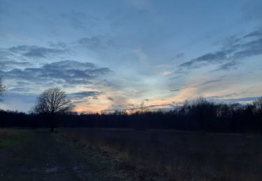
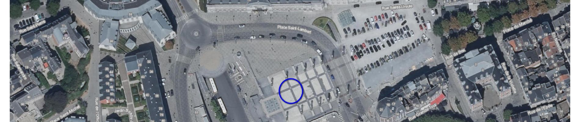
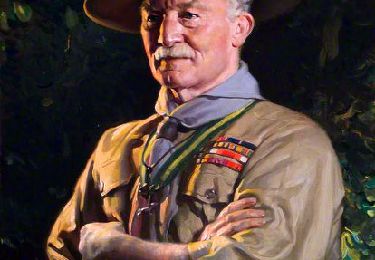
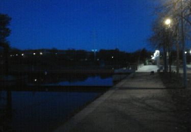
57 fotos in totaal. Klik op een foto om ze allemaal in de galerij weer te geven.
Stappen

Stappen
Stappen
Stappen
Stappen
Stappen
Stappen
Stappen