Tocht Stappen Nancray - Nancray-danse - Photo
 eltonnermou
eltonnermou

Gebruiker

© OpenStreetMap contributors
Lengte
Lengte
15,5 km
Max. hoogte
Max. hoogte
509 m
Positief hoogteverschil
208 m
Km-Effort
Km-Effort  
18,3 km
Min. hoogte
Min. hoogte
421 m
Negatief hoogteverschil
209 m
Boucle
Boucle
Ja
Datum van aanmaak :
2023-11-29 07:49:38.508
Laatste wijziging :
2023-12-02 13:51:53.985

(1 Bericht)

Stappen
Stappen
4h09
Moeilijkheid : Gemakkelijk

Scan deze QR-code om de tocht te openen in de SityTrail-applicatie

Gratisgps-wandelapplicatie

Logo SityTrail SityTrail

IGN / Geografische instituten

SityTrail uit de App Store downloaden SityTrail uit Google Play downloaden

Logo SityTrail SityTrail World

De wereld gaat voor u open

SityTrail uit de App Store downloaden SityTrail uit Google Play downloaden SityTrail op Huawei AppGallery downloaden

Over ons

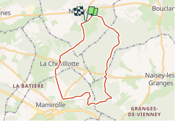
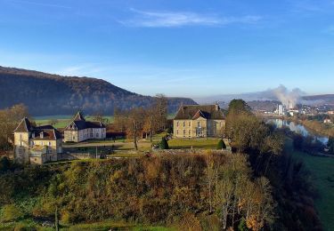
Tocht Stappen van 15,5 km beschikbaar op Bourgondië-Franche-Comté, Doubs, Nancray. Deze tocht wordt voorgesteld door eltonnermou.

Beschrijving

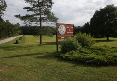
parking des maisons comtoises.
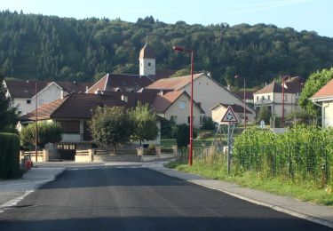
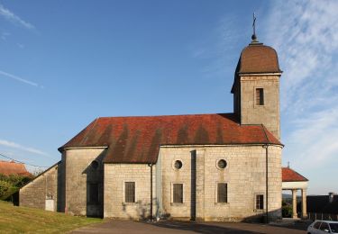
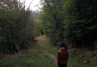
randonnée (4/5ième pieds propres) agréable, à faire en période hivernale ; en très grande partie dans la forêt avoisinante qui apporte un grand bol de calme et son lot d'air pur.
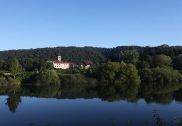
Laissez vous surprendre par la flore (suivant la saison) et par le passage d’un ou plusieurs chevreuils au détour d'un sentier.  

Hoogteprofiel

Foto's

Plaatsbepaling

Land:
France
Regio :
Bourgondië-Franche-Comté
Departement/Provincie :
Doubs
Gemeente :
Nancray
Locatie:
Unknown
Vertrek:(UTM)
286904 ; 5235636 (32T) N.

Opmerkingen

Gelieve in te loggen om een commentaar of een beoordeling achter te laten


Wandeltochten in de omgeving

Tocht Te voet Nancray - Circuit du Chêne Président - Photo
Te voet
PRO

Te voet

Gemakkelijk
Nancray, Bourgondië-Franche-Comté, Doubs, France
6,4 km | 7,2 km-effort
1h 38min
Ja
Tocht Te voet Nancray - Sentier du Fonteny - Photo
Te voet
PRO

Te voet

Gemakkelijk
Nancray, Bourgondië-Franche-Comté, Doubs, France
7,4 km | 9 km-effort
2h 2min
Ja
Tocht Te voet Mamirolle - Sentier du Golf - Photo
Te voet
PRO

Te voet

Gemakkelijk
Mamirolle, Bourgondië-Franche-Comté, Doubs, France
8,7 km | 10,4 km-effort
2h 21min
Ja
Tocht Te voet Nancray - Sentier du Moulin - Photo
Te voet
PRO

Te voet

Gemakkelijk
Nancray, Bourgondië-Franche-Comté, Doubs, France
9,5 km | 12,5 km-effort
2h 50min
Ja
Tocht Te voet Nancray - Sentier du Tour des Landes - Photo
Te voet
PRO

Te voet

Gemakkelijk
Nancray, Bourgondië-Franche-Comté, Doubs, France
8 km | 10,4 km-effort
2h 22min
Ja
Tocht Te voet Gennes - Sentier du Fort des Epesses - Photo
Te voet
PRO

Te voet

Gemakkelijk
Gennes, Bourgondië-Franche-Comté, Doubs, France
10,4 km | 14,4 km-effort
3h 16min
Ja
Tocht Te voet Vaire - Sentier des Sources 2 - Photo
Te voet
PRO

Te voet

Gemakkelijk
Vaire, Bourgondië-Franche-Comté, Doubs, France
4,9 km | 6,7 km-effort
1h 30min
Ja
Tocht Te voet Vaire - Sentier des Sources 1 - Photo
Te voet
PRO

Te voet

Gemakkelijk
Vaire, Bourgondië-Franche-Comté, Doubs, France
7,6 km | 10,9 km-effort
2h 29min
Ja
Tocht Stappen Gennes - Source d'Arcier - Photo
Stappen
GUIDE
David25400

Stappen

Gemakkelijk
Gennes, Bourgondië-Franche-Comté, Doubs, France
6,3 km | 10,7 km-effort
1h 54min
Ja


Sluiten
Mijn abonnementen