Tocht Stappen Vielsalm - Balade à Salmchateau - Photo

Balade à Salmchateau

 Desrumaux
Desrumaux

Gebruiker GUIDE

© OpenStreetMap contributors
Lengte
Lengte
9,8 km
Max. hoogte
Max. hoogte
541 m
Positief hoogteverschil
267 m
Km-Effort
Km-Effort  
13,4 km
Min. hoogte
Min. hoogte
376 m
Negatief hoogteverschil
269 m
Boucle
Boucle
Ja
Datum van aanmaak :
2024-01-10 10:50:57.613
Laatste wijziging :
2024-01-10 12:02:12.507

(0 Bericht)

Stappen
Stappen
3h02
Moeilijkheid : Moeilijk

Scan deze QR-code om de tocht te openen in de SityTrail-applicatie

Gratisgps-wandelapplicatie

Logo SityTrail SityTrail

IGN / Geografische instituten

SityTrail uit de App Store downloaden SityTrail uit Google Play downloaden

Logo SityTrail SityTrail World

De wereld gaat voor u open

SityTrail uit de App Store downloaden SityTrail uit Google Play downloaden SityTrail op Huawei AppGallery downloaden

Over ons

Tocht Stappen van 9,8 km beschikbaar op Wallonië, Luxemburg, Vielsalm. Deze tocht wordt voorgesteld door Desrumaux.

Beschrijving

Les Trésors du Pays de Salm

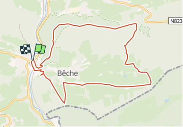
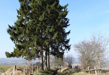
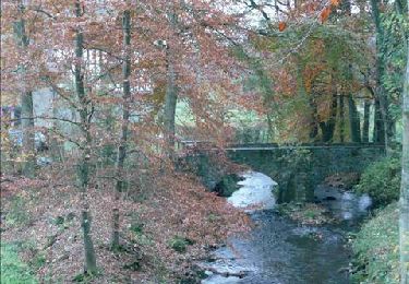
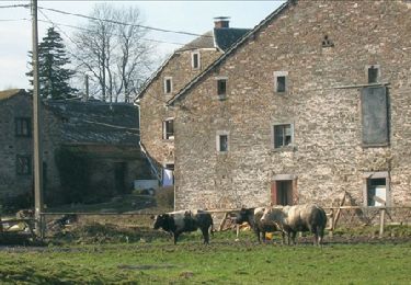
La balade des “Trésors du Pays de Salm” vous emmène le long d’un chemin sauvage et préservé au travers d’une des plus belle réserve naturelle de la région. Vous découvrirez aussi des sites extraordinaires qui sont les témoins archéologiques et historiques d’un riche passé. Vous aurez le plaisir d’admirer les meules oubliées, les galeries des ardoisiers ou encore les traces des chercheurs d’or pour arriver enfin au célèbre Musée du Coticule. Après cette enthousiasmante randonnée vous pouvez faire une pause bienvenue à la taverne devant l’église de Salm-Château.

Le départ se trouve sur la place de Salm-Château devant l’église en direction de Bèche.
Balisage TPV

https://www.vielsalm-tourisme.be/fr/index.php/activites/a-pied/promenades-a-theme/les-tresors-du-pays-de-salm/


Hoogteprofiel

Foto's

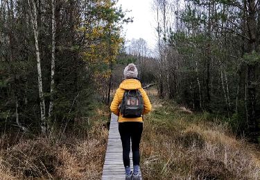
24 fotos in totaal. Klik op een foto om ze allemaal in de galerij weer te geven.

Plaatsbepaling

Land:
Belgium
Regio :
Wallonië
Departement/Provincie :
Luxemburg
Gemeente :
Vielsalm
Locatie:
Unknown
Vertrek:(UTM)
707099 ; 5572266 (31U) N.

Wandeltochten in de omgeving

Tocht Stappen Vielsalm - 2023-04-02_15h38m24_Cirkwi-Vielsalm___Pays_du_bois,_de_la_pierre_de_l_eau - Photo
Stappen
GUIDE
mumu.larandonneuse

Stappen

Medium
(2)
Vielsalm, Wallonië, Luxemburg, Belgium
11,6 km | 15,6 km-effort
3h 32min
Ja
Tocht Stappen Vielsalm - GG-Lu-16_Vielsalm - Gouvy - Photo
Stappen
PRO

Stappen

Zeer moeilijk
(3)
Vielsalm, Wallonië, Luxemburg, Belgium
16 km | 22 km-effort
4h 48min
Neen
Tocht Stappen Lierneux - RB-Lg-25_Arbrefontaine_via-racc-2 - Photo
Stappen
PRO

Stappen

(3)
Lierneux, Wallonië, Luik, Belgium
17,7 km | 23 km-effort
5h 12min
Ja
Tocht Stappen Lierneux - RB-Lg-25_Arbrefontaine - Photo
Stappen
PRO

Stappen

(4)
Lierneux, Wallonië, Luik, Belgium
25 km | 33 km-effort
7h 25min
Ja
Tocht Stappen Vielsalm - RB-LUX-03 - Raccourci - Dans les vallées de la Salm et du Glain - Photo
Stappen
PRO

Stappen

Gemakkelijk
(4)
Vielsalm, Wallonië, Luxemburg, Belgium
16,8 km | 23 km-effort
3h 36min
Ja
Tocht Stappen Vielsalm - RB-LUX-03 - Dans les vallées de la Salm et du Glain - Photo
Stappen
PRO

Stappen

Medium
(4)
Vielsalm, Wallonië, Luxemburg, Belgium
22 km | 30 km-effort
6h 10min
Ja
Tocht Stappen Gouvy - 15 juli 2012 - Photo
Stappen
pietsnot

Stappen

Heel gemakkelijk
(1)
Gouvy, Wallonië, Luxemburg, Belgium
5,1 km | 6,1 km-effort
1h 53min
Ja
Tocht Mountainbike Lierneux - O2bikers_151_petit_sart - Photo
Mountainbike
GUIDE+

Mountainbike

Heel gemakkelijk
(1)
Lierneux, Wallonië, Luik, Belgium
38 km | 50 km-effort
6h 44min
Ja
Tocht Stappen Gouvy - Promenade vers la réserve naturelle
Stappen
GUIDE+

Stappen

Gemakkelijk
(3)
Gouvy, Wallonië, Luxemburg, Belgium
4,4 km | 5,3 km-effort
1h 11min
Ja


Sluiten
Mijn abonnementen