Tocht Stappen Viroinval - Balade dans le Viroinval - De Vierves à Olloy - Photo

Balade dans le Viroinval - De Vierves à Olloy

 Desrumaux
Desrumaux

Gebruiker GUIDE

© OpenStreetMap contributors
Lengte
Lengte
10,5 km
Max. hoogte
Max. hoogte
244 m
Positief hoogteverschil
268 m
Km-Effort
Km-Effort  
14 km
Min. hoogte
Min. hoogte
130 m
Negatief hoogteverschil
269 m
Boucle
Boucle
Ja
Datum van aanmaak :
2015-03-10 00:00:00.0
Laatste wijziging :
2015-03-10 00:00:00.0

(1 Bericht)

Stappen
Stappen
3h03
Moeilijkheid : Gemakkelijk

Scan deze QR-code om de tocht te openen in de SityTrail-applicatie

Gratisgps-wandelapplicatie

Logo SityTrail SityTrail

IGN / Geografische instituten

SityTrail uit de App Store downloaden SityTrail uit Google Play downloaden

Logo SityTrail SityTrail World

De wereld gaat voor u open

SityTrail uit de App Store downloaden SityTrail uit Google Play downloaden SityTrail op Huawei AppGallery downloaden

Over ons

Tocht Stappen van 10,5 km beschikbaar op Wallonië, Namen, Viroinval. Deze tocht wordt voorgesteld door Desrumaux.

Beschrijving

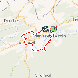
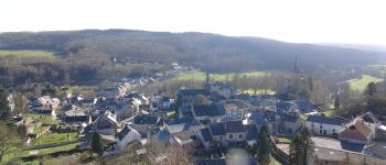
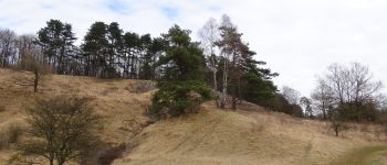
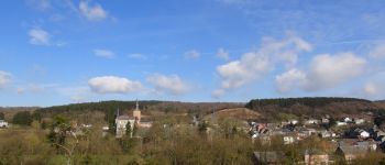
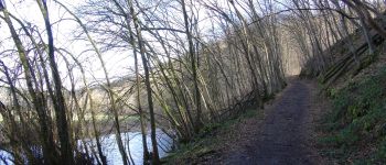
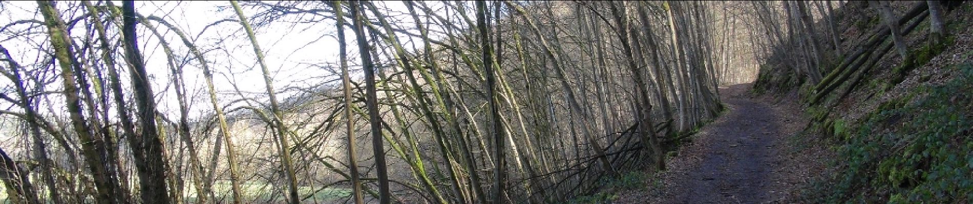
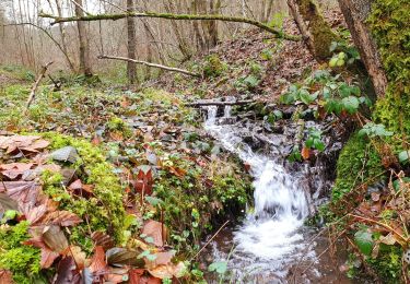
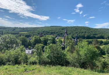
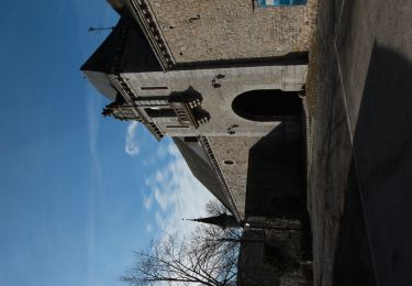
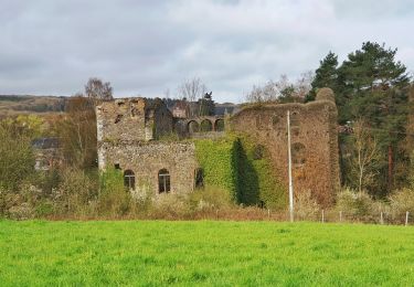
Cette randonnée aux paysages variés vous mènera le long de la rivière Viroin en bordure de la grande forêt d’Ardenne, sur les crêtes de la Calestienne et à la lisière de la réserve naturelle de la Roche Madoux.Village à flanc de coteaux où dévalent les rues et ruelles escarpées, Vierves, un des plus beaux villages de Wallonie, présente d'anciennes habitations qui se blottissent autour du majestueux château des barons de Hamal.Extrait du guide touristique de la Commune de Viroinval.Départ : Eglise de Vierves ou église d’Olloy.

Hoogteprofiel

Foto's

POI's

POI Viroinval - Vièrves-sur-Viroin - Photo
Desrumaux
POI Viroinval - Vièrves-sur-Viroin - Photo
Desrumaux
POI Viroinval - Vièrves-sur-Viroin - Photo
Desrumaux
POI Viroinval - Vièrves-sur-Viroin - Photo
Desrumaux
POI Viroinval - Vièrves-sur-Viroin - Photo
Desrumaux

Plaatsbepaling

Land:
Belgium
Regio :
Wallonië
Departement/Provincie :
Namen
Gemeente :
Viroinval
Locatie:
Vierves-sur-Viroin
Vertrek:(Dec)
Vertrek:(UTM)
616926 ; 5548816 (31U) N.

Opmerkingen

Gelieve in te loggen om een commentaar of een beoordeling achter te laten


Wandeltochten in de omgeving

Tocht Stappen Viroinval - Balade dans le Viroinval - De Vierves à Olloy - Photo
Stappen
GUIDE
Desrumaux

Stappen

Heel gemakkelijk
(2)
Viroinval, Wallonië, Namen, Belgium
8,9 km | 12,7 km-effort
4h 17min
Ja
Tocht Stappen Viroinval - RB-Na-12 Ed4 Balade franco-belge chez Toine Culot - Photo
Stappen
PRO

Stappen

Medium
(2)
Viroinval, Wallonië, Namen, Belgium
14,8 km | 21 km-effort
6h 13min
Ja
Tocht Stappen Viroinval - Vierves. Natura 2000, des sites qui valent le détour ! Na6 - Photo
Stappen
GUIDE+

Stappen

Gemakkelijk
(2)
Viroinval, Wallonië, Namen, Belgium
9,7 km | 12,7 km-effort
2h 41min
Ja
Tocht Stappen Viroinval - Mazée, sur le sentier des Douaniers - Photo
Stappen
GUIDE
Desrumaux

Stappen

Heel gemakkelijk
(1)
Viroinval, Wallonië, Namen, Belgium
7,6 km | 10,5 km-effort
4h 2min
Ja
Tocht Mountainbike Viroinval - Vierves - Olloy - Petigny - Nismes - Photo
Mountainbike
Chris Tian

Mountainbike

Moeilijk
(1)
Viroinval, Wallonië, Namen, Belgium
34 km | 42 km-effort
2h 9min
Ja
Tocht Noords wandelen Viroinval - VNW - Olloy-sur-viroin - 1 Fond de chênaux - Photo
Noords wandelen
hannodi

Noords wandelen

Medium
(1)
Viroinval, Wallonië, Namen, Belgium
5 km | 6,5 km-effort
1h 3min
Ja
Tocht Stappen Viroinval - Autour de vierves sur viroin - Photo
Stappen
GUIDE
pascalou73

Stappen

Medium
(3)
Viroinval, Wallonië, Namen, Belgium
11 km | 14,6 km-effort
3h 10min
Ja
Tocht Stappen Viroinval - A la découverte du Viroinval - Dourbes - Photo
Stappen
GUIDE
Desrumaux

Stappen

Gemakkelijk
(1)
Viroinval, Wallonië, Namen, Belgium
12,3 km | 16,4 km-effort
3h 0min
Ja
Tocht Stappen Viroinval - Balade dans le Viroinval - Olloy - Photo
Stappen
GUIDE
Desrumaux

Stappen

Moeilijk
Viroinval, Wallonië, Namen, Belgium
9,7 km | 13,2 km-effort
2h 59min
Ja


Sluiten
Mijn abonnementen