Tocht Stappen Sentheim - Knapphutte Saegenkopf Hütte - Photo

Knapphutte Saegenkopf Hütte

 helmut68
helmut68

Gebruiker

© OpenStreetMap contributors
Lengte
Lengte
13,8 km
Max. hoogte
Max. hoogte
535 m
Positief hoogteverschil
259 m
Km-Effort
Km-Effort  
17,2 km
Min. hoogte
Min. hoogte
353 m
Negatief hoogteverschil
261 m
Boucle
Boucle
Ja
Datum van aanmaak :
2024-02-28 09:45:11.429
Laatste wijziging :
2024-02-28 19:50:57.808

(0 Bericht)

Stappen
Stappen
5h11
Moeilijkheid : Medium

Scan deze QR-code om de tocht te openen in de SityTrail-applicatie

Gratisgps-wandelapplicatie

Logo SityTrail SityTrail

IGN / Geografische instituten

SityTrail uit de App Store downloaden SityTrail uit Google Play downloaden

Logo SityTrail SityTrail World

De wereld gaat voor u open

SityTrail uit de App Store downloaden SityTrail uit Google Play downloaden SityTrail op Huawei AppGallery downloaden

Over ons

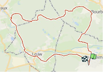
Tocht Stappen van 13,8 km beschikbaar op Grand Est, Haut-Rhin, Sentheim. Deze tocht wordt voorgesteld door helmut68.

Beschrijving

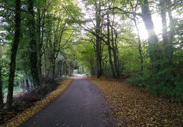
Agréable randonnée au départ de la place de l'église de Sentheim .Suivez le balisage " Rouge blanc rouge " direction col de Schirm .
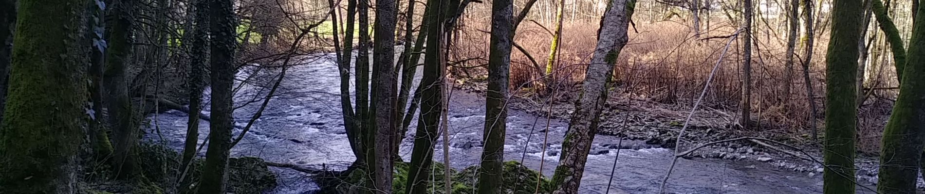
Aprés le parcours Vitae de Bourbach le Bas tournez sur votre gauche , balisage " disque jaune "jusqu'à la Knapphutte ( chapelle des mineurs ) .Continuez de suivre le balisage " disque jaune "jusqu'à l' abri du Saegenkopf Hütte ( tables, barbecue ).
Pour le retour continuez d'utiliser le balisage " disque jaune " ( direction Masevaux ) pour arriver à un super point de vue nommé " Tobelfels " . Ensuite utilisez la piste cyclable ( direction Lauw ) jusqu'à la fin de l'usine LauwPlast , tournez à droite , empruntez un sentier jusqu'à la Doller ( rivière ) que vous traverserez par un pont métallique.  Longez le terrain de football , au centre du village de Lauw , suivez le balisage " triangle bleu "  jusqu'à Sentheim.
Alors à vos chaussures !

Hoogteprofiel

Foto's

Plaatsbepaling

Land:
France
Regio :
Grand Est
Departement/Provincie :
Haut-Rhin
Gemeente :
Sentheim
Locatie:
Unknown
Vertrek:(UTM)
353914 ; 5290664 (32T) N.

Wandeltochten in de omgeving

Tocht Stappen Masevaux-Niederbruck - Masevaux - Rossberg par le belvédère du Fuchsfelsen - Photo
Stappen
Bart2015

Stappen

Medium
(1)
Masevaux-Niederbruck, Grand Est, Haut-Rhin, France
19,9 km | 34 km-effort
4h 44min
Ja
Tocht Stappen Sentheim - Sentheim Rossberg - Photo
Stappen
helmut68

Stappen

Medium
(1)
Sentheim, Grand Est, Haut-Rhin, France
27 km | 40 km-effort
6h 11min
Ja
Tocht Stappen Lauw - 2022-07-14 Marche Lauw Refuge CAF Baerenkopf - Photo
Stappen
GUIDE
holtzv

Stappen

Zeer moeilijk
Lauw, Grand Est, Haut-Rhin, France
18,4 km | 31 km-effort
5h 35min
Neen
Tocht Te voet Sentheim - Sentier géologique du Wolfloch - Photo
Te voet
PRO

Te voet

Gemakkelijk
Sentheim, Grand Est, Haut-Rhin, France
3,8 km | 4,8 km-effort
1h 5min
Neen
Tocht Te voet Sentheim - Sentheim - Bergwald - Eichwald - Guevenheim - Sentheim - Photo
Te voet
patrickbeyrath

Te voet

Gemakkelijk
(1)
Sentheim, Grand Est, Haut-Rhin, France
13,4 km | 16,6 km-effort
Onbekend
Ja
Tocht Stappen Sentheim - Montori - Photo
Stappen
helmut68

Stappen

Medium
Sentheim, Grand Est, Haut-Rhin, France
17,7 km | 24 km-effort
4h 47min
Ja
Tocht Mountainbike Sentheim - AperoDioller - Photo
Mountainbike
helmut68

Mountainbike

Gemakkelijk
Sentheim, Grand Est, Haut-Rhin, France
24 km | 27 km-effort
1h 23min
Ja
Tocht Stappen Sentheim - Baerenkopf  - Photo
Stappen
helmut68

Stappen

Moeilijk
Sentheim, Grand Est, Haut-Rhin, France
33 km | 49 km-effort
7h 0min
Ja
Tocht Stappen Sentheim - Lac Seigneurie Soultzbach - Photo
Stappen
helmut68

Stappen

Gemakkelijk
Sentheim, Grand Est, Haut-Rhin, France
10,9 km | 12,7 km-effort
3h 26min
Ja


Sluiten
Mijn abonnementen