Tocht Wegfiets Lalinde - Lalinde 39km - Photo
 amelie14
amelie14

Gebruiker

© OpenStreetMap contributors
Lengte
Lengte
39 km
Max. hoogte
Max. hoogte
182 m
Positief hoogteverschil
668 m
Km-Effort
Km-Effort  
48 km
Min. hoogte
Min. hoogte
38 m
Negatief hoogteverschil
664 m
Boucle
Boucle
Ja
Datum van aanmaak :
2024-04-12 11:44:07.621
Laatste wijziging :
2024-04-12 13:54:55.726

(0 Bericht)

Wegfiets
Wegfiets
1h38
Moeilijkheid : Medium

Scan deze QR-code om de tocht te openen in de SityTrail-applicatie

Gratisgps-wandelapplicatie

Logo SityTrail SityTrail

IGN / Geografische instituten

SityTrail uit de App Store downloaden SityTrail uit Google Play downloaden

Logo SityTrail SityTrail World

De wereld gaat voor u open

SityTrail uit de App Store downloaden SityTrail uit Google Play downloaden SityTrail op Huawei AppGallery downloaden

Over ons

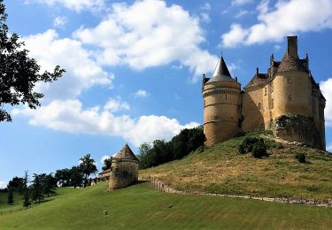
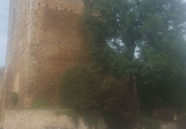
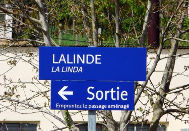
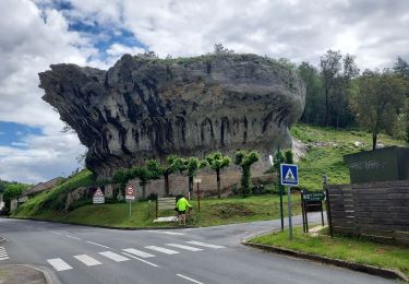
Tocht Wegfiets van 39 km beschikbaar op Nieuw-Aquitanië, Dordogne, Lalinde. Deze tocht wordt voorgesteld door amelie14.

Hoogteprofiel

Plaatsbepaling

Land:
France
Regio :
Nieuw-Aquitanië
Departement/Provincie :
Dordogne
Gemeente :
Lalinde
Locatie:
Unknown
Vertrek:(Dec)
Vertrek:(UTM)
318614 ; 4967936 (31T) N.

Wandeltochten in de omgeving

Tocht Te voet Bayac - Boucle du rocher du corbeau - Photo
Te voet
PRO

Te voet

Gemakkelijk
Bayac, Nieuw-Aquitanië, Dordogne, France
10,6 km | 14,1 km-effort
3h 12min
Neen
Tocht Te voet Cause-de-Clérans - Cause de Clérans - Photo
Te voet
audier

Te voet

Medium
Cause-de-Clérans, Nieuw-Aquitanië, Dordogne, France
23 km | 28 km-effort
6h 28min
Ja
Tocht Te voet Lanquais - Boucle des coteaux - Photo
Te voet
PRO

Te voet

Gemakkelijk
Lanquais, Nieuw-Aquitanië, Dordogne, France
6,4 km | 8,2 km-effort
1h 52min
Ja
Tocht Te voet Lanquais - Boucle des eaux - Photo
Te voet
PRO

Te voet

Gemakkelijk
Lanquais, Nieuw-Aquitanië, Dordogne, France
10 km | 12,9 km-effort
2h 56min
Neen
Tocht Te voet Couze-et-Saint-Front - Boucle de Saint-Front - Photo
Te voet
PRO

Te voet

Gemakkelijk
Couze-et-Saint-Front, Nieuw-Aquitanië, Dordogne, France
8,2 km | 10,7 km-effort
2h 25min
Ja
Tocht Stappen Lalinde - Boucle de Pontour(modifiée) - Photo
Stappen
swp648

Stappen

Gemakkelijk
Lalinde, Nieuw-Aquitanië, Dordogne, France
21 km | 28 km-effort
5h 37min
Ja
Tocht Stappen Cause-de-Clérans - Autour de Cause-de-Clérans - Photo
Stappen
tracegps

Stappen

Medium
(1)
Cause-de-Clérans, Nieuw-Aquitanië, Dordogne, France
14,3 km | 18,2 km-effort
3h 30min
Ja
Tocht Wegfiets Lalinde - J5 Montpazier - Photo
Wegfiets
Specialized77

Wegfiets

Gemakkelijk
Lalinde, Nieuw-Aquitanië, Dordogne, France
90 km | 104 km-effort
6h 18min
Ja
Tocht Wegfiets Lalinde - J4 La Vézère Les Eyzies - Photo
Wegfiets
Specialized77

Wegfiets

Zeer moeilijk
Lalinde, Nieuw-Aquitanië, Dordogne, France
72 km | 86 km-effort
5h 13min
Neen


Sluiten
Mijn abonnementen