


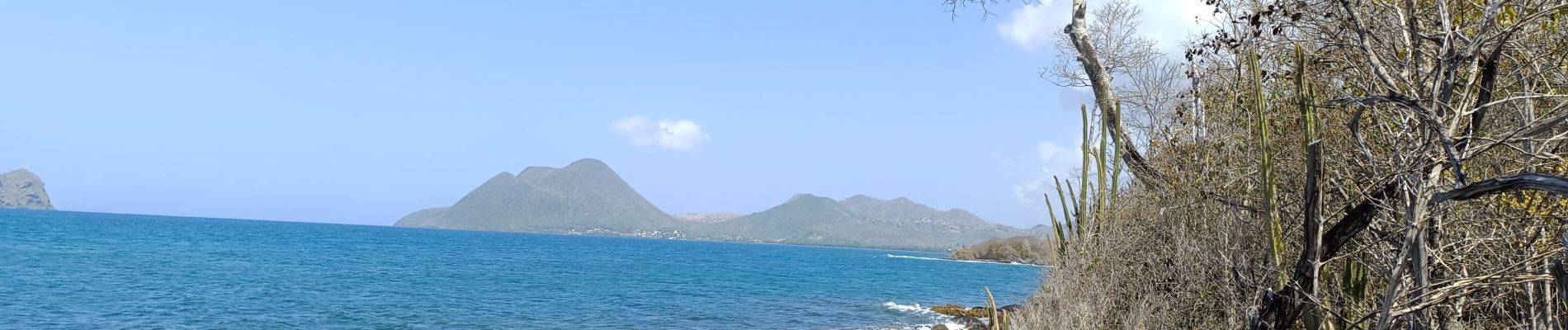
le Diamant de Taupinière vers O'mulane bas.

GabyG
Gebruiker GUIDE
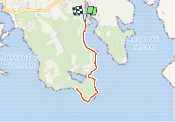

Lengte
5 km

Max. hoogte
19 m

Positief hoogteverschil
42 m
Km-Effort
5,5 km

Min. hoogte
0 m

Negatief hoogteverschil
41 m
Boucle
Ja
Datum van aanmaak :
2024-05-12 12:57:30.255
Laatste wijziging :
2024-05-12 15:03:19.085
2h05
Moeilijkheid : Gemakkelijk

Gratisgps-wandelapplicatie
 SityTrail
IGN / Geografische instituten
SityTrail Plus
De wereld gaat voor u open
Over ons
Tocht Stappen van 5 km beschikbaar op Martinique, Onbekend, Le Diamant. Deze tocht wordt voorgesteld door GabyG.
Beschrijving
Randonnées du dimanche, visite de la mangrove rose.
Foto's


24 fotos in totaal. Klik op een foto om ze allemaal in de galerij weer te geven.
Plaatsbepaling
Land:
France
Regio :
Martinique
Departement/Provincie :
Onbekend
Gemeente :
Le Diamant
Locatie:
Unknown
Vertrek:(Dec)
Vertrek:(UTM)
716422 ; 1601802 (20P) N.
Opmerkingen