22 km | 28 km-effort
Au pays des pierres
alain2306
Gebruiker
Lengte
11,6 km
Max. hoogte
329 m
Positief hoogteverschil
347 m
Km-Effort
16,2 km
Min. hoogte
163 m
Negatief hoogteverschil
347 m
Boucle
Ja
Datum van aanmaak :
2015-09-07 00:00:00.0
Laatste wijziging :
2015-09-07 00:00:00.0
3h30
Moeilijkheid : Moeilijk
Gratisgps-wandelapplicatie
Over ons
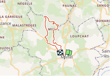
Tocht Stappen van 11,6 km beschikbaar op Occitanië, Lot, Martel. Deze tocht wordt voorgesteld door alain2306.
Beschrijving
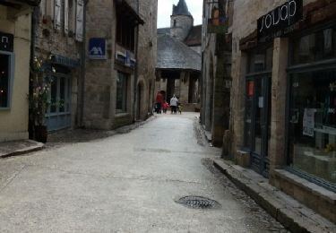
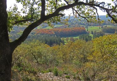
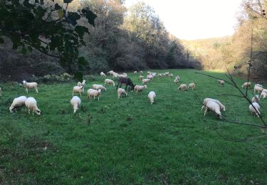
Issu du topoGuide "Le Lot à pied" parcours 26. Martel et le hameau de Murel
Plaatsbepaling
Land:
France
Regio :
Occitanië
Departement/Provincie :
Lot
Gemeente :
Martel
Locatie:
Unknown
Vertrek:(Dec)
Vertrek:(UTM)
390085 ; 4976712 (31T) N.
Opmerkingen
Wandeltochten in de omgeving
autour de Floirac
Stappen
Heel gemakkelijk
Floirac,
Occitanië,
Lot,
France
16,5 km | 22 km-effort
4h 7min
Ja
le caillon cirque de foirac
Stappen
Heel gemakkelijk
Floirac,
Occitanië,
Lot,
France
13,5 km | 18,8 km-effort
3h 13min
Ja
boucle pierre et eau
Stappen
Gemakkelijk
Martel,
Occitanië,
Lot,
France
11,7 km | 16,3 km-effort
2h 59min
Ja
Vayrac par Uxelmodunum
Stappen
Heel gemakkelijk
Saint-Denis-lès-Martel,
Occitanië,
Lot,
France
15,7 km | 18,6 km-effort
3h 46min
Ja
Boucle Floirac - Montvalent par Le Pech Cayrou et Roque De Cor
Mountainbike
Gemakkelijk
Floirac,
Occitanië,
Lot,
France
30 km | 38 km-effort
18min
Ja
Martel-Carennac-Castelnau-Loubressac-Autoire-Saint Céré-Bretenoux
Motorfiets
Gemakkelijk
Martel,
Occitanië,
Lot,
France
116 km | 142 km-effort
2h 30min
Neen
11255276-le Mont Mercou depuis Martel
Stappen
Moeilijk
Martel,
Occitanië,
Lot,
France
12 km | 16,6 km-effort
3h 45min
Ja
Murel/Oeil de la Doue
Stappen
Gemakkelijk
Martel,
Occitanië,
Lot,
France
20 km | 28 km-effort
5h 28min
Ja