


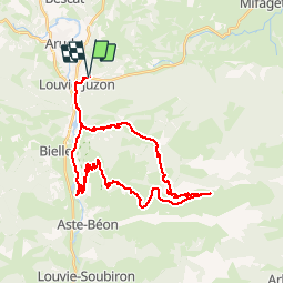

12,2 km | 25 km-effort


Gebruiker


Gratisgps-wandelapplicatie
 SityTrail
IGN / Geografische instituten
SityTrail World
De wereld gaat voor u open
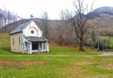
Tocht Mountainbike van 38 km beschikbaar op Nieuw-Aquitanië, Pyrénées-Atlantiques, Louvie-Juzon. Deze tocht wordt voorgesteld door francislassauce.
très roulant jusqu'au col de jau malgrès des pourcentages assez élevés.
ensuite il faut suivre le parcours VTT no 10 qui est balisé avec des petits poteaux au raz du sol. on roule dans la prairie en suivant des sentiers faits par les vaches. donc il y en a partout.
après qq kms j'ai perdu la trace des balises. donc j'ai fait au feeling.
la descente est super belle mais caillouteuse. 10kms environ de descente. super panoramas.


Stappen
Stappen
Stappen

Te voet
Te voet
Te voet
Te voet
Te voet
Te voet