Tocht Stappen Sainte-Marie-la-Mer - 66 SAINTE-MARIE-LA-MER - à Sainte-Marie plage par la SALANQUE, la TÊT, le port le front de mer, et les canaux  - Photo

66 SAINTE-MARIE-LA-MER - à Sainte-Marie plage par la SALANQUE, la TÊT, le port le front de mer, et les canaux

 jeff66
jeff66

Gebruiker

© OpenStreetMap contributors
Lengte
Lengte
12,1 km
Max. hoogte
Max. hoogte
6 m
Positief hoogteverschil
42 m
Km-Effort
Km-Effort  
12,6 km
Min. hoogte
Min. hoogte
-2 m
Negatief hoogteverschil
41 m
Boucle
Boucle
Ja
Datum van aanmaak :
2016-03-09 00:00:00.0
Laatste wijziging :
2016-03-09 00:00:00.0

(1 Bericht)

Stappen
Stappen
2h00
Moeilijkheid : Medium

Scan deze QR-code om de tocht te openen in de SityTrail-applicatie

Gratisgps-wandelapplicatie

Logo SityTrail SityTrail

IGN / Geografische instituten

SityTrail uit de App Store downloaden SityTrail uit Google Play downloaden

Logo SityTrail SityTrail World

De wereld gaat voor u open

SityTrail uit de App Store downloaden SityTrail uit Google Play downloaden SityTrail op Huawei AppGallery downloaden

Over ons

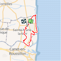
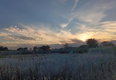
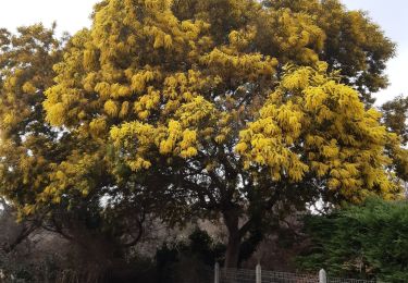
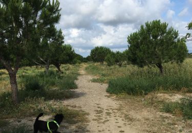
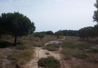
Tocht Stappen van 12,1 km beschikbaar op Occitanië, Pyrénées-Orientales, Sainte-Marie-la-Mer. Deze tocht wordt voorgesteld door jeff66.

Beschrijving

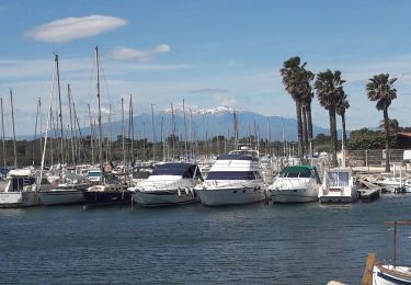
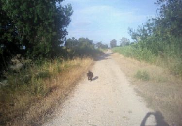
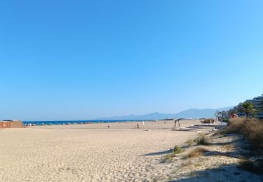
66 SAINTE-MARIE-LA-MER - parking du stade Louis Carrere, D12. av. du stade,pl. g. Brassens et j. cocteau, rue Debussy. Av. Pablo Casals, rue  sdes palmiers, des chênes - els Carboelles - Carrer de Mallorca - champs d'artichauts - El Riberal - la TÊT, passage sous la D81, les closes - petite passerelle sur l'Eixau vella - SAINTE-MARIE-PLAGE - els Gravatels - port de plaisance - av. des dauphins et des berges du canal - bar l'oasis, plages, Bld du front de mer, rue des mouettes, el pica pica, pica beach, etang, Agulla de l'Auca, moli de la vilallonga. Les illes - rues des abricotiers, des pêchers - sainte Marie la mer villahe, passage piéton sous D81

Hoogteprofiel

Foto's

Plaatsbepaling

Land:
France
Regio :
Occitanië
Departement/Provincie :
Pyrénées-Orientales
Gemeente :
Sainte-Marie-la-Mer
Locatie:
Unknown
Vertrek:(Dec)
Vertrek:(UTM)
502029 ; 4730902 (31T) N.

Opmerkingen

Gelieve in te loggen om een commentaar of een beoordeling achter te laten


Wandeltochten in de omgeving

Tocht Stappen Canet-en-Roussillon - CANET-EN-ROUSSILLON 66 - entre TÊT, marais. étang et RÉART  - Photo
Stappen
jeff66

Stappen

Medium
(1)
Canet-en-Roussillon, Occitanië, Pyrénées-Orientales, France
16,3 km | 17,5 km-effort
2h 49min
Ja
Tocht Stappen Sainte-Marie-la-Mer - sainte marie la mer - village et plage  - Photo
Stappen
stef789

Stappen

Gemakkelijk
Sainte-Marie-la-Mer, Occitanië, Pyrénées-Orientales, France
8,6 km | 8,9 km-effort
2h 40min
Ja
Tocht Stappen Sainte-Marie-la-Mer - sainte Marie la mer HUIT KM plus retour en voiture oups désolé  - Photo
Stappen
stef789

Stappen

Zeer moeilijk
Sainte-Marie-la-Mer, Occitanië, Pyrénées-Orientales, France
45 km | 49 km-effort
4h 18min
Neen
Tocht Stappen Sainte-Marie-la-Mer - sainte-marie côté mer  - Photo
Stappen
stef789

Stappen

Heel gemakkelijk
Sainte-Marie-la-Mer, Occitanië, Pyrénées-Orientales, France
8,4 km | 8,7 km-effort
2h 45min
Ja
Tocht Stappen Torreilles - Torreilles plage -Torreilles village  - Photo
Stappen
merencianoep

Stappen

Torreilles, Occitanië, Pyrénées-Orientales, France
8,2 km | 8,6 km-effort
1h 47min
Ja
Tocht Stappen Torreilles - Les Dunes Juhègues - Photo
Stappen
karani27

Stappen

Gemakkelijk
Torreilles, Occitanië, Pyrénées-Orientales, France
11,5 km | 12 km-effort
2h 21min
Neen
Tocht Stappen Sainte-Marie-la-Mer - tour de ste Marie la mer  - Photo
Stappen
junique

Stappen

Heel gemakkelijk
Sainte-Marie-la-Mer, Occitanië, Pyrénées-Orientales, France
5,7 km | 6 km-effort
1h 19min
Ja
Tocht Stappen Torreilles - long agly pres juhegues 29 juin 2013 matin - Photo
Stappen
merencianoep

Stappen

Heel gemakkelijk
Torreilles, Occitanië, Pyrénées-Orientales, France
9,5 km | 10,1 km-effort
1h 31min
Neen
Tocht Stappen Canet-en-Roussillon - Le canet, la plage des kèkès ... - Photo
Stappen
stef789

Stappen

Gemakkelijk
Canet-en-Roussillon, Occitanië, Pyrénées-Orientales, France
4,3 km | 4,6 km-effort
1h 7min
Ja


Sluiten
Mijn abonnementen