


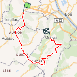

15,2 km | 22 km-effort


Gebruiker


Gratisgps-wandelapplicatie
 SityTrail
IGN / Geografische instituten
SityTrail World
De wereld gaat voor u open
Tocht Mountainbike van 12,9 km beschikbaar op Nieuw-Aquitanië, Lot-et-Garonne, Estillac. Deze tocht wordt voorgesteld door mapomme.
Tres jolie demi boucle à compléter par autre demi boucle moirax-estillac. Attention petite erreur au niveau de trotte lapin. Tourner avant !

Stappen

Mountainbike

Stappen

Stappen
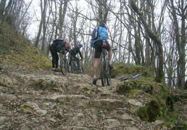
Mountainbike

Paard

Mountainbike
Stappen
Stappen