Tocht Stappen Billière - Montagne d'Espiau - Photo
 lhomme.ph
lhomme.ph

Gebruiker GUIDE

© OpenStreetMap contributors
Lengte
Lengte
8 km
Max. hoogte
Max. hoogte
1835 m
Positief hoogteverschil
744 m
Km-Effort
Km-Effort  
17,9 km
Min. hoogte
Min. hoogte
1081 m
Negatief hoogteverschil
743 m
Boucle
Boucle
Ja
Datum van aanmaak :
2016-11-17 00:00:00.0
Laatste wijziging :
2016-11-17 00:00:00.0

(1 Bericht)

Stappen
Stappen
4h47
Moeilijkheid : Medium

Scan deze QR-code om de tocht te openen in de SityTrail-applicatie

Gratisgps-wandelapplicatie

Logo SityTrail SityTrail

IGN / Geografische instituten

SityTrail uit de App Store downloaden SityTrail uit Google Play downloaden

Logo SityTrail SityTrail World

De wereld gaat voor u open

SityTrail uit de App Store downloaden SityTrail uit Google Play downloaden SityTrail op Huawei AppGallery downloaden

Over ons

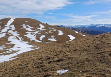
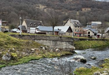
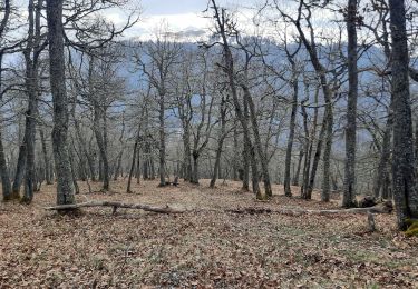
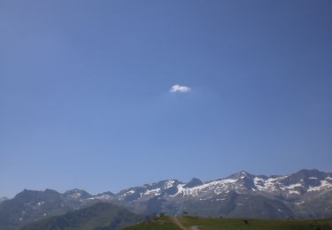
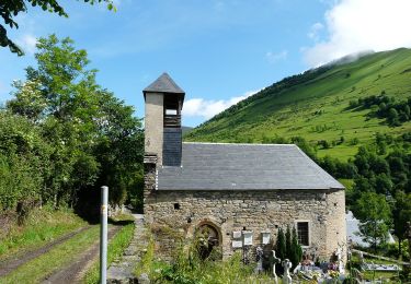
Tocht Stappen van 8 km beschikbaar op Occitanië, Haute-Garonne, Billière. Deze tocht wordt voorgesteld door lhomme.ph.

Hoogteprofiel

Plaatsbepaling

Land:
France
Regio :
Occitanië
Departement/Provincie :
Haute-Garonne
Gemeente :
Billière
Locatie:
Unknown
Vertrek:(Dec)
Vertrek:(UTM)
297895 ; 4742855 (31T) N.

Opmerkingen

Gelieve in te loggen om een commentaar of een beoordeling achter te laten


inadmissible de lancer les gens sur des sentiers aussi pentus à travers las pâturages, la prochaine fois abstenez vous de publier de telles randonnées au risque de mettre en péril certains randonneurs.


Wandeltochten in de omgeving

Tocht Mountainbike Saint-Aventin - Luchon Kbour - Photo
Mountainbike
tracegps

Mountainbike

Zeer moeilijk
(1)
Saint-Aventin, Occitanië, Haute-Garonne, France
11 km | 16,7 km-effort
1h 0min
Neen
Tocht Stappen Saccourvielle - Cap de Salières en boucle depuis Saccourvielle - Photo
Stappen
GUIDE
lhomme.ph

Stappen

Medium
Saccourvielle, Occitanië, Haute-Garonne, France
12,1 km | 24 km-effort
6h 23min
Ja
Tocht Stappen Mayrègne - mail de la pène de Rustier en boucle depuis Mayrègne  - Photo
Stappen
GUIDE
lhomme.ph

Stappen

Medium
Mayrègne, Occitanië, Haute-Garonne, France
11,7 km | 21 km-effort
6h 2min
Ja
Tocht Stappen Gouaux-de-Larboust - Boucle autour d’Oô - Photo
Stappen
nandaf

Stappen

Gouaux-de-Larboust, Occitanië, Haute-Garonne, France
9 km | 15,6 km-effort
3h 5min
Ja
Tocht Stappen Saint-Aventin - Cabane de Courreau en boucle depuis St Aventin  - Photo
Stappen
GUIDE
lhomme.ph

Stappen

Medium
Saint-Aventin, Occitanië, Haute-Garonne, France
13,3 km | 24 km-effort
6h 10min
Ja
Tocht Stappen Mayrègne - Cap de Serrède en boucle depuis Mayrègne  - Photo
Stappen
GUIDE
lhomme.ph

Stappen

Medium
Mayrègne, Occitanië, Haute-Garonne, France
6,6 km | 15,2 km-effort
4h 11min
Ja
Tocht Stappen Gouaux-de-Larboust - Agudes  - Photo
Stappen
GUIDE
antignacs

Stappen

Heel gemakkelijk
Gouaux-de-Larboust, Occitanië, Haute-Garonne, France
4,7 km | 8,2 km-effort
1h 42min
Ja
Tocht Te voet Saint-Aventin - La Forestière - Photo
Te voet
PRO

Te voet

Gemakkelijk
Saint-Aventin, Occitanië, Haute-Garonne, France
7,3 km | 11,7 km-effort
2h 39min
Neen
Tocht Te voet Benque-Dessous-et-Dessus - Boucle dans la vallée du Larboust et la Vallée d'Oueil - Photo
Te voet
PRO

Te voet

Gemakkelijk
Benque-Dessous-et-Dessus, Occitanië, Haute-Garonne, France
4,9 km | 8,7 km-effort
1h 58min
Neen


Sluiten
Mijn abonnementen