depuis ST Michel de Cuixa
ThonyM
Gebruiker
Lengte
16,3 km
Max. hoogte
700 m
Positief hoogteverschil
484 m
Km-Effort
23 km
Min. hoogte
440 m
Negatief hoogteverschil
481 m
Boucle
Ja
Datum van aanmaak :
2017-01-09 00:00:00.0
Laatste wijziging :
2017-01-09 00:00:00.0
4h18
Moeilijkheid : Medium
Gratisgps-wandelapplicatie
Over ons
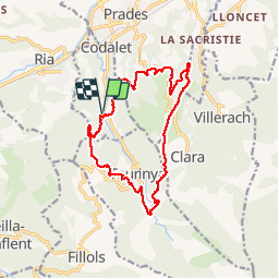
Tocht Stappen van 16,3 km beschikbaar op Occitanië, Pyrénées-Orientales, Codalet. Deze tocht wordt voorgesteld door ThonyM.
Beschrijving
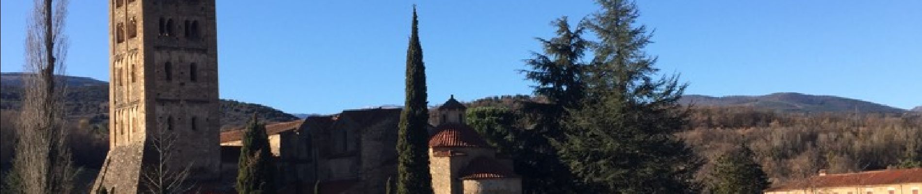
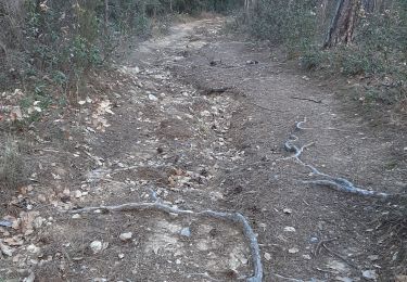
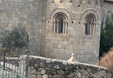
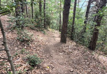
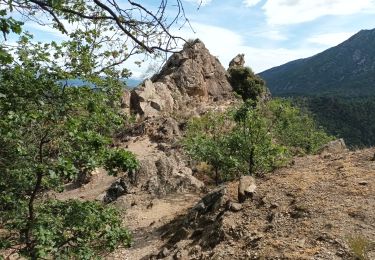
En partant du parking de l'abbaye, vers la tour de Corts puis le col de Clara où nous avons déjeuné avant de refermer la boucle par le canal de Bohere. Pas de difficulté majeure
Plaatsbepaling
Land:
France
Regio :
Occitanië
Departement/Provincie :
Pyrénées-Orientales
Gemeente :
Codalet
Locatie:
Unknown
Vertrek:(Dec)
Vertrek:(UTM)
452099 ; 4715997 (31T) N.
Opmerkingen
Wandeltochten in de omgeving
Sirach-Taurinya-Saint Michel de Cuxa
Stappen
Gemakkelijk
(2)
Ria-Sirach,
Occitanië,
Pyrénées-Orientales,
France
13,5 km | 17,2 km-effort
2h 31min
Ja
Prades - Villefranche de Conflent - Evol
Motor
Gemakkelijk
(1)
Codalet,
Occitanië,
Pyrénées-Orientales,
France
36 km | 48 km-effort
3h 47min
Neen
cami del pi
Mountainbike
Heel gemakkelijk
(1)
Ria-Sirach,
Occitanië,
Pyrénées-Orientales,
France
11,2 km | 18,4 km-effort
1h 52min
Ja
le Canigou depuis le col de Millères
Stappen
Moeilijk
(1)
Taurinya,
Occitanië,
Pyrénées-Orientales,
France
22 km | 48 km-effort
8h 30min
Ja
fuilla (66)
Stappen
Moeilijk
Fuilla,
Occitanië,
Pyrénées-Orientales,
France
11,7 km | 17,8 km-effort
5h 57min
Ja
Corneilla de Conflent
Stappen
Gemakkelijk
Corneilla-de-Conflent,
Occitanië,
Pyrénées-Orientales,
France
12,8 km | 17,7 km-effort
3h 27min
Ja
Vernet 3
Stappen
Medium
Vernet-les-Bains,
Occitanië,
Pyrénées-Orientales,
France
8,6 km | 13,8 km-effort
2h 12min
Ja
Vernet 1
Stappen
Medium
Vernet-les-Bains,
Occitanië,
Pyrénées-Orientales,
France
6,5 km | 12,6 km-effort
1h 59min
Ja
les mines du Salver
Stappen
Gemakkelijk
Taurinya,
Occitanië,
Pyrénées-Orientales,
France
3 km | 4,7 km-effort
1h 41min
Ja