Tocht Stappen Villeneuve-sur-Vère - Villeneuve sur vere - Photo
 Frayssinet
Frayssinet

Gebruiker

© OpenStreetMap contributors
Lengte
Lengte
22 km
Max. hoogte
Max. hoogte
308 m
Positief hoogteverschil
441 m
Km-Effort
Km-Effort  
28 km
Min. hoogte
Min. hoogte
234 m
Negatief hoogteverschil
443 m
Boucle
Boucle
Ja
Datum van aanmaak :
2019-04-30 13:02:23.534
Laatste wijziging :
2019-04-30 13:02:23.622

(0 Bericht)

Stappen
Stappen
7h03
Moeilijkheid : Onbekend

Scan deze QR-code om de tocht te openen in de SityTrail-applicatie

Gratisgps-wandelapplicatie

Logo SityTrail SityTrail

IGN / Geografische instituten

SityTrail uit de App Store downloaden SityTrail uit Google Play downloaden

Logo SityTrail SityTrail World

De wereld gaat voor u open

SityTrail uit de App Store downloaden SityTrail uit Google Play downloaden SityTrail op Huawei AppGallery downloaden

Over ons

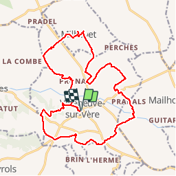
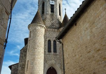
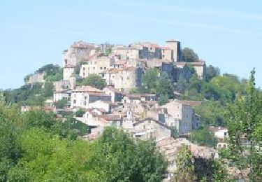
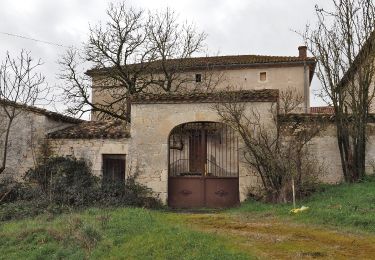
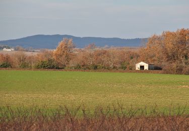
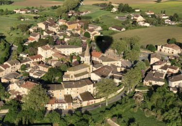
Tocht Stappen van 22 km beschikbaar op Occitanië, Tarn, Villeneuve-sur-Vère. Deze tocht wordt voorgesteld door Frayssinet.

Beschrijving

tournee du facteur

Hoogteprofiel

Plaatsbepaling

Land:
France
Regio :
Occitanië
Departement/Provincie :
Tarn
Gemeente :
Villeneuve-sur-Vère
Locatie:
Unknown
Vertrek:(Dec)
Vertrek:(UTM)
422112 ; 4872498 (31T) N.

Wandeltochten in de omgeving

Tocht Stappen Cestayrols - Lincarque autrement - Photo
Stappen
tercla

Stappen

Medium
Cestayrols, Occitanië, Tarn, France
11,8 km | 14,8 km-effort
2h 43min
Ja
Tocht Noords wandelen Souel - sentier du Causse et un peu plus... - Photo
Noords wandelen
chripaci

Noords wandelen

Moeilijk
Souel, Occitanië, Tarn, France
12,4 km | 16,9 km-effort
2h 49min
Ja
Tocht Stappen Villeneuve-sur-Vère - Villeneuve sur Vere via Milhavet (version 2) - Photo
Stappen
tercla

Stappen

Heel gemakkelijk
Villeneuve-sur-Vère, Occitanië, Tarn, France
14,9 km | 18,9 km-effort
4h 50min
Ja
Tocht Stappen Villeneuve-sur-Vère - Boucle Villeneuve-sur-Vere/Roumanou - Photo
Stappen
tercla

Stappen

Heel gemakkelijk
Villeneuve-sur-Vère, Occitanië, Tarn, France
20 km | 25 km-effort
5h 2min
Ja
Tocht Stappen Cestayrols - cestayrols - Photo
Stappen
la_hulotte

Stappen

Heel gemakkelijk
Cestayrols, Occitanië, Tarn, France
9,9 km | 12,4 km-effort
2h 56min
Ja
Tocht Stappen Cestayrols - cestayrols - Photo
Stappen
la_hulotte

Stappen

Heel gemakkelijk
Cestayrols, Occitanië, Tarn, France
9,9 km | 12,4 km-effort
2h 56min
Ja
Tocht Stappen Milhavet - 2024-01-02_12h41m15_Cirkwi-De_la_vigne_à_l_olivier - Photo
Stappen
tercla

Stappen

Moeilijk
Milhavet, Occitanië, Tarn, France
11,4 km | 14,2 km-effort
3h 13min
Ja
Tocht Noords wandelen Cestayrols - Sentier des chevaux Cestayrol - Photo
Noords wandelen
chripaci

Noords wandelen

Medium
(1)
Cestayrols, Occitanië, Tarn, France
9,7 km | 12,1 km-effort
2h 13min
Ja
Tocht Noords wandelen Castanet - Chemin Des Moines Castanet - Photo
Noords wandelen
chripaci

Noords wandelen

Medium
Castanet, Occitanië, Tarn, France
8,1 km | 10,7 km-effort
1h 53min
Ja


Sluiten
Mijn abonnementen