Tocht Stappen Potigny - Potigny - La brèche au diable - Photo

Potigny - La brèche au diable

 neodraig
neodraig

Gebruiker

© OpenStreetMap contributors
Lengte
Lengte
11,8 km
Max. hoogte
Max. hoogte
167 m
Positief hoogteverschil
197 m
Km-Effort
Km-Effort  
14,4 km
Min. hoogte
Min. hoogte
80 m
Negatief hoogteverschil
200 m
Boucle
Boucle
Ja
Datum van aanmaak :
2014-12-10 00:00:00.0
Laatste wijziging :
2014-12-10 00:00:00.0

(0 Bericht)

Stappen
Stappen
4h00
Moeilijkheid : Medium

Scan deze QR-code om de tocht te openen in de SityTrail-applicatie

Gratisgps-wandelapplicatie

Logo SityTrail SityTrail

IGN / Geografische instituten

SityTrail uit de App Store downloaden SityTrail uit Google Play downloaden

Logo SityTrail SityTrail World

De wereld gaat voor u open

SityTrail uit de App Store downloaden SityTrail uit Google Play downloaden SityTrail op Huawei AppGallery downloaden

Over ons

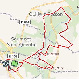
Tocht Stappen van 11,8 km beschikbaar op Normandië, Calvados, Potigny. Deze tocht wordt voorgesteld door neodraig.

Beschrijving

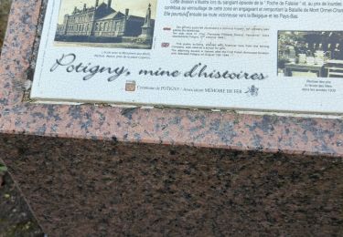
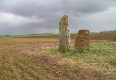
Au beau milieu de la plaine de Falaise, La Brèche au Diable, Terre "ouverte", montagne fendue comme par un coup d'épée et habitée par un torrent tumultueux, vous plongera dans un monde fait de légendes et de rêverie ! D'un côté, des éboulis nés d'un chaos titanesque ou d'un jet de pierres diabolique ; de l'autre, un mur vide et nu, supportant un tombeau en équilibre au-dessus de l'abîme. C'est celui de l'actrice Marie Joty. Ici est intimement liée l'histoire écrite et non écrite

Hoogteprofiel

Plaatsbepaling

Land:
France
Regio :
Normandië
Departement/Provincie :
Calvados
Gemeente :
Potigny
Locatie:
Unknown
Vertrek:(Dec)
Vertrek:(UTM)
702059 ; 5427592 (30U) N.

Wandeltochten in de omgeving

Tocht Stappen Potigny - potigny-01 - Photo
Stappen
gr1346

Stappen

Medium
Potigny, Normandië, Calvados, France
7,1 km | 7,9 km-effort
1h 47min
Ja
Tocht Te voet Villers-Canivet - Circuit des Pépinières - Photo
Te voet
PRO

Te voet

Gemakkelijk
Villers-Canivet, Normandië, Calvados, France
11,2 km | 12,8 km-effort
2h 54min
Neen
Tocht Te voet Potigny - Circuit de la Brèche au Diable - Photo
Te voet
PRO

Te voet

Gemakkelijk
Potigny, Normandië, Calvados, France
11,9 km | 14,5 km-effort
3h 18min
Ja
Tocht Te voet Potigny - Circuit de la Brèche au Diable - Photo
Te voet
PRO

Te voet

Gemakkelijk
Potigny, Normandië, Calvados, France
5,8 km | 7 km-effort
1h 35min
Ja
Tocht Te voet Villers-Canivet - Circuit de Torp - Photo
Te voet
PRO

Te voet

Gemakkelijk
Villers-Canivet, Normandië, Calvados, France
10,6 km | 11,6 km-effort
2h 38min
Neen
Tocht Te voet Épaney - Circuit des 4 Vents - Photo
Te voet
PRO

Te voet

Medium
Épaney, Normandië, Calvados, France
20 km | 23 km-effort
5h 16min
Ja
Tocht Stappen Rouvres - Rouvres - Photo
Stappen
gr1346

Stappen

Gemakkelijk
(2)
Rouvres, Normandië, Calvados, France
10,5 km | 11,3 km-effort
2h 32min
Ja
Tocht Te voet Épaney - Circuit du Lavoir - Photo
Te voet
PRO

Te voet

Gemakkelijk
Épaney, Normandië, Calvados, France
9,2 km | 10,4 km-effort
2h 21min
Ja
Tocht Te voet Soumont-Saint-Quentin - 2020-09-10_14h10m14_la breche au diable - Photo
Te voet
lepompi

Te voet

Gemakkelijk
(1)
Soumont-Saint-Quentin, Normandië, Calvados, France
9,1 km | 11,6 km-effort
Onbekend
Ja


Sluiten
Mijn abonnementen