Tocht Paard Chalais - Chalais dans la Brenne - Photo

Chalais dans la Brenne

 Gus23
Gus23

Gebruiker

© OpenStreetMap contributors
Lengte
Lengte
21 km
Max. hoogte
Max. hoogte
157 m
Positief hoogteverschil
226 m
Km-Effort
Km-Effort  
24 km
Min. hoogte
Min. hoogte
102 m
Negatief hoogteverschil
226 m
Boucle
Boucle
Ja
Datum van aanmaak :
2017-06-13 00:00:00.0
Laatste wijziging :
2017-06-13 00:00:00.0

(3 Bericht)

Paard
Paard
3h02
Moeilijkheid : Medium

Scan deze QR-code om de tocht te openen in de SityTrail-applicatie

Gratisgps-wandelapplicatie

Logo SityTrail SityTrail

IGN / Geografische instituten

SityTrail uit de App Store downloaden SityTrail uit Google Play downloaden

Logo SityTrail SityTrail World

De wereld gaat voor u open

SityTrail uit de App Store downloaden SityTrail uit Google Play downloaden SityTrail op Huawei AppGallery downloaden

Over ons

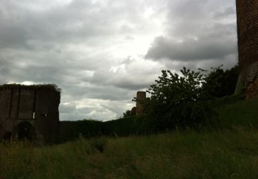
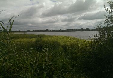
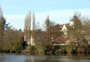
Tocht Paard van 21 km beschikbaar op Centre-Val de Loire, Indre, Chalais. Deze tocht wordt voorgesteld door Gus23.

Beschrijving

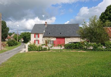
Rando avec les cavaliers de Beaumont

Hoogteprofiel

Foto's

POI's

POI Chalais - Un bon repas - Photo
Gus23
CHALAIS 
POI Chalais - Etang - Photo
Gus23
CHALAIS 
POI Chalais -  - Photo
Gus23
CHALAIS 

Plaatsbepaling

Land:
France
Regio :
Centre-Val de Loire
Departement/Provincie :
Indre
Gemeente :
Chalais
Locatie:
Unknown
Vertrek:(Dec)
Vertrek:(UTM)
363828 ; 5154292 (31T) N.

Opmerkingen

Gelieve in te loggen om een commentaar of een beoordeling achter te laten


belle promenade


Wandeltochten in de omgeving

Tocht Stappen Chaillac - Les gorges de l'Anglin - Photo
Stappen
DERAISON

Stappen

Medium
Chaillac, Centre-Val de Loire, Indre, France
9,8 km | 12,9 km-effort
4h 27min
Neen
Tocht Stappen Ciron - CIRON - Photo
Stappen
CAMBON

Stappen

Gemakkelijk
Ciron, Centre-Val de Loire, Indre, France
9,9 km | 10,8 km-effort
2h 24min
Ja
Tocht Stappen Fontgombault - Le village des Roches - Fontgombault - Photo
Stappen
tracegps

Stappen

Gemakkelijk
Fontgombault, Centre-Val de Loire, Indre, France
5,1 km | 5,8 km-effort
1h 15min
Ja
Tocht Stappen Lignac - lignc - Photo
Stappen
Patlac3

Stappen

Gemakkelijk
(1)
Lignac, Centre-Val de Loire, Indre, France
9,2 km | 10,4 km-effort
2h 48min
Ja
Tocht Stappen Azerables - Azerables  - Photo
Stappen
micheletissier

Stappen

Heel gemakkelijk
Azerables, Nieuw-Aquitanië, Creuse, France
13,5 km | 15,7 km-effort
3h 43min
Ja
Tocht Mountainbike Le Blanc - Brenne-Le Blanc-Rufec-retour - Photo
Mountainbike
Arnoldr8491

Mountainbike

Medium
Le Blanc, Centre-Val de Loire, Indre, France
33 km | 37 km-effort
3h 10min
Ja
Tocht Wegfiets Saint-Gaultier -  Voie verte  - Photo
Wegfiets
sereton

Wegfiets

Gemakkelijk
Saint-Gaultier, Centre-Val de Loire, Indre, France
30 km | 33 km-effort
2h 11min
Ja
Tocht Wegfiets Rivarennes - dondon rivarenne - Photo
Wegfiets
mib65

Wegfiets

Zeer moeilijk
Rivarennes, Centre-Val de Loire, Indre, France
68 km | 80 km-effort
4h 12min
Ja
Tocht Stappen Luzeret -  Loup y es-tu ?  (Les plus belles balades de la Brenne ) - Photo
Stappen
Phil36

Stappen

Gemakkelijk
Luzeret, Centre-Val de Loire, Indre, France
8,8 km | 9,8 km-effort
1h 58min
Ja


Sluiten
Mijn abonnementen