Tocht Stappen Azay-le-Brûlé - Fonvérine circuit 1 - Photo
 olaze
olaze

Gebruiker

© OpenStreetMap contributors
Lengte
Lengte
9,4 km
Max. hoogte
Max. hoogte
110 m
Positief hoogteverschil
182 m
Km-Effort
Km-Effort  
11,8 km
Min. hoogte
Min. hoogte
43 m
Negatief hoogteverschil
182 m
Boucle
Boucle
Ja
Datum van aanmaak :
2018-04-17 10:59:56.317
Laatste wijziging :
2018-04-17 10:59:56.317

(0 Bericht)

Stappen
Stappen
2h30
Moeilijkheid : Medium

Scan deze QR-code om de tocht te openen in de SityTrail-applicatie

Gratisgps-wandelapplicatie

Logo SityTrail SityTrail

IGN / Geografische instituten

SityTrail uit de App Store downloaden SityTrail uit Google Play downloaden

Logo SityTrail SityTrail World

De wereld gaat voor u open

SityTrail uit de App Store downloaden SityTrail uit Google Play downloaden SityTrail op Huawei AppGallery downloaden

Over ons

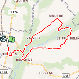
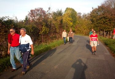
Tocht Stappen van 9,4 km beschikbaar op Nieuw-Aquitanië, Deux-Sèvres, Azay-le-Brûlé. Deze tocht wordt voorgesteld door olaze.

Beschrijving

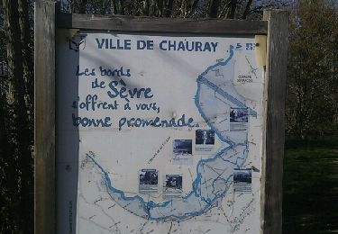
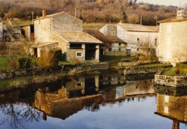
Départ centre de Fonvérine.
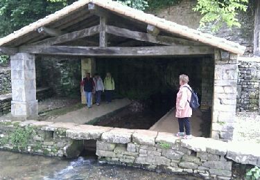
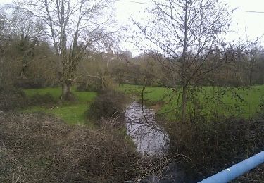
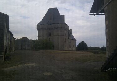
Ballade sur chemins et petites routes Vallée du Chambon

Hoogteprofiel

Plaatsbepaling

Land:
France
Regio :
Nieuw-Aquitanië
Departement/Provincie :
Deux-Sèvres
Gemeente :
Azay-le-Brûlé
Locatie:
Unknown
Vertrek:(Dec)
Vertrek:(UTM)
706778 ; 5143046 (30T) N.

Wandeltochten in de omgeving

Tocht Paardrijden Augé - Bois Aigu Clavé 2 - Photo
Paardrijden
Dom4i

Paardrijden

Zeer moeilijk
(1)
Augé, Nieuw-Aquitanië, Deux-Sèvres, France
40 km | 50 km-effort
6h 32min
Ja
Tocht Stappen Saint-Christophe-sur-Roc - St Christophe sur Roc - Photo
Stappen
olaze

Stappen

Gemakkelijk
Saint-Christophe-sur-Roc, Nieuw-Aquitanië, Deux-Sèvres, France
10,9 km | 13 km-effort
2h 49min
Ja
Tocht Stappen Cherveux - Cherveux- 9,1km - Photo
Stappen
olaze

Stappen

Medium
Cherveux, Nieuw-Aquitanië, Deux-Sèvres, France
9,1 km | 10,5 km-effort
2h 19min
Ja
Tocht Stappen Cherveux - Cherveux . (ATSCAF) 10km - Photo
Stappen
olaze

Stappen

Gemakkelijk
Cherveux, Nieuw-Aquitanië, Deux-Sèvres, France
10,1 km | 11,8 km-effort
2h 42min
Ja
Tocht Stappen Chauray - Chauray - Photo
Stappen
olaze

Stappen

Gemakkelijk
Chauray, Nieuw-Aquitanië, Deux-Sèvres, France
8,7 km | 9,6 km-effort
2h 7min
Ja
Tocht Stappen Azay-le-Brûlé - Fonvérine circuit 2 - Photo
Stappen
olaze

Stappen

Medium
Azay-le-Brûlé, Nieuw-Aquitanië, Deux-Sèvres, France
9,5 km | 11,9 km-effort
2h 33min
Ja
Tocht Mountainbike La Crèche - Rando VTT à La Crêche 30/01/11 - Photo
Mountainbike
tracegps

Mountainbike

Moeilijk
La Crèche, Nieuw-Aquitanië, Deux-Sèvres, France
41 km | 49 km-effort
3h 0min
Ja
Tocht Stappen Sainte-Néomaye - 13-09-11 Sainte-Néomaye - Photo
Stappen
olaze

Stappen

Gemakkelijk
(1)
Sainte-Néomaye, Nieuw-Aquitanië, Deux-Sèvres, France
7,7 km | 9,5 km-effort
Onbekend
Ja
Tocht Stappen La Crèche - 202403-14 - Photo
Stappen
JO Dessinmekss

Stappen

Medium
La Crèche, Nieuw-Aquitanië, Deux-Sèvres, France
9 km | 10,2 km-effort
2h 15min
Ja


Sluiten
Mijn abonnementen