Tocht Stappen Tellin - Balade à Bure - Photo
 Desrumaux
Desrumaux

Gebruiker GUIDE

© OpenStreetMap contributors
Lengte
Lengte
9,6 km
Max. hoogte
Max. hoogte
369 m
Positief hoogteverschil
222 m
Km-Effort
Km-Effort  
12,6 km
Min. hoogte
Min. hoogte
240 m
Negatief hoogteverschil
223 m
Boucle
Boucle
Ja
Datum van aanmaak :
2018-04-17 22:26:13.142
Laatste wijziging :
2018-04-17 22:26:13.142

(0 Bericht)

Stappen
Stappen
2h47
Moeilijkheid : Gemakkelijk

Scan deze QR-code om de tocht te openen in de SityTrail-applicatie

Gratisgps-wandelapplicatie

Logo SityTrail SityTrail

IGN / Geografische instituten

SityTrail uit de App Store downloaden SityTrail uit Google Play downloaden

Logo SityTrail SityTrail World

De wereld gaat voor u open

SityTrail uit de App Store downloaden SityTrail uit Google Play downloaden SityTrail op Huawei AppGallery downloaden

Over ons

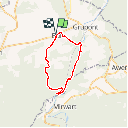
Tocht Stappen van 9,6 km beschikbaar op Wallonië, Luxemburg, Tellin. Deze tocht wordt voorgesteld door Desrumaux.

Beschrijving

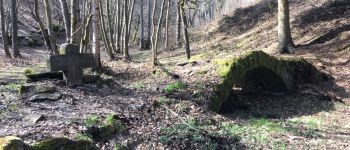
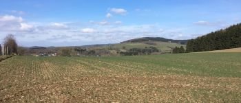
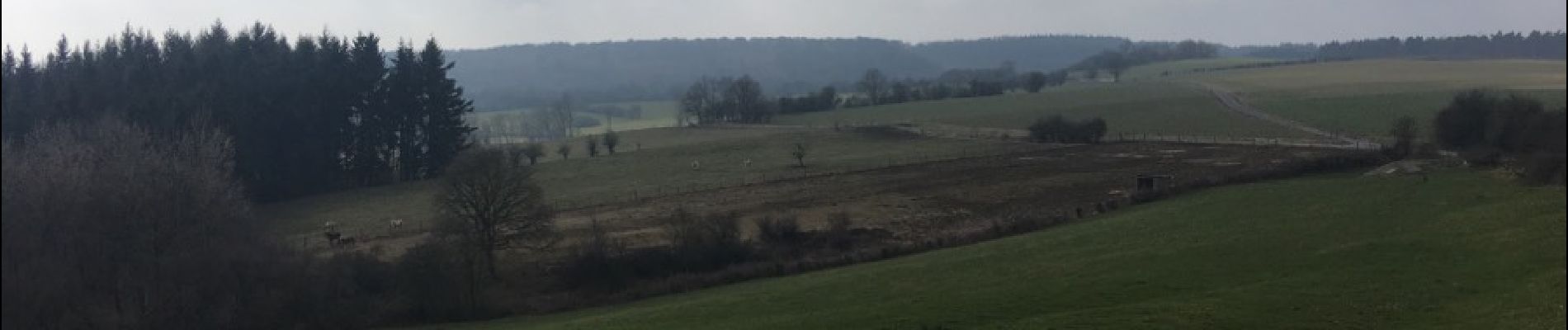
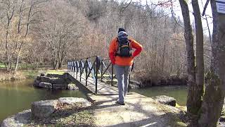
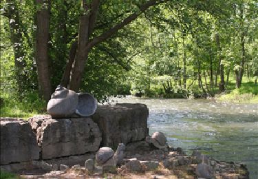
Très jolie balade en province du Luxembourg dans la belle entité de Tellin au départ du village de Bure.
De Bure au pont de clôye suivre le balisage triangle rouge, du pont de clôye à Bure suivre le balisage rectangle vert.

Hoogteprofiel

Foto's

POI's

POI Tellin - Bure - Photo
Desrumaux
TELLIN 
POI Tellin - Bure - Photo
Desrumaux
TELLIN 
POI Tellin - Bure - Photo
Desrumaux
TELLIN 
POI Tellin - Bure - Photo
Desrumaux
TELLIN 
POI Tellin - Bure - Photo
Desrumaux
TELLIN 
POI Tellin - Bure - Photo
Desrumaux
TELLIN 

Plaatsbepaling

Land:
Belgium
Regio :
Wallonië
Departement/Provincie :
Luxemburg
Gemeente :
Tellin
Locatie:
Bure
Vertrek:(Dec)
Vertrek:(UTM)
661626 ; 5550967 (31U) N.

Wandeltochten in de omgeving

Tocht Stappen Tellin - Tellin. Natura 2000, des sites qui valent le détour ! Lx 7 - Photo
Stappen
GUIDE+

Stappen

Medium
(6)
Tellin, Wallonië, Luxemburg, Belgium
9,6 km | 11,9 km-effort
1h 30min
Ja
Tocht Stappen Saint-Hubert - Mirwart_Vieux Moulin de Mirwart_Alternative Forêt (SH29 bis) - Photo
Stappen
GUIDE+

Stappen

Moeilijk
(11)
Saint-Hubert, Wallonië, Luxemburg, Belgium
10,8 km | 14,2 km-effort
3h 4min
Ja
Tocht Stappen Rochefort - Natuur : Belvaux -Les Rouges-Gorges (de roodborstjes) - Photo
Stappen
PRO

Stappen

Gemakkelijk
(8)
Rochefort, Wallonië, Namen, Belgium
6,5 km | 8,4 km-effort
1h 20min
Ja
Tocht Stappen Rochefort - Natuur : Belvaux -Les Rouges-Gorges (de roodborstjes) - Photo
Stappen
PRO

Stappen

Gemakkelijk
(13)
Rochefort, Wallonië, Namen, Belgium
5,8 km | 7,6 km-effort
1h 20min
Ja
Tocht Stappen Tellin - GG-Lu-13_Grupont - Poix-Saint-Hubert - Photo
Stappen
PRO

Stappen

Zeer moeilijk
(2)
Tellin, Wallonië, Luxemburg, Belgium
26 km | 34 km-effort
7h 23min
Neen
Tocht Stappen Tellin - Balade à Grupont - Photo
Stappen
GUIDE
Desrumaux

Stappen

Gemakkelijk
(1)
Tellin, Wallonië, Luxemburg, Belgium
8,4 km | 11,9 km-effort
2h 33min
Ja
Tocht Stappen Rochefort - Natuur : Belvaux -Les Rouges-Gorges (de roodborstjes) - Photo
Stappen
PRO

Stappen

Gemakkelijk
(3)
Rochefort, Wallonië, Namen, Belgium
5,8 km | 7,6 km-effort
1h 20min
Ja
Tocht Stappen Tellin - Bure - Promenade des chapelles - Photo
Stappen
GUIDE+

Stappen

Gemakkelijk
(1)
Tellin, Wallonië, Luxemburg, Belgium
4,5 km | 5,9 km-effort
1h 15min
Ja
Tocht Stappen Tellin - Tellin - Promenade du trou des Lûtons  - Photo
Stappen
GUIDE+

Stappen

Gemakkelijk
(1)
Tellin, Wallonië, Luxemburg, Belgium
5,2 km | 6,1 km-effort
1h 21min
Ja


Sluiten
Mijn abonnementen