Tocht Fiets De Panne - la panne 3 veurne coxyde - Photo

la panne 3 veurne coxyde

 c.watrin
c.watrin

Gebruiker

© OpenStreetMap contributors
Lengte
Lengte
40 km
Max. hoogte
Max. hoogte
17 m
Positief hoogteverschil
168 m
Km-Effort
Km-Effort  
42 km
Min. hoogte
Min. hoogte
-5 m
Negatief hoogteverschil
168 m
Boucle
Boucle
Ja
Datum van aanmaak :
2018-06-26 13:07:54.898
Laatste wijziging :
2018-06-26 13:07:54.898

(1 Bericht)

Fiets
Fiets
2h29
Moeilijkheid : Gemakkelijk

Scan deze QR-code om de tocht te openen in de SityTrail-applicatie

Gratisgps-wandelapplicatie

Logo SityTrail SityTrail

IGN / Geografische instituten

SityTrail uit de App Store downloaden SityTrail uit Google Play downloaden

Logo SityTrail SityTrail World

De wereld gaat voor u open

SityTrail uit de App Store downloaden SityTrail uit Google Play downloaden SityTrail op Huawei AppGallery downloaden

Over ons

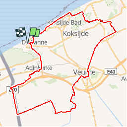
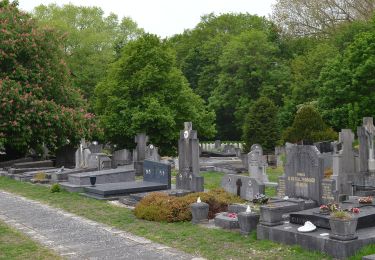
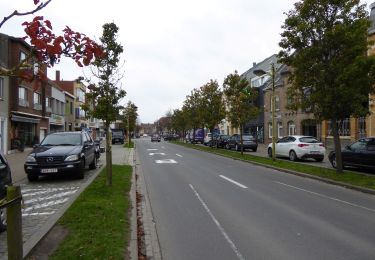
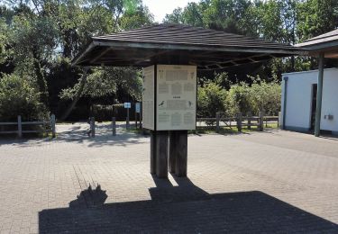
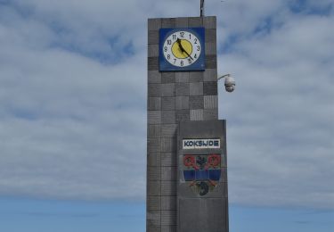
Tocht Fiets van 40 km beschikbaar op Vlaanderen, West-Vlaanderen, De Panne. Deze tocht wordt voorgesteld door c.watrin.

Hoogteprofiel

POI's

POI De Panne - 1 +71 - Photo
c.watrin
DE PANNE 
POI Veurne - 10 +83 - Photo
c.watrin
VEURNE 
POI Veurne - 12 +10 - Photo
c.watrin
VEURNE 
POI Veurne - 21 +34 - Photo
c.watrin
VEURNE 
POI Veurne - 34 +85 - Photo
c.watrin
VEURNE 
POI Veurne - 4 +75 - Photo
c.watrin
VEURNE 
POI De Panne - 50 +1 - Photo
c.watrin
DE PANNE 
POI Koksijde - 58 +88 - Photo
c.watrin
KOKSIJDE 
POI Koksijde - 6 +98 - Photo
c.watrin
KOKSIJDE 
POI Koksijde - 66 +58 - Photo
c.watrin
KOKSIJDE 
POI Veurne - 68 +86 - Photo
c.watrin
VEURNE 
POI Gijvelde - 71 +21 - Photo
c.watrin
GIJVELDE 
POI Koksijde - 74 +76 - Photo
c.watrin
KOKSIJDE 
POI Veurne - 75 +68 - Photo
c.watrin
VEURNE 
POI Koksijde - 76 +50 - Photo
c.watrin
KOKSIJDE 
POI Veurne - 83 +4 - Photo
c.watrin
VEURNE 
POI Veurne - 85 +12 - Photo
c.watrin
VEURNE 
POI Veurne - 86 +6 - Photo
c.watrin
VEURNE 
POI Koksijde - 88 +74 - Photo
c.watrin
KOKSIJDE 
POI Koksijde - 98 +66 - Photo
c.watrin
KOKSIJDE 

Plaatsbepaling

Land:
Belgium
Regio :
Vlaanderen
Departement/Provincie :
West-Vlaanderen
Gemeente :
De Panne
Locatie:
De Panne
Vertrek:(Dec)
Vertrek:(UTM)
470871 ; 5660728 (31U) N.

Opmerkingen

Gelieve in te loggen om een commentaar of een beoordeling achter te laten


Wandeltochten in de omgeving

Tocht Stappen Koksijde - St. Idesbald et Noorduinen - Photo
Stappen
cdeg62

Stappen

Gemakkelijk
(2)
Koksijde, Vlaanderen, West-Vlaanderen, Belgium
4,5 km | 4,8 km-effort
1h 4min
Ja
Tocht Te voet Koksijde - IJslandvaarders - Photo
Te voet
PRO

Te voet

Gemakkelijk
Koksijde, Vlaanderen, West-Vlaanderen, Belgium
5,3 km | 5,7 km-effort
1h 17min
Ja
Tocht Te voet Koksijde - Artiestenwandelroute - Photo
Te voet
PRO

Te voet

Gemakkelijk
Koksijde, Vlaanderen, West-Vlaanderen, Belgium
9,2 km | 9,9 km-effort
2h 14min
Ja
Tocht Te voet De Panne - Westhoek wandelroute - Photo
Te voet
PRO

Te voet

Gemakkelijk
(1)
De Panne, Vlaanderen, West-Vlaanderen, Belgium
11,2 km | 12,2 km-effort
2h 46min
Ja
Tocht Te voet Koksijde - Doornpanne wandelroute - Photo
Te voet
PRO

Te voet

Gemakkelijk
Koksijde, Vlaanderen, West-Vlaanderen, Belgium
7,7 km | 8,4 km-effort
1h 54min
Ja
Tocht Stappen De Panne - w-belgie-westhoekreservaat - Photo
Stappen
gpstracks

Stappen

Heel gemakkelijk
(1)
De Panne, Vlaanderen, West-Vlaanderen, Belgium
9,8 km | 10,6 km-effort
Onbekend
Ja
Tocht Te voet Koksijde - Schipgat - Photo
Te voet
PRO

Te voet

Gemakkelijk
Koksijde, Vlaanderen, West-Vlaanderen, Belgium
5,5 km | 6,1 km-effort
1h 23min
Ja
Tocht Te voet Koksijde - Erfgoedwandelroute Sint-Idesbald - Photo
Te voet
PRO

Te voet

Gemakkelijk
Koksijde, Vlaanderen, West-Vlaanderen, Belgium
3,4 km | 3,6 km-effort
49min
Ja
Tocht Stappen Koksijde - 20200802 - Koksijde 7.8 Km - Photo
Stappen
GUIDE
pierreh01

Stappen

Heel gemakkelijk
Koksijde, Vlaanderen, West-Vlaanderen, Belgium
7,8 km | 8,6 km-effort
1h 40min
Neen


Sluiten
Mijn abonnementen