


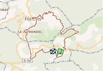

16,7 km | 25 km-effort


Gebruiker


Gratisgps-wandelapplicatie
 SityTrail
IGN / Geografische instituten
SityTrail World
De wereld gaat voor u open
Tocht Stappen van 12,1 km beschikbaar op Occitanië, Hérault, Saint-Privat. Deze tocht wordt voorgesteld door grageot.
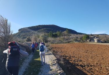
juin 2018- une variante de la classique. Une belle arrivée en surplomb de Fozières. Faire le tour de Fauzières et monter jusqu'à l'église

Stappen

Stappen

Noords wandelen
Stappen
Stappen
Stappen

Stappen

Stappen

Stappen