


Spring announces the upcoming arrival of SityTrail+
Dear friends, today is spring, and we take this opportunity to announce to you in images and videos our ongoing developments to soon offer you a new application: SityTrail+
SityTrail+ leverages a new cartographic engine in vector mode, so not in raster image like the traditional IGN maps derived from paper maps.
SityTrail+ offers topographic maps of the world and various marked networks: pedestrian, bike, mountain bike, and ski.
But that's not all, because SityTrail+ is about more, more, and even more! 😎👍
The new vector topographic maps from IGN France, SwissTopo, Great Britain, and Luxembourg will be included with our world maps. 😲🤪
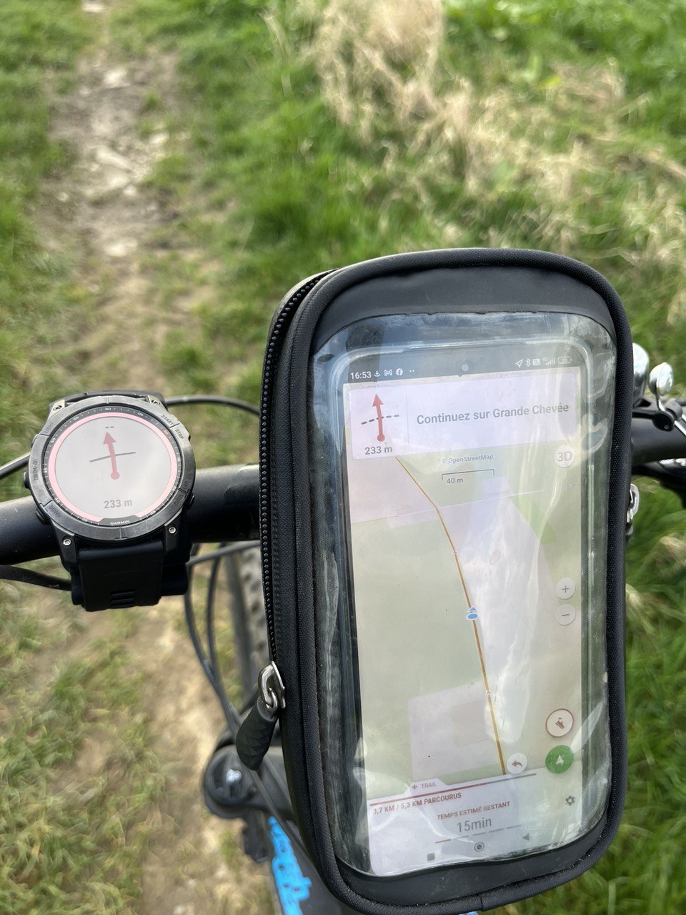
A brand new Roadbook type navigation engine will allow for predicting the next intersections/turns with astonishing accuracy. Magic! 😍
Utilization of these Roadbook symbols from the followed route/track on Apple Watch, Wear OS... BUT also on GARMIN watches. 🥳🤩
All these services will be offered at a price of 30 euros per year. 🤪🥳
Starting today, we will call upon Alpha testers, first on Android and Wear OS and Garmin watches. Following, the production launch of this new SityTrail+ application which we hope will be before the summer of 2024 for Android and iOS. 🙏
So, the entire Geolives team wishes you all, on this day, a very beautiful spring.
Spring announces the upcoming arrival of SityTrail+
SityTrail+
SityTrail+
Published on 3/21/24 - Most recently updated on 3/21/24
For Outdoor Enthusiasts


© Geolives 2024 l All rights reserved
Send with ❤️ by SityTrail