Saint-Christophe-sur-Guiers, Isère, On foot: Best trails, routes and walks

8 comments

Saint-Christophe-sur-Guiers: Discover the best trails: 2 on foot, 54 walking and 1 nordic walking. All these trails, routes and outdoor activities are available in our SityTrail applications for smartphones and tablets.


The best trails (57)

Trail Walking Saint-Christophe-sur-Guiers - Petit Som 1772m,  depuis La Ruchère - Photo
Walking 6.043
Km

Walking

Medium
(2)
Saint-Christophe-sur-Guiers, Auvergne-Rhône-Alpes, Isère, France
6 km | 13.2 km-effort
3h 30min
538 m
543 m
Yes
tracegps

Trail Walking Saint-Christophe-sur-Guiers - Petit Som par le Col de la Ruchère - Photo
Walking 7.143
Km

Walking

Medium
(2)
Saint-Christophe-sur-Guiers, Auvergne-Rhône-Alpes, Isère, France
7.1 km | 15.2 km-effort
3h 5min
603 m
609 m
Yes
simon.paume

Trail Walking Saint-Christophe-sur-Guiers - 38 grand som par sente intermediaire - Photo
Walking 14.521
Km

Walking

Medium
Saint-Christophe-sur-Guiers, Auvergne-Rhône-Alpes, Isère, France
14.5 km | 28 km-effort
7h 11min
1005 m
1008 m
Yes
himba26100

Trail Walking Saint-Christophe-sur-Guiers - Petit Som 8 km - Photo
Walking 7.933
Km
GUIDE

Walking

Medium
(1)
Saint-Christophe-sur-Guiers, Auvergne-Rhône-Alpes, Isère, France
7.9 km | 16.1 km-effort
4h 54min
617 m
614 m
Yes
rvapeldo

Trail Walking Saint-Christophe-sur-Guiers - La Ruchere - Col de l'Allienard - Photo
Walking 11.876
Km

Walking

Medium
Saint-Christophe-sur-Guiers, Auvergne-Rhône-Alpes, Isère, France
11.9 km | 18.7 km-effort
4h 34min
510 m
509 m
Yes
bruno.saget

Trail Walking Saint-Christophe-sur-Guiers - COL DE LA RUCHERE - Photo
Walking 11.369
Km

Walking

Difficult
Saint-Christophe-sur-Guiers, Auvergne-Rhône-Alpes, Isère, France
11.4 km | 17.6 km-effort
4h 13min
470 m
468 m
Yes
floup6138

Trail Walking Saint-Christophe-sur-Guiers - Le Petit Som - Photo
Walking 7.488
Km

Walking

Very easy
Saint-Christophe-sur-Guiers, Auvergne-Rhône-Alpes, Isère, France
7.5 km | 15.8 km-effort
3h 7min
622 m
623 m
Yes
Michel_Martin

• Retour par le pas du loup

Trail Walking Saint-Christophe-sur-Guiers - Col de la Ruchere - Photo
Walking 13.942
Km

Walking

Very easy
Saint-Christophe-sur-Guiers, Auvergne-Rhône-Alpes, Isère, France
13.9 km | 22 km-effort
4h 42min
568 m
571 m
Yes
Michel_Martin

• Reco du 03/05/17

Trail Walking Saint-Christophe-sur-Guiers - Le petit Som par La Ruchere - retour par le pas du Loup - Photo
Walking 8.95
Km

Walking

Medium
Saint-Christophe-sur-Guiers, Auvergne-Rhône-Alpes, Isère, France
8.9 km | 17.6 km-effort
3h 44min
638 m
675 m
No
patjobou

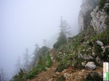
• Montée par le Nord sur un itinéraire peu fréquenté. Retour par Bovinant et le Pas de Loup. Pas difficultés particuliè...

Trail Walking Saint-Christophe-sur-Guiers - Petit Som en circuit - Photo
Walking 11.573
Km

Walking

Medium
Saint-Christophe-sur-Guiers, Auvergne-Rhône-Alpes, Isère, France
11.6 km | 21 km-effort
5h 21min
721 m
721 m
Yes
Emelle

Trail Walking Saint-Christophe-sur-Guiers - 20220703 petit som - Photo
Walking 11.663
Km

Walking

Very difficult
Saint-Christophe-sur-Guiers, Auvergne-Rhône-Alpes, Isère, France
11.7 km | 21 km-effort
7h 30min
701 m
702 m
Yes
GALIBER

Trail Walking Saint-Christophe-sur-Guiers - Le Petit Som par La Cheminée et Le Pas du loup - Photo
Walking 8.895
Km

Walking

Medium
Saint-Christophe-sur-Guiers, Auvergne-Rhône-Alpes, Isère, France
8.9 km | 18.1 km-effort
4h 56min
687 m
694 m
Yes
patjobou

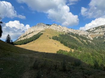
• Belle Boucle - Sentiers bien tracés, même dans la cheminée. Tranquillement: 2h de montée, 2,5 h de descente.

Trail Walking Saint-Christophe-sur-Guiers - 2013 05 05 Rocher du Frou - Photo
Walking 9.698
Km

Walking

Very easy
Saint-Christophe-sur-Guiers, Auvergne-Rhône-Alpes, Isère, France
9.7 km | 19.6 km-effort
3h 57min
743 m
737 m
Yes
lechner

Trail Walking Saint-Christophe-sur-Guiers - Le Belvédère d'Arpison en raquettes, depuis la Ruchère - Photo
Walking 11.261
Km

Walking

Easy
Saint-Christophe-sur-Guiers, Auvergne-Rhône-Alpes, Isère, France
11.3 km | 17.2 km-effort
4h 0min
449 m
449 m
Yes
tracegps

Trail Walking Saint-Christophe-sur-Guiers - Col d'Arpison et col de la Ruchère en boucle - Photo
Walking 8.284
Km

Walking

Medium
Saint-Christophe-sur-Guiers, Auvergne-Rhône-Alpes, Isère, France
8.3 km | 14.3 km-effort
2h 40min
449 m
446 m
Yes
tracegps

Trail Walking Saint-Christophe-sur-Guiers - Petit Som 1772m, descente par le Habert de Bovinant - Photo
Walking 8.833
Km

Walking

Medium
Saint-Christophe-sur-Guiers, Auvergne-Rhône-Alpes, Isère, France
8.8 km | 17.3 km-effort
4h 15min
635 m
636 m
Yes
tracegps

Trail Walking Saint-Christophe-sur-Guiers - Petit Som 1772m, descente par le Pas du Loup - Photo
Walking 7.924
Km

Walking

Difficult
(1)
Saint-Christophe-sur-Guiers, Auvergne-Rhône-Alpes, Isère, France
7.9 km | 15.8 km-effort
3h 34min
590 m
590 m
Yes
tracegps

Trail Walking Saint-Christophe-sur-Guiers - Tour du Petit Som - Photo
Walking 8.581
Km

Walking

Difficult
Saint-Christophe-sur-Guiers, Auvergne-Rhône-Alpes, Isère, France
8.6 km | 18.5 km-effort
3h 31min
746 m
746 m
Yes
Marco Paulo

Trail Walking Saint-Christophe-sur-Guiers - La Verchere / le Petit Som  - Photo
Walking 10.706
Km

Walking

Very difficult
Saint-Christophe-sur-Guiers, Auvergne-Rhône-Alpes, Isère, France
10.7 km | 20 km-effort
4h 14min
699 m
703 m
Yes
Marco Paulo

Trail Walking Saint-Christophe-sur-Guiers - Randonnée des trois cols - Photo
Walking 9.553
Km

Walking

Easy
Saint-Christophe-sur-Guiers, Auvergne-Rhône-Alpes, Isère, France
9.6 km | 15.8 km-effort
2h 59min
470 m
471 m
Yes
choubaka77

20 trails displayed on 57

FREE GPS app for hiking

Logo SityTrail SityTrail

IGN / Geographical institutes

Download SityTrail from the App Store Download SityTrail from Google Play

Logo SityTrail SityTrail World

The world is yours!

Download SityTrail from the App Store Download SityTrail from Google Play Download SityTrail on Huawei AppGallery

Activities

Close
My subscriptions