Belley, Ain, On foot: Best trails, routes and walks

9 comments

Belley: Discover the best trails: 1 on foot, 5 walking, 3 running and 1 trail. All these trails, routes and outdoor activities are available in our SityTrail applications for smartphones and tablets.


The best trails (10)
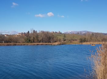
Trail Walking Belley - Chenal - Photo
Walking 5.288
Km

Walking

Easy
Belley, Auvergne-Rhône-Alpes, Ain, France
5.3 km | 5.6 km-effort
1h 12min
25 m
25 m
Yes
Henri.Vekemans

Trail Running Belley - Petite course et marche - Photo
Running 3.856
Km

Running

Belley, Auvergne-Rhône-Alpes, Ain, France
3.9 km | 4.1 km-effort
38min
16 m
19 m
Yes
sandrine-s01

Trail Trail Belley - foulée gourmande  - Photo
Trail 10.533
Km

Trail

Very easy
Belley, Auvergne-Rhône-Alpes, Ain, France
10.5 km | 13.2 km-effort
1h 0min
203 m
204 m
Yes
Yoann Gerboud

Trail Running Belley - Trail Belley - Photo
Running 27.17
Km

Running

Medium
(1)
Belley, Auvergne-Rhône-Alpes, Ain, France
27 km | 36 km-effort
2h 40min
630 m
629 m
Yes
tracegps

Trail Walking Belley - Trail Belley - Photo
Walking 27.17
Km

Walking

Difficult
Belley, Auvergne-Rhône-Alpes, Ain, France
27 km | 36 km-effort
4h 0min
630 m
629 m
Yes
tracegps

Trail On foot Belley - boucle dans la forêt de rothonne - Photo
On foot 9.094
Km

On foot

Easy
Belley, Auvergne-Rhône-Alpes, Ain, France
9.1 km | 11.9 km-effort
2h 42min
212 m
212 m
Yes
PerrierDaniel

Trail Walking Belley - rhotonn  - Photo
Walking 5.303
Km

Walking

Medium
Belley, Auvergne-Rhône-Alpes, Ain, France
5.3 km | 6.5 km-effort
1h 33min
90 m
89 m
Yes
Henri.Vekemans

Trail Walking Belley - lac - Photo
Walking 4.988
Km

Walking

Easy
Belley, Auvergne-Rhône-Alpes, Ain, France
5 km | 5.3 km-effort
1h 6min
23 m
23 m
Yes
Henri.Vekemans

Trail Walking Belley - belley rive droite - Photo
Walking 4.018
Km

Walking

Easy
Belley, Auvergne-Rhône-Alpes, Ain, France
4 km | 4.6 km-effort
56min
43 m
42 m
Yes
Henri.Vekemans

Trail Running Belley - belley forêt de rothonne - Photo
Running 9.064
Km

Running

Medium
(1)
Belley, Auvergne-Rhône-Alpes, Ain, France
9.1 km | 11.8 km-effort
1h 47min
204 m
204 m
Yes
tytycity

10 trails displayed on 10

FREE GPS app for hiking

Logo SityTrail SityTrail

IGN / Geographical institutes

Download SityTrail from the App Store Download SityTrail from Google Play

Logo SityTrail SityTrail World

The world is yours!

Download SityTrail from the App Store Download SityTrail from Google Play Download SityTrail on Huawei AppGallery

Activities

Close
My subscriptions