Indre, Centre-Loire Valley, On foot: Best trails, routes and walks

25 comments

Indre: Discover the best trails: 228 walking, 3 running, 5 nordic walking and 14 on foot. All these trails, routes and outdoor activities are available in our SityTrail applications for smartphones and tablets.


The best trails (250)

Trail Walking Éguzon-Chantôme - SityTrail - eguzon,la Feyte barrage d'eguzon - Photo
Walking 18.454
Km
GUIDE

Walking

Very difficult
(1)
Éguzon-Chantôme, Centre-Loire Valley, Indre, France
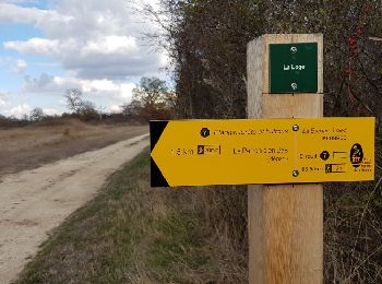
18.5 km | 24 km-effort
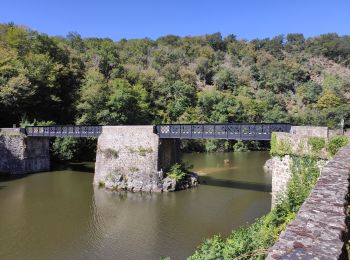
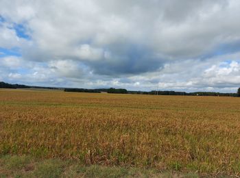
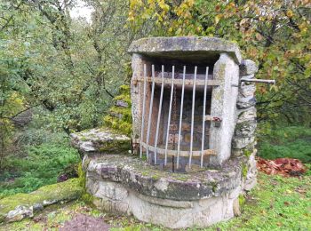
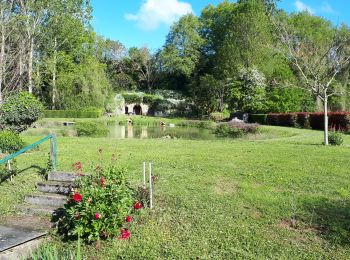
5h 26min
414 m
414 m
Yes
jeanmarcMasson

Trail Walking Saint-Plantaire - SityTrail - Fougères Rochers de la Fileuse sentier des arts - Photo
Walking 17.275
Km
GUIDE

Walking

Very difficult
(1)
Saint-Plantaire, Centre-Loire Valley, Indre, France
17.3 km | 22 km-effort
5h 6min
392 m
390 m
Yes
jeanmarcMasson

Trail Walking Gargilesse-Dampierre - SityTrail - La Chaumerette,Gargilesse - Photo
Walking 15.844
Km
GUIDE

Walking

Very difficult
(1)
Gargilesse-Dampierre, Centre-Loire Valley, Indre, France
15.8 km | 19.7 km-effort
4h 28min
290 m
290 m
Yes
jeanmarcMasson

Trail Running Châteauroux - sortie 1er de l'an - Photo
Running 10.343
Km

Running

Easy
(1)
Châteauroux, Centre-Loire Valley, Indre, France
10.3 km | 11.4 km-effort
58min
76 m
76 m
Yes
will36

• élimination petit four

Trail Walking Rosnay - Parc naturel régional de la Brenne à ROSNAY - Photo
Walking 4.426
Km

Walking

Easy
Rosnay, Centre-Loire Valley, Indre, France
4.4 km | 4.7 km-effort
1h 11min
21 m
24 m
No
zanogueb

Trail Walking Mézières-en-Brenne - Mézières - Domaine de Bellebouche - Photo
Walking 17.695
Km

Walking

Medium
Mézières-en-Brenne, Centre-Loire Valley, Indre, France
17.7 km | 18.9 km-effort
3h 59min
94 m
75 m
No
zanogueb

Trail On foot Gargilesse-Dampierre - La Gargilesse secrète et sauvage - Photo
On foot 6.676
Km
PRO

On foot

Easy
Gargilesse-Dampierre, Centre-Loire Valley, Indre, France
6.7 km | 8.3 km-effort
1h 53min
116 m
152 m
No
SityTrail - itinéraires balisés pédestres

Trail Walking Gargilesse-Dampierre - Compostelle etape 13 - Photo
Walking 29.043
Km

Walking

Difficult
Gargilesse-Dampierre, Centre-Loire Valley, Indre, France
29 km | 39 km-effort
9h 58min
766 m
571 m
No
maginot

Trail Walking Cluis - Compostelle etape 12 - Photo
Walking 18.177
Km

Walking

Easy
Cluis, Centre-Loire Valley, Indre, France
18.2 km | 21 km-effort
19h 6min
204 m
330 m
No
maginot

Trail Walking Gargilesse-Dampierre - Beau parcours au départ du moulin de Gargilesse - Photo
Walking 16.22
Km

Walking

Very easy
Gargilesse-Dampierre, Centre-Loire Valley, Indre, France
16.2 km | 21 km-effort
3h 48min
324 m
324 m
Yes
Ecureuiltrailer

Trail Walking Anjouin - anjouin - Photo
Walking 19.628
Km

Walking

Very easy
Anjouin, Centre-Loire Valley, Indre, France
19.6 km | 23 km-effort
3h 57min
223 m
223 m
Yes
mimilolo

Trail Walking Saint-Plantaire - le rocher de la fileuse - Photo
Walking 15.022
Km

Walking

Medium
(1)
Saint-Plantaire, Centre-Loire Valley, Indre, France
15 km | 19.4 km-effort
6h 7min
326 m
327 m
Yes
viam19

Trail Walking Villentrois-Faverolles-en-Berry - villentrois 2019 - Photo
Walking 17.803
Km

Walking

Very easy
Villentrois-Faverolles-en-Berry, Centre-Loire Valley, Indre, France
17.8 km | 20 km-effort
3h 13min
190 m
194 m
No
mimilolo

Trail Walking Méobecq - Forêt de Lanscome et étangs - Photo
Walking 13.808
Km

Walking

Easy
Méobecq, Centre-Loire Valley, Indre, France
13.8 km | 14.6 km-effort
4h 52min
58 m
59 m
Yes
viam19

• Rando en boucle

Trail Walking Chaillac - Les gorges de l'Anglin - Photo
Walking 9.763
Km

Walking

Medium
Chaillac, Centre-Loire Valley, Indre, France
9.8 km | 12.9 km-effort
4h 27min
233 m
233 m
No
DERAISON

• Entre langues d'oc et d'oïl

Trail Walking Ciron - CIRON - Photo
Walking 9.923
Km

Walking

Easy
Ciron, Centre-Loire Valley, Indre, France
9.9 km | 10.8 km-effort
2h 24min
66 m
64 m
Yes
CAMBON

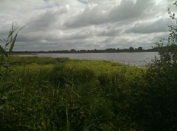
• Randonnée aux bord des étang, observation des oiseaux. Le travail de l'homme sur le modelage de son environement

Trail Walking Sainte-Sévère-sur-Indre - Sur les pas des Maîtres Sonneurs Variante 1 (Sainte Sévère sur Indre -La Motte-Feuilly) - Photo
Walking 9.347
Km

Walking

Medium
Sainte-Sévère-sur-Indre, Centre-Loire Valley, Indre, France
9.3 km | 10.6 km-effort
2h 19min
80 m
129 m
No
tracegps

Trail Walking La Motte-Feuilly - Sur les pas des Maîtres Sonneurs (La Motte Feuilly - Châteaumeillant)  - Photo
Walking 16.204
Km

Walking

Difficult
La Motte-Feuilly, Centre-Loire Valley, Indre, France
16.2 km | 18.5 km-effort
4h 10min
172 m
173 m
No
tracegps

Trail Walking La Berthenoux - Sur les pas des Maîtres Sonneurs (La Berthenoux - La Motte-Feuilly) - Photo
Walking 18.967
Km

Walking

Difficult
La Berthenoux, Centre-Loire Valley, Indre, France
19 km | 21 km-effort
4h 45min
167 m
167 m
No
tracegps

Trail Walking La Châtre - Sur les pas des Maîtres Sonneurs (La Châtre - La Berthenoux) - Photo
Walking 18.477
Km

Walking

Difficult
La Châtre, Centre-Loire Valley, Indre, France
18.5 km | 21 km-effort
4h 40min
204 m
186 m
No
tracegps

20 trails displayed on 250

FREE GPS app for hiking

Logo SityTrail SityTrail

IGN / Geographical institutes

Download SityTrail from the App Store Download SityTrail from Google Play

Logo SityTrail SityTrail World

The world is yours!

Download SityTrail from the App Store Download SityTrail from Google Play Download SityTrail on Huawei AppGallery

Activities

Nearby regions

Close
My subscriptions