Schwyz, Switzerland: Best trails, routes and walks

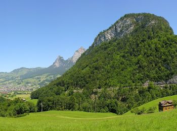
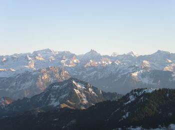
Schwyz: Discover the best trails: 103 hiking trails and 4 bike and mountain-bike routes. All these trails, routes and outdoor activities are available in our SityTrail applications for smartphones and tablets.


The best trails (147)

Trail On foot Einsiedeln - Einsiedler Herbschtfäscht - Photo
On foot 9.6
Km
PRO

On foot

Easy
Einsiedeln, Schwyz, Einsiedeln, Switzerland
9.6 km | 11.3 km-effort
2h 33min
124 m
127 m
Yes
SityTrail - itinéraires balisés pédestres

• Website: http://www.herbscht-faescht.ch

Trail On foot Morschach - Stoos - Klingenstock - Photo
On foot 3.816
Km
PRO

On foot

Easy
Morschach, Schwyz, Schwyz, Switzerland
3.8 km | 9.9 km-effort
2h 14min
603 m
3 m
No
SityTrail - itinéraires balisés pédestres

• Symbol: weiss-rot-weiss

Trail On foot Einsiedeln - Wildegg - Vorderthal - Photo
On foot 6.775
Km
PRO

On foot

Easy
Einsiedeln, Schwyz, Einsiedeln, Switzerland
6.8 km | 9.5 km-effort
2h 9min
9 m
787 m
No
SityTrail - itinéraires balisés pédestres

• Trail created by Umweltdepartement Kt Schwyz. Symbol: weiss-rot-weiss

Trail On foot Schübelbach - Schübelbach - Tostel - Photo
On foot 3.286
Km
PRO

On foot

Easy
Schübelbach, Schwyz, March, Switzerland
3.3 km | 9.1 km-effort
2h 4min
583 m
1 m
No
SityTrail - itinéraires balisés pédestres

• Symbol: weiss-rot-weiss

Trail On foot Muotathal - CH-Dräckloch - nördlich Brunalpelhöchi - Photo
On foot 3.171
Km
PRO

On foot

Easy
Muotathal, Schwyz, Schwyz, Switzerland
3.2 km | 7.1 km-effort
1h 36min
382 m
24 m
No
SityTrail - itinéraires balisés pédestres

• Dräckloch - nördlich Brunalpelhöchi Symbol: weiss-rot-weiss

Trail On foot Muotathal - CH-Chratzerenfurggeli - Dräckloch - Photo
On foot 4.393
Km
PRO

On foot

Easy
Muotathal, Schwyz, Schwyz, Switzerland
4.4 km | 7.5 km-effort
1h 41min
36 m
811 m
No
SityTrail - itinéraires balisés pédestres

• Chratzerenfurggeli - Dräckloch Symbol: weiss-rot-weiss

Trail On foot Muotathal - CH-Dräckloch - Chäseren - Photo
On foot 3.61
Km
PRO

On foot

Easy
Muotathal, Schwyz, Schwyz, Switzerland
3.6 km | 5.4 km-effort
1h 13min
9 m
502 m
No
SityTrail - itinéraires balisés pédestres

• Dräckloch - Chäseren Symbol: weiss-rot-weiss

Trail On foot Innerthal - CH-Au - Stock - Photo
On foot 3.254
Km
PRO

On foot

Easy
Innerthal, Schwyz, March, Switzerland
3.3 km | 4.1 km-effort
56min
68 m
64 m
No
SityTrail - itinéraires balisés pédestres

• Trail created by Umweltdepartement Kt Schwyz. Au - Stock Symbol: gelber Diamant

Trail On foot Morschach - Morschach - Stoss - Photo
On foot 4.901
Km
PRO

On foot

Easy
Morschach, Schwyz, Schwyz, Switzerland
4.9 km | 7.2 km-effort
1h 37min
9 m
649 m
No
SityTrail - itinéraires balisés pédestres

• Symbol: gelber Diamant

Trail On foot Arth - Rigi Kulm - Dächli - Photo
On foot 3.959
Km
PRO

On foot

Easy
Arth, Schwyz, Schwyz, Switzerland
4 km | 6.6 km-effort
1h 29min
13 m
749 m
No
SityTrail - itinéraires balisés pédestres

• Symbol: weiss-rot-weiss

Trail On foot Küssnacht (SZ) - Meierskappel - Küssnacht - Photo
On foot 5.94
Km
PRO

On foot

Easy
Küssnacht (SZ), Schwyz, Küssnacht, Switzerland
5.9 km | 7.6 km-effort
1h 43min
134 m
91 m
No
SityTrail - itinéraires balisés pédestres

• Trail created by Schwyzer Wanderwege. Symbol: gelber Rhombus

Trail On foot Illgau - Ybriger 7-Egg-Weg - Photo
On foot 9.393
Km
PRO

On foot

Easy
Illgau, Schwyz, Schwyz, Switzerland
9.4 km | 13.4 km-effort
3h 2min
146 m
763 m
No
SityTrail - itinéraires balisés pédestres

• Trail created by Wanderland Schweiz. This is route 830 from Wanderland Schweiz, the symbol on the signposts however ...

Trail On foot Schwyz - Mythenweg - fixme - Photo
On foot 5.54
Km
PRO

On foot

Easy
Schwyz, Schwyz, Schwyz, Switzerland
5.5 km | 17 km-effort
3h 51min
981 m
489 m
No
SityTrail - itinéraires balisés pédestres

• Trail created by Wanderland Schweiz. This is route 829 from Wanderland Schweiz, the symbol on the signposts however ...

Trail On foot Muotathal - Urwaldspur - Photo
On foot 3.336
Km
PRO

On foot

Easy
Muotathal, Schwyz, Schwyz, Switzerland
3.3 km | 5.7 km-effort
1h 18min
179 m
179 m
Yes
SityTrail - itinéraires balisés pédestres

• Symbol: Bäume auf grünem Viereck

Trail On foot Schwyz - Schlattli - Bläckerli - Photo
On foot 3.329
Km
PRO

On foot

Easy
Schwyz, Schwyz, Schwyz, Switzerland
3.3 km | 4.2 km-effort
57min
66 m
70 m
No
SityTrail - itinéraires balisés pédestres

• Symbol: gelber Diamant

Trail On foot Muotathal - Guetentalboden - Stalden (Hölloch) - Photo
On foot 6.789
Km
PRO

On foot

Easy
Muotathal, Schwyz, Schwyz, Switzerland
6.8 km | 9.4 km-effort
2h 8min
32 m
688 m
No
SityTrail - itinéraires balisés pédestres

• Symbol: gelber Diamant

Trail On foot Muotathal - Silberenalp - Alpeli - Photo
On foot 3.448
Km
PRO

On foot

Easy
Muotathal, Schwyz, Schwyz, Switzerland
3.4 km | 5.3 km-effort
1h 12min
100 m
257 m
No
SityTrail - itinéraires balisés pédestres

• Symbol: weiss-rot-weiss

Trail On foot Innerthal - Schwarzenegghöchi - Innerthal - Photo
On foot 3.939
Km
PRO

On foot

Easy
Innerthal, Schwyz, March, Switzerland
3.9 km | 5.5 km-effort
1h 15min
4 m
469 m
No
SityTrail - itinéraires balisés pédestres

• Trail created by Umweltdepartement Kt Schwyz. Symbol: gelber Diamant

Trail On foot Innerthal - Au-Diethelm - Photo
On foot 4.332
Km
PRO

On foot

Easy
Innerthal, Schwyz, March, Switzerland
4.3 km | 15.4 km-effort
3h 30min
1109 m
1 m
No
SityTrail - itinéraires balisés pédestres

• Au-Diethelm Symbol: rot weiss rot

Trail On foot Unteriberg - Ochsenboden-Diethelm - Photo
On foot 4.857
Km
PRO

On foot

Easy
Unteriberg, Schwyz, Schwyz, Switzerland
4.9 km | 15.7 km-effort
3h 34min
1087 m
2 m
No
SityTrail - itinéraires balisés pédestres

• Ochsenboden-Diethelm Symbol: rot weiss rot

20 trails displayed on 147

FREE GPS app for hiking

Logo SityTrail SityTrail

IGN / Geographical institutes

Download SityTrail from the App Store Download SityTrail from Google Play

Logo SityTrail SityTrail World

The world is yours!

Download SityTrail from the App Store Download SityTrail from Google Play Download SityTrail on Huawei AppGallery

Activities

Nearby regions

Close
My subscriptions