Kall, Kreis Euskirchen: Best trails, routes and walks

Kall: Discover the best trails: 10 hiking trails. All these trails, routes and outdoor activities are available in our SityTrail applications for smartphones and tablets.


The best trails (10)
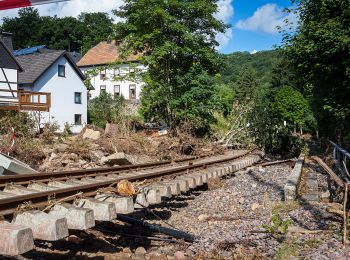
Trail On foot Kall - EifelSchleife Von Bären und Bärlauch - Photo
On foot 15.672
Km
PRO

On foot

Medium
Kall, North Rhine-Westphalia, Kreis Euskirchen, Germany
15.7 km | 20 km-effort
4h 37min
349 m
349 m
Yes
SityTrail - itinéraires balisés pédestres

• Trail created by Nordeifel Tourismus GmbH. Symbol: quadratisches Logo oben blaue Fläche (Himmel) unten grüne Fläche ...

Trail On foot Kall - EifelSchleife Zur Zeit der Römer - Photo
On foot 11.541
Km
PRO

On foot

Easy
Kall, North Rhine-Westphalia, Kreis Euskirchen, Germany
11.5 km | 15.6 km-effort
3h 33min
305 m
309 m
Yes
SityTrail - itinéraires balisés pédestres

• Trail created by Nordeifel Tourismus GmbH. Symbol: quadratisches Logo oben blaue Fläche (Himmel) unten grüne Fläche ...

Trail On foot Kall - EifelSchleife Kaller Sagen - Photo
On foot 6.859
Km
PRO

On foot

Easy
Kall, North Rhine-Westphalia, Kreis Euskirchen, Germany
6.9 km | 9.4 km-effort
2h 8min
193 m
193 m
Yes
SityTrail - itinéraires balisés pédestres

• Symbol: quadratisches Logo oben blaue Fläche (Himmel) unten grüne Fläche (Berg/Landschaft), unten bis nach oben auf d...
Trail On foot Kall - Kall A12 - Photo
On foot 5.212
Km
PRO

On foot

Easy
Kall, North Rhine-Westphalia, Kreis Euskirchen, Germany
5.2 km | 7.2 km-effort
1h 37min
148 m
141 m
Yes
SityTrail - itinéraires balisés pédestres

• Trail created by Eifelverein. Symbol: schwarze A12 auf weißem Grund; Beschilderung unvollständig; Zahl auch ohne A;

Trail On foot Kall - Kall 10 - Photo
On foot 3.273
Km
PRO

On foot

Easy
Kall, North Rhine-Westphalia, Kreis Euskirchen, Germany
3.3 km | 4.7 km-effort
1h 4min
119 m
76 m
No
SityTrail - itinéraires balisés pédestres

• Symbol: schwarze 10 auf weißem Grund

Trail On foot Kall - EifelSchleife Kuttenbachtal - Photo
On foot 9.156
Km
PRO

On foot

Easy
Kall, North Rhine-Westphalia, Kreis Euskirchen, Germany
9.2 km | 13.1 km-effort
2h 58min
293 m
295 m
Yes
SityTrail - itinéraires balisés pédestres

• Trail created by Nordeifel Tourismus GmbH. Symbol: quadratisches Logo oben blaue Fläche (Himmel) unten grüne Fläche ...

Trail On foot Kall - EifelSpur Pingenwanderpfad - Photo
On foot 10.818
Km
PRO

On foot

Easy
Kall, North Rhine-Westphalia, Kreis Euskirchen, Germany
10.8 km | 14.5 km-effort
3h 17min
276 m
276 m
Yes
SityTrail - itinéraires balisés pédestres

• Trail created by Nordeifel Tourismus GmbH.

Trail On foot Kall - Kall A7 - Photo
On foot 4.891
Km
PRO

On foot

Easy
Kall, North Rhine-Westphalia, Kreis Euskirchen, Germany
4.9 km | 6.6 km-effort
1h 30min
131 m
129 m
Yes
SityTrail - itinéraires balisés pédestres

• Symbol: schwarze A7 auf weißem Grund; Beschilderung unvollständig; Zahl auch ohne A;

Trail On foot Kall - Kall A6 - Photo
On foot 4.438
Km
PRO

On foot

Easy
Kall, North Rhine-Westphalia, Kreis Euskirchen, Germany
4.4 km | 6.2 km-effort
1h 25min
137 m
132 m
Yes
SityTrail - itinéraires balisés pédestres

• Trail created by Eifelverein. Symbol: schwarze A6 auf weißem Grund; Beschilderung nicht einheitlich; auch ohne A ode...

Trail Walking Kall - ESt-06 - Photo
Walking 22.542
Km

Walking

Medium
Kall, North Rhine-Westphalia, Kreis Euskirchen, Germany
23 km | 29 km-effort
6h 5min
468 m
507 m
No
hubbi

• Steinfeld - Blankenheim

10 trails displayed on 10

FREE GPS app for hiking

Logo SityTrail SityTrail

IGN / Geographical institutes

Download SityTrail from the App Store Download SityTrail from Google Play

Logo SityTrail SityTrail World

The world is yours!

Download SityTrail from the App Store Download SityTrail from Google Play Download SityTrail on Huawei AppGallery

Activities

Close
My subscriptions