Kreis Euskirchen, North Rhine-Westphalia: Best trails, routes and walks

Kreis Euskirchen: Discover the best trails: 113 hiking trails and 3 bike and mountain-bike routes. All these trails, routes and outdoor activities are available in our SityTrail applications for smartphones and tablets.
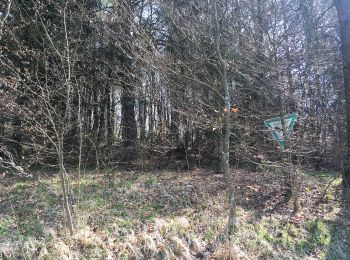
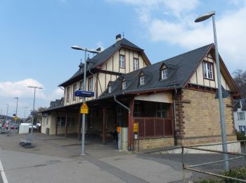
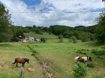
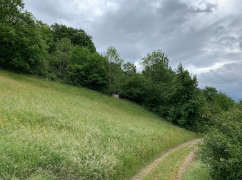

The best trails (120)

Trail On foot Bad Münstereifel - EifelSchleife Eselsberg - Photo
On foot 4.765
Km
PRO

On foot

Easy
Bad Münstereifel, North Rhine-Westphalia, Kreis Euskirchen, Germany
4.8 km | 6.9 km-effort
1h 34min
164 m
152 m
Yes
SityTrail - itinéraires balisés pédestres

• Trail created by Nordeifel Tourismus GmbH. Symbol: quadratisches Logo oben blaue Fläche (Himmel) unten grüne Fläche ...

Trail On foot Blankenheim - EifelSchleife Über den Brotpfad - Photo
On foot 12.154
Km
PRO

On foot

Easy
Blankenheim, North Rhine-Westphalia, Kreis Euskirchen, Germany
12.2 km | 15.6 km-effort
3h 33min
261 m
262 m
Yes
SityTrail - itinéraires balisés pédestres

• Trail created by Nordeifel Tourismus GmbH. Symbol: quadratisches Logo oben blaue Fläche (Himmel) unten grüne Fläche ...

Trail On foot Blankenheim - EifelSchleife Freilinger See - Photo
On foot 9.861
Km
PRO

On foot

Easy
Blankenheim, North Rhine-Westphalia, Kreis Euskirchen, Germany
9.9 km | 12 km-effort
2h 44min
162 m
164 m
Yes
SityTrail - itinéraires balisés pédestres

• Trail created by Nordeifel Tourismus GmbH. Symbol: quadratisches Logo oben blaue Fläche (Himmel) unten grüne Fläche ...

Trail On foot Blankenheim - EifelSchleife Durchs Auelbachtal - Photo
On foot 13.319
Km
PRO

On foot

Easy
Blankenheim, North Rhine-Westphalia, Kreis Euskirchen, Germany
13.3 km | 16.8 km-effort
3h 48min
259 m
259 m
Yes
SityTrail - itinéraires balisés pédestres

• Trail created by Nordeifel Tourismus GmbH. Symbol: quadratisches Logo oben blaue Fläche (Himmel) unten grüne Fläche ...

Trail On foot Nettersheim - EifelSchleife Quelle der Erft - Photo
On foot 20.289
Km
PRO

On foot

Medium
Nettersheim, North Rhine-Westphalia, Kreis Euskirchen, Germany
20 km | 26 km-effort
5h 55min
434 m
434 m
Yes
SityTrail - itinéraires balisés pédestres

• Trail created by Nordeifel Tourismus GmbH. Symbol: quadratisches Logo oben blaue Fläche (Himmel) unten grüne Fläche ...

Trail On foot Mechernich - EifelSpur Soweit das Auge reicht - Photo
On foot 16.231
Km
PRO

On foot

Medium
Mechernich, North Rhine-Westphalia, Kreis Euskirchen, Germany
16.2 km | 21 km-effort
4h 46min
358 m
362 m
Yes
SityTrail - itinéraires balisés pédestres

• Trail created by Nordeifel Tourismus GmbH. Symbol: quadratisches Logo oben blaue Fläche unten grüne Fläche, unten li...

Trail On foot Mechernich - EifelSchleife Eickser Busch - Photo
On foot 7.846
Km
PRO

On foot

Easy
Mechernich, North Rhine-Westphalia, Kreis Euskirchen, Germany
7.8 km | 9.5 km-effort
2h 9min
123 m
127 m
Yes
SityTrail - itinéraires balisés pédestres

• Trail created by Nordeifel Tourismus GmbH. Symbol: quadratisches Logo oben blaue Fläche (Himmel) unten grüne Fläche ...

Trail On foot Mechernich - EifelSchleife Altusknipp-Weg - Photo
On foot 4.177
Km
PRO

On foot

Easy
Mechernich, North Rhine-Westphalia, Kreis Euskirchen, Germany
4.2 km | 5.7 km-effort
1h 18min
118 m
116 m
Yes
SityTrail - itinéraires balisés pédestres

• Trail created by Nordeifel Tourismus GmbH. Symbol: quadratisches Logo oben blaue Fläche (Himmel) unten grüne Fläche ...

Trail On foot Mechernich - EifelSchleife Kommerner Fachwerkidylle - Photo
On foot 9.616
Km
PRO

On foot

Easy
Mechernich, North Rhine-Westphalia, Kreis Euskirchen, Germany
9.6 km | 11.6 km-effort
2h 38min
149 m
149 m
Yes
SityTrail - itinéraires balisés pédestres

• Trail created by Nordeifel Tourismus GmbH. Symbol: quadratisches Logo oben blaue Fläche (Himmel) unten grüne Fläche ...

Trail On foot Mechernich - EifelSchleife Burg Satzvey - Photo
On foot 7.293
Km
PRO

On foot

Easy
Mechernich, North Rhine-Westphalia, Kreis Euskirchen, Germany
7.3 km | 8.7 km-effort
1h 58min
104 m
106 m
Yes
SityTrail - itinéraires balisés pédestres

• Trail created by Nordeifel Tourismus GmbH. Symbol: quadratisches Logo oben blaue Fläche (Himmel) unten grüne Fläche ...

Trail On foot Kall - EifelSchleife Von Bären und Bärlauch - Photo
On foot 15.672
Km
PRO

On foot

Medium
Kall, North Rhine-Westphalia, Kreis Euskirchen, Germany
15.7 km | 20 km-effort
4h 37min
349 m
349 m
Yes
SityTrail - itinéraires balisés pédestres

• Trail created by Nordeifel Tourismus GmbH. Symbol: quadratisches Logo oben blaue Fläche (Himmel) unten grüne Fläche ...

Trail On foot Kall - EifelSchleife Zur Zeit der Römer - Photo
On foot 11.541
Km
PRO

On foot

Easy
Kall, North Rhine-Westphalia, Kreis Euskirchen, Germany
11.5 km | 15.6 km-effort
3h 33min
305 m
309 m
Yes
SityTrail - itinéraires balisés pédestres

• Trail created by Nordeifel Tourismus GmbH. Symbol: quadratisches Logo oben blaue Fläche (Himmel) unten grüne Fläche ...

Trail On foot Blankenheim - EifelSpur Toscana der Eifel - Photo
On foot 15.322
Km
PRO

On foot

Medium
Blankenheim, North Rhine-Westphalia, Kreis Euskirchen, Germany
15.3 km | 21 km-effort
4h 42min
406 m
406 m
Yes
SityTrail - itinéraires balisés pédestres

• Trail created by Nordeifel Tourismus GmbH. Symbol: quadratisches Logo oben blaue Fläche unten grüne Fläche, unten li...

Trail On foot Bad Münstereifel - EifelSchleife Burgenblick - Photo
On foot 4.137
Km
PRO

On foot

Easy
Bad Münstereifel, North Rhine-Westphalia, Kreis Euskirchen, Germany
4.1 km | 5.6 km-effort
1h 16min
112 m
116 m
Yes
SityTrail - itinéraires balisés pédestres

• Trail created by Nordeifel Tourismus GmbH. Symbol: quadratisches Logo oben blaue Fläche (Himmel) unten grüne Fläche ...

Trail On foot Dahlem - EifelSchleife Naturwanderpfad - Photo
On foot 9.271
Km
PRO

On foot

Easy
Dahlem, North Rhine-Westphalia, Kreis Euskirchen, Germany
9.3 km | 11.9 km-effort
2h 42min
198 m
201 m
Yes
SityTrail - itinéraires balisés pédestres

• Trail created by Nordeifel Tourismus GmbH. Symbol: quadratisches Logo oben blaue Fläche (Himmel) unten grüne Fläche ...

Trail On foot Mechernich - EifelSpur Wasser für Köln - Photo
On foot 17.118
Km
PRO

On foot

Medium
Mechernich, North Rhine-Westphalia, Kreis Euskirchen, Germany
17.1 km | 23 km-effort
5h 17min
461 m
466 m
Yes
SityTrail - itinéraires balisés pédestres

• Trail created by Nordeifel Tourismus GmbH. Symbol: quadratisches Logo oben blaue Fläche unten grüne Fläche, unten li...

Trail On foot Mechernich - Eifeltor Panorama - Route - Photo
On foot 8.62
Km
PRO

On foot

Easy
Mechernich, North Rhine-Westphalia, Kreis Euskirchen, Germany
8.6 km | 11.3 km-effort
2h 34min
202 m
203 m
Yes
SityTrail - itinéraires balisés pédestres

• Trail created by Touristik-Agentur Mechernich e.V..

Trail On foot Bad Münstereifel - EifelSchleife Um den Langen Kopf - Photo
On foot 10.28
Km
PRO

On foot

Easy
Bad Münstereifel, North Rhine-Westphalia, Kreis Euskirchen, Germany
10.3 km | 14.2 km-effort
3h 13min
295 m
293 m
Yes
SityTrail - itinéraires balisés pédestres

• Trail created by Nordeifel Tourismus GmbH. Symbol: quadratisches Logo oben blaue Fläche (Himmel) unten grüne Fläche ...

Trail On foot Euskirchen - EifelSchleife Hahnenberg - Photo
On foot 9.888
Km
PRO

On foot

Easy
Euskirchen, North Rhine-Westphalia, Kreis Euskirchen, Germany
9.9 km | 12.7 km-effort
2h 53min
210 m
214 m
Yes
SityTrail - itinéraires balisés pédestres

• Trail created by Nordeifel Tourismus GmbH. Symbol: quadratisches Logo oben blaue Fläche (Himmel) unten grüne Fläche ...

Trail On foot Euskirchen - EifelSchleife Kloster Schweinheim - Photo
On foot 4.455
Km
PRO

On foot

Easy
Euskirchen, North Rhine-Westphalia, Kreis Euskirchen, Germany
4.5 km | 5.7 km-effort
1h 17min
90 m
90 m
Yes
SityTrail - itinéraires balisés pédestres

• Trail created by Nordeifel Tourismus GmbH. Symbol: quadratisches Logo oben blaue Fläche (Himmel) unten grüne Fläche ...

20 trails displayed on 120

FREE GPS app for hiking

Logo SityTrail SityTrail

IGN / Geographical institutes

Download SityTrail from the App Store Download SityTrail from Google Play

Logo SityTrail SityTrail World

The world is yours!

Download SityTrail from the App Store Download SityTrail from Google Play Download SityTrail on Huawei AppGallery

Activities

Nearby regions

Close
My subscriptions