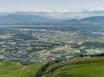
Thoiry, Ain: Best trails, routes and walks

1 comments

Thoiry: Discover the best trails: 15 hiking trails and 1 bike and mountain-bike routes. All these trails, routes and outdoor activities are available in our SityTrail applications for smartphones and tablets.


The best trails (35)

Trail Walking Thoiry - Le Reculet Le Crêt de la Neige - Photo
Walking 10.705
Km

Walking

Difficult
(1)
Thoiry, Auvergne-Rhône-Alpes, Ain, France
10.7 km | 23 km-effort
4h 39min
925 m
918 m
Yes
dominiq

Trail Walking Thoiry - Le Reculet  - Photo
Walking 11.216
Km

Walking

Difficult
Thoiry, Auvergne-Rhône-Alpes, Ain, France
11.2 km | 26 km-effort
4h 29min
1120 m
1124 m
Yes
Arvierie56@Gmail.com

• par Thoiry

Trail Walking Thoiry - Crêt de la Neige et Reculet - Thoiry - Photo
Walking 10.596
Km

Walking

Difficult
Thoiry, Auvergne-Rhône-Alpes, Ain, France
10.6 km | 23 km-effort
5h 15min
919 m
919 m
Yes
tracegps

Trail Walking Thoiry - 05.01 - Photo
Walking 12.083
Km

Walking

Thoiry, Auvergne-Rhône-Alpes, Ain, France
12.1 km | 14.3 km-effort
1h 20min
171 m
152 m
No
monique surace

Trail Walking Thoiry - Sergy  - Photo
Walking 7.344
Km

Walking

Thoiry, Auvergne-Rhône-Alpes, Ain, France
7.3 km | 8.2 km-effort
1h 49min
67 m
67 m
Yes
monique surace

Trail Walking Thoiry - Le Reculet par Narderans - Photo
Walking 6.659
Km

Walking

Very easy
Thoiry, Auvergne-Rhône-Alpes, Ain, France
6.7 km | 17.7 km-effort
2h 13min
826 m
833 m
Yes
philippe.michel10

Trail Walking Thoiry - Trek- Mont du Jura - Photo
Walking 16.38
Km

Walking

Very easy
Thoiry, Auvergne-Rhône-Alpes, Ain, France
16.4 km | 30 km-effort
6h 12min
976 m
1062 m
No
tippex01

Trail Other activity Thoiry - Lelex jour 2 - Photo
Other activity 17.238
Km

Other activity

Very easy
Thoiry, Auvergne-Rhône-Alpes, Ain, France
17.2 km | 29 km-effort
5min
769 m
1337 m
No
GerardVaginay

Trail Other activity Thoiry - dd - Photo
Other activity 4.318
Km

Other activity

Very easy
Thoiry, Auvergne-Rhône-Alpes, Ain, France
4.3 km | 8 km-effort
2h 2min
209 m
475 m
No
michel.dauby

Trail Walking Thoiry - Reculet - Photo
Walking 10.017
Km

Walking

Medium
Thoiry, Auvergne-Rhône-Alpes, Ain, France
10 km | 22 km-effort
Unknown
914 m
918 m
Yes
michel.dauby

Trail Other activity Thoiry - vtt040912 - Photo
Other activity 15.042
Km

Other activity

Very easy
Thoiry, Auvergne-Rhône-Alpes, Ain, France
15 km | 27 km-effort
Unknown
1106 m
157 m
No
anselmo

Trail Other activity Thoiry - cp040317 - Photo
Other activity 10.456
Km

Other activity

Very easy
Thoiry, Auvergne-Rhône-Alpes, Ain, France
10.5 km | 12.1 km-effort
Unknown
120 m
123 m
Yes
anselmo

Trail Other activity Thoiry - cp040316 - Photo
Other activity 6.895
Km

Other activity

Very easy
Thoiry, Auvergne-Rhône-Alpes, Ain, France
6.9 km | 7.9 km-effort
Unknown
77 m
79 m
Yes
anselmo

Trail Other activity Thoiry - CP040314 - Photo
Other activity 5.376
Km

Other activity

Very easy
Thoiry, Auvergne-Rhône-Alpes, Ain, France
5.4 km | 6.2 km-effort
Unknown
58 m
59 m
Yes
anselmo

Trail Other activity Thoiry - 20040229 - Photo
Other activity 4.627
Km

Other activity

Very easy
Thoiry, Auvergne-Rhône-Alpes, Ain, France
4.6 km | 5.5 km-effort
Unknown
63 m
69 m
Yes
anselmo

Trail Other activity Thoiry - VTT-fin 2003 - Photo
Other activity 42.884
Km

Other activity

Very easy
Thoiry, Auvergne-Rhône-Alpes, Ain, France
43 km | 57 km-effort
Unknown
1103 m
1051 m
No
anselmo

Trail Other activity Thoiry - VTT 2003-09-07 - Photo
Other activity 66.973
Km

Other activity

Very easy
Thoiry, Auvergne-Rhône-Alpes, Ain, France
67 km | 93 km-effort
Unknown
1962 m
1964 m
No
anselmo

Trail Winter sports Thoiry - VTT 2003-08-31 - Photo
Winter sports 32.105
Km

Winter sports

Very easy
Thoiry, Auvergne-Rhône-Alpes, Ain, France
32 km | 41 km-effort
Unknown
659 m
657 m
No
anselmo

Trail Other activity Thoiry - VTT 2003-08-07 - Photo
Other activity 38.698
Km

Other activity

Very easy
Thoiry, Auvergne-Rhône-Alpes, Ain, France
39 km | 50 km-effort
Unknown
824 m
830 m
Yes
anselmo

Trail Other activity Thoiry - VTT 2003-07-27 - Photo
Other activity 57.258
Km

Other activity

Very easy
Thoiry, Auvergne-Rhône-Alpes, Ain, France
57 km | 79 km-effort
Unknown
1653 m
1651 m
Yes
anselmo

20 trails displayed on 35

FREE GPS app for hiking

Logo SityTrail SityTrail

IGN / Geographical institutes

Download SityTrail from the App Store Download SityTrail from Google Play

Logo SityTrail SityTrail World

The world is yours!

Download SityTrail from the App Store Download SityTrail from Google Play Download SityTrail on Huawei AppGallery

Activities

Close
My subscriptions