Saint-Anthème, Puy-de-Dôme: Best trails, routes and walks

6 comments

Saint-Anthème: Discover the best trails: 26 hiking trails, 22 bike and mountain-bike routes and 18 equestrian circuits. All these trails, routes and outdoor activities are available in our SityTrail applications for smartphones and tablets.


The best trails (75)
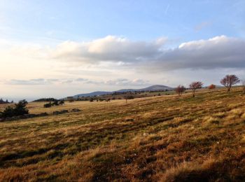
Trail On foot Saint-Anthème - Le Colporteur des Jasseries - Photo
On foot 9.382
Km
PRO

On foot

Easy
Saint-Anthème, Auvergne-Rhône-Alpes, Puy-de-Dôme, France
9.4 km | 13.1 km-effort
2h 58min
277 m
282 m
Yes
SityTrail - itinéraires balisés pédestres

• Trail created by CD63.

Trail On foot Saint-Anthème - Beauvoir - Photo
On foot 7.44
Km
PRO

On foot

Easy
Saint-Anthème, Auvergne-Rhône-Alpes, Puy-de-Dôme, France
7.4 km | 11.7 km-effort
2h 39min
319 m
318 m
Yes
SityTrail - itinéraires balisés pédestres

• Trail created by CD63.

Trail Walking Saint-Anthème - Col des Supeyres au départ du Coq noir - Photo
Walking 13.367
Km

Walking

Difficult
Saint-Anthème, Auvergne-Rhône-Alpes, Puy-de-Dôme, France
13.4 km | 18.1 km-effort
3h 32min
356 m
357 m
Yes
swp648

Trail On foot Saint-Anthème - Les Prats-de-la-Chaux - Photo
On foot 13.337
Km
PRO

On foot

Easy
Saint-Anthème, Auvergne-Rhône-Alpes, Puy-de-Dôme, France
13.3 km | 19.1 km-effort
4h 19min
425 m
441 m
No
SityTrail - itinéraires balisés pédestres

• Trail created by CD63.

Trail Mountain bike Saint-Anthème - Descente barracuchet Montbrison - Photo
Mountain bike 29.935
Km

Mountain bike

Medium
Saint-Anthème, Auvergne-Rhône-Alpes, Puy-de-Dôme, France
30 km | 36 km-effort
2h 36min
233 m
1119 m
No
cyclopat42600

Trail Walking Saint-Anthème - Les Hautes Chaumes - Saint Anthème  - Photo
Walking 10.006
Km

Walking

Difficult
Saint-Anthème, Auvergne-Rhône-Alpes, Puy-de-Dôme, France
10 km | 13.5 km-effort
3h 15min
259 m
258 m
Yes
tracegps

Trail Road bike Saint-Anthème - Ça pique  - Photo
Road bike 39.893
Km

Road bike

Difficult
Saint-Anthème, Auvergne-Rhône-Alpes, Puy-de-Dôme, France
40 km | 52 km-effort
2h 38min
918 m
917 m
Yes
pierrebmw84

Trail Cross-country skiing Saint-Anthème - Plan chevalat - Photo
Cross-country skiing 7.88
Km

Cross-country skiing

Medium
Saint-Anthème, Auvergne-Rhône-Alpes, Puy-de-Dôme, France
7.9 km | 10.1 km-effort
1h 27min
163 m
163 m
Yes
cyclopat42600

Trail Walking Saint-Anthème - boucle des Pradeaux - Photo
Walking 15.007
Km

Walking

Easy
(1)
Saint-Anthème, Auvergne-Rhône-Alpes, Puy-de-Dôme, France
15 km | 18.7 km-effort
3h 34min
278 m
278 m
Yes
dudu42

Trail Walking Saint-Anthème - jasserie du coq noir - Photo
Walking 13.309
Km

Walking

Easy
Saint-Anthème, Auvergne-Rhône-Alpes, Puy-de-Dôme, France
13.3 km | 18 km-effort
4h 26min
349 m
349 m
Yes
jibe01

Trail Walking Saint-Anthème - Les Prats de la Chau - Saint Anthème - Photo
Walking 13.624
Km

Walking

Medium
(2)
Saint-Anthème, Auvergne-Rhône-Alpes, Puy-de-Dôme, France
13.6 km | 19.6 km-effort
4h 0min
446 m
446 m
Yes
tracegps

Trail Mountain bike Saint-Anthème - Espace VTT FFC de la Vallée de l'Ance - Circuit n° 6 - Photo
Mountain bike 22.833
Km

Mountain bike

Very difficult
Saint-Anthème, Auvergne-Rhône-Alpes, Puy-de-Dôme, France
23 km | 31 km-effort
3h 0min
616 m
614 m
Yes
tracegps

Trail Mountain bike Saint-Anthème - Espace VTT FFC de la Vallée de l'Ance - Circuit n° 4 - Photo
Mountain bike 14.829
Km

Mountain bike

Medium
Saint-Anthème, Auvergne-Rhône-Alpes, Puy-de-Dôme, France
14.8 km | 18.7 km-effort
2h 0min
292 m
292 m
Yes
tracegps

Trail Mountain bike Saint-Anthème - Espace VTT FFC de la Vallée de l'Ance - Circuit n° 3 - Photo
Mountain bike 32.456
Km

Mountain bike

Very difficult
Saint-Anthème, Auvergne-Rhône-Alpes, Puy-de-Dôme, France
32 km | 44 km-effort
3h 15min
830 m
832 m
Yes
tracegps

Trail Mountain bike Saint-Anthème - Espace VTT FFC de la Vallée de l'Ance - Circuit n° 2 - Photo
Mountain bike 21.889
Km

Mountain bike

Difficult
(1)
Saint-Anthème, Auvergne-Rhône-Alpes, Puy-de-Dôme, France
22 km | 29 km-effort
2h 15min
551 m
553 m
Yes
tracegps

Trail Mountain bike Saint-Anthème - Espace VTT FFC de la Vallée de l'Ance - Circuit n° 1 - Photo
Mountain bike 13.502
Km

Mountain bike

Medium
Saint-Anthème, Auvergne-Rhône-Alpes, Puy-de-Dôme, France
13.5 km | 18.3 km-effort
1h 30min
363 m
365 m
Yes
tracegps

Trail Horseback riding Saint-Anthème - SityTrail - 2473583 - jas-du-masxchemintrans - Photo
Horseback riding 24.185
Km

Horseback riding

Difficult
Saint-Anthème, Auvergne-Rhône-Alpes, Puy-de-Dôme, France
24 km | 31 km-effort
4h 7min
490 m
698 m
No
Flocharlot

• ne pas rater la baignade dans le lac des pradeaux et l'apero au col

Trail Walking Saint-Anthème - boucle col du supeyres - Photo
Walking 13.22
Km

Walking

Easy
(1)
Saint-Anthème, Auvergne-Rhône-Alpes, Puy-de-Dôme, France
13.2 km | 18 km-effort
3h 36min
359 m
359 m
Yes
fab0202

Trail Bicycle tourism Saint-Anthème - 4ème jour Forez (la chapelle en la faye) - Photo
Bicycle tourism 16.165
Km

Bicycle tourism

Medium
Saint-Anthème, Auvergne-Rhône-Alpes, Puy-de-Dôme, France
16.2 km | 22 km-effort
3h 46min
579 m
96 m
No
Gbreuilh

Trail Horseback riding Saint-Anthème - Forza - Photo
Horseback riding 26.071
Km

Horseback riding

Saint-Anthème, Auvergne-Rhône-Alpes, Puy-de-Dôme, France
26 km | 35 km-effort
6h 33min
696 m
569 m
No
Francisco42

20 trails displayed on 75

FREE GPS app for hiking

Logo SityTrail SityTrail

IGN / Geographical institutes

Download SityTrail from the App Store Download SityTrail from Google Play

Logo SityTrail SityTrail World

The world is yours!

Download SityTrail from the App Store Download SityTrail from Google Play Download SityTrail on Huawei AppGallery

Activities

Close
My subscriptions