Bitschwiller-lès-Thann, Haut-Rhin: Best trails, routes and walks

5 comments

Bitschwiller-lès-Thann: Discover the best trails: 73 hiking trails. All these trails, routes and outdoor activities are available in our SityTrail applications for smartphones and tablets.


The best trails (75)

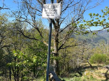
Trail On foot Bitschwiller-lès-Thann - Bitschwiller les Thann - Rehbrunnel - Abri du Becherkopf - Roche Albert - Photo
On foot 10.308
Km

On foot

Medium
(1)
Bitschwiller-lès-Thann, Grand Est, Haut-Rhin, France
10.3 km | 16.4 km-effort
Unknown
460 m
460 m
Yes
patrickbeyrath

Trail Walking Bitschwiller-lès-Thann - 68 Col du Hundsrück  - FA Gsang - retour ThannerHubel - Photo
Walking 11.244
Km

Walking

Medium
(1)
Bitschwiller-lès-Thann, Grand Est, Haut-Rhin, France
11.2 km | 18.4 km-effort
3h 48min
533 m
533 m
Yes
Seppala - Balades du jeudi

Trail Walking Bitschwiller-lès-Thann - JD 16/20 Willer sur Thur - Ferme Auberge d'Ostein 15km 4h - Photo
Walking 15.129
Km

Walking

Difficult
Bitschwiller-lès-Thann, Grand Est, Haut-Rhin, France
15.1 km | 22 km-effort
4h 7min
516 m
511 m
Yes
argonneuweg

Trail Walking Bitschwiller-lès-Thann - Col du Hundsruck - Belacker (30/7/2020) - Photo
Walking 15.291
Km

Walking

Medium
(1)
Bitschwiller-lès-Thann, Grand Est, Haut-Rhin, France
15.3 km | 23 km-effort
4h 13min
611 m
605 m
Yes
Richard68500

Trail Walking Bitschwiller-lès-Thann - Bitschwiller-Fourmi (29/11/2018) - Photo
Walking 11.478
Km

Walking

Medium
Bitschwiller-lès-Thann, Grand Est, Haut-Rhin, France
11.5 km | 19.8 km-effort
3h 1min
621 m
621 m
Yes
Richard68500

Trail Walking Bitschwiller-lès-Thann - Col du Hundsrucken - Photo
Walking 14.774
Km

Walking

Medium
Bitschwiller-lès-Thann, Grand Est, Haut-Rhin, France
14.8 km | 23 km-effort
4h 47min
601 m
601 m
Yes
VacheKiri67

• Faite le 26/07/2018. D'après : Guide Frank Vosges - N°28 Col du Hundsrucken - Rossberg - Belacker. La durée indiquée ...
Trail Walking Bitschwiller-lès-Thann - Hunsrueck -Gsang (31/08/2017) - Photo
Walking 15.516
Km

Walking

Medium
Bitschwiller-lès-Thann, Grand Est, Haut-Rhin, France
15.5 km | 24 km-effort
5h 4min
626 m
634 m
Yes
Richard68500

Trail Walking Bitschwiller-lès-Thann - Bitschwiller les Thann  - Photo
Walking 10.527
Km

Walking

Medium
Bitschwiller-lès-Thann, Grand Est, Haut-Rhin, France
10.5 km | 16.8 km-effort
3h 7min
474 m
473 m
Yes
jeankrust

Trail Walking Bitschwiller-lès-Thann - rdpr g3 hunsruck 220816 - Photo
Walking 9.297
Km
GUIDE

Walking

Difficult
Bitschwiller-lès-Thann, Grand Est, Haut-Rhin, France
9.3 km | 14.5 km-effort
4h 30min
393 m
396 m
Yes
stempfel52

Trail Walking Bitschwiller-lès-Thann - 2022 06 02 - Photo
Walking 11.24
Km

Walking

Medium
Bitschwiller-lès-Thann, Grand Est, Haut-Rhin, France
11.2 km | 17.8 km-effort
3h 12min
495 m
470 m
Yes
E.BURCK

Trail Walking Bitschwiller-lès-Thann - 18.11.13.Bitschwiller - Photo
Walking 11.653
Km

Walking

Very easy
Bitschwiller-lès-Thann, Grand Est, Haut-Rhin, France
11.7 km | 16.3 km-effort
6h 25min
347 m
353 m
Yes
ROPPJP

Trail Walking Bitschwiller-lès-Thann - waldverein- samedi-14:10/24 - Photo
Walking 16.546
Km

Walking

Bitschwiller-lès-Thann, Grand Est, Haut-Rhin, France
16.5 km | 28 km-effort
9h 0min
840 m
838 m
Yes
chantalwaltzer

Trail Walking Bitschwiller-lès-Thann - Waldmatt -12/08/23 Copains w- end - Photo
Walking 7.836
Km

Walking

Bitschwiller-lès-Thann, Grand Est, Haut-Rhin, France
7.8 km | 16.1 km-effort
4h 20min
805 m
64 m
No
chantalwaltzer

Trail Walking Bitschwiller-lès-Thann - Bitschwiller- Molkenrain- copains jeudi-05/07 - Photo
Walking 20.959
Km

Walking

Bitschwiller-lès-Thann, Grand Est, Haut-Rhin, France
21 km | 34 km-effort
7h 35min
978 m
977 m
Yes
chantalwaltzer

Trail Walking Bitschwiller-lès-Thann - Bitschwille- Etang Ehrlenbach- Reco- Christian - Photo
Walking 16.101
Km

Walking

Bitschwiller-lès-Thann, Grand Est, Haut-Rhin, France
16.1 km | 28 km-effort
4h 51min
862 m
858 m
Yes
chantalwaltzer

Trail Walking Bitschwiller-lès-Thann - ostein- repas serge-18/12/22 - Photo
Walking 23.261
Km

Walking

Bitschwiller-lès-Thann, Grand Est, Haut-Rhin, France
23 km | 33 km-effort
6h 22min
724 m
680 m
No
chantalwaltzer

Trail Walking Bitschwiller-lès-Thann - hundsruck rossberg - Photo
Walking 8.015
Km

Walking

Medium
Bitschwiller-lès-Thann, Grand Est, Haut-Rhin, France
8 km | 13.2 km-effort
3h 12min
390 m
391 m
Yes
randoclas

Trail On foot Bitschwiller-lès-Thann - au dessus de  bitschwiller les thann - Photo
On foot 14.779
Km

On foot

Easy
Bitschwiller-lès-Thann, Grand Est, Haut-Rhin, France
14.8 km | 27 km-effort
Unknown
925 m
927 m
Yes
senn francis

Trail On foot Bitschwiller-lès-Thann - étape1 autour de la  vallée de thann - Photo
On foot 24.381
Km

On foot

Medium
Bitschwiller-lès-Thann, Grand Est, Haut-Rhin, France
24 km | 40 km-effort
8h 0min
1353 m
527 m
No
senn francis

Trail On foot Bitschwiller-lès-Thann - bitschwiller/tete du rouge gazon - Photo
On foot 19.172
Km

On foot

Medium
Bitschwiller-lès-Thann, Grand Est, Haut-Rhin, France
19.2 km | 34 km-effort
7min
1351 m
516 m
No
senn francis

20 trails displayed on 75

FREE GPS app for hiking

Logo SityTrail SityTrail

IGN / Geographical institutes

Download SityTrail from the App Store Download SityTrail from Google Play

Logo SityTrail SityTrail World

The world is yours!

Download SityTrail from the App Store Download SityTrail from Google Play Download SityTrail on Huawei AppGallery

Activities

Close
My subscriptions