Viens, Vaucluse: Best trails, routes and walks

2 comments

Viens: Discover the best trails: 10 hiking trails and 4 bike and mountain-bike routes. All these trails, routes and outdoor activities are available in our SityTrail applications for smartphones and tablets.


The best trails (16)
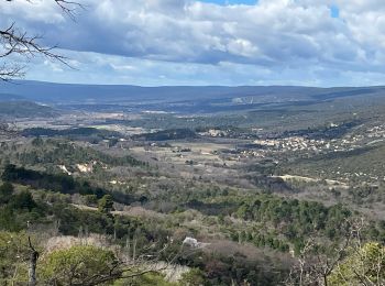
Trail Walking Viens - PF-Viens, Hameaux et Chapelles - Photo
Walking 15.469
Km

Walking

Very difficult
Viens, Provence-Alpes-Côte d'Azur, Vaucluse, France
15.5 km | 22 km-effort
5h 45min
477 m
477 m
Yes
MicDul

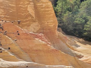
Trail Walking Viens - Le Cirque des Barriès, Ocres et fossiles - Photo
Walking 16.808
Km

Walking

Medium
Viens, Provence-Alpes-Côte d'Azur, Vaucluse, France
16.8 km | 23 km-effort
4h 54min
493 m
493 m
Yes
MarcLEBARON

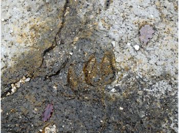
Trail Walking Viens - 2024-01-14_08h25m55_Viens-Dalle à empreintes - Photo
Walking 4.495
Km

Walking

Medium
Viens, Provence-Alpes-Côte d'Azur, Vaucluse, France
4.5 km | 6 km-effort
1h 22min
116 m
116 m
Yes
boulinevelyne

Trail Walking Viens - Viens - Photo
Walking 14.213
Km

Walking

Easy
Viens, Provence-Alpes-Côte d'Azur, Vaucluse, France
14.2 km | 19.4 km-effort
4h 23min
386 m
386 m
Yes
les joyeux randonneurs

Trail Walking Viens - Viens traces  - Photo
Walking 14.134
Km

Walking

Very easy
Viens, Provence-Alpes-Côte d'Azur, Vaucluse, France
14.1 km | 18.7 km-effort
4h 28min
352 m
321 m
No
Nathy8913

• facile

Trail Mountain bike Viens - Luberon - Grande Traversée de Vaucluse via Le Luberon - de Viens à Vitrolles-en-Luberon - Photo
Mountain bike 21.548
Km
GUIDE+

Mountain bike

Difficult
Viens, Provence-Alpes-Côte d'Azur, Vaucluse, France
22 km | 29 km-effort
1h 54min
532 m
647 m
No
Vélo Loisir Provence

Trail Walking Viens - autour de Viens - Photo
Walking 14.38
Km

Walking

Medium
Viens, Provence-Alpes-Côte d'Azur, Vaucluse, France
14.4 km | 20 km-effort
6h 4min
458 m
449 m
Yes
ghione

Trail Walking Viens - Viens - Photo
Walking 14.622
Km

Walking

Very easy
Viens, Provence-Alpes-Côte d'Azur, Vaucluse, France
14.6 km | 18.9 km-effort
5h 0min
322 m
324 m
Yes
makane

Trail sport Viens - Viens, par le Travers de Piéroux et la falaise de Subarroques - Photo
sport 13.776
Km

sport

Very easy
Viens, Provence-Alpes-Côte d'Azur, Vaucluse, France
13.8 km | 18.8 km-effort
Unknown
373 m
375 m
Yes
boulinevelyne

Trail Mountain bike Viens - viens vitrolles - Photo
Mountain bike 20.747
Km

Mountain bike

Difficult
Viens, Provence-Alpes-Côte d'Azur, Vaucluse, France
21 km | 29 km-effort
2h 56min
565 m
676 m
No
jjduvar

Trail Electric bike Viens - Maubec-Lacoste_16 - Photo
Electric bike 29.4
Km

Electric bike

Medium
Viens, Provence-Alpes-Côte d'Azur, Vaucluse, France
29 km | 38 km-effort
Unknown
626 m
627 m
Yes
verleihnix

Trail Other activity Viens - viens  - Photo
Other activity 5.325
Km

Other activity

Easy
Viens, Provence-Alpes-Côte d'Azur, Vaucluse, France
5.3 km | 6.8 km-effort
1h 56min
110 m
111 m
Yes
jmorando

Trail Walking Viens - Viens - Photo
Walking 8.34
Km

Walking

Very easy
(1)
Viens, Provence-Alpes-Côte d'Azur, Vaucluse, France
8.3 km | 11.2 km-effort
2h 23min
209 m
228 m
Yes
derrives

Trail Walking Viens - Viens, hameaux et chapelles - Photo
Walking 15.051
Km

Walking

Medium
(1)
Viens, Provence-Alpes-Côte d'Azur, Vaucluse, France
15.1 km | 21 km-effort
4h 32min
476 m
475 m
Yes
lviallet

Trail Walking Viens - 20200112viens - Photo
Walking 2.724
Km

Walking

Very easy
Viens, Provence-Alpes-Côte d'Azur, Vaucluse, France
2.7 km | 3.9 km-effort
1h 8min
100 m
39 m
No
michelfehrenbach

Trail Mountain bike Viens - viens St. Paul  - Photo
Mountain bike 2.864
Km

Mountain bike

Very easy
Viens, Provence-Alpes-Côte d'Azur, Vaucluse, France
2.9 km | 3.6 km-effort
12min
8 m
194 m
No
poupou84

16 trails displayed on 16

FREE GPS app for hiking

Logo SityTrail SityTrail

IGN / Geographical institutes

Download SityTrail from the App Store Download SityTrail from Google Play

Logo SityTrail SityTrail World

The world is yours!

Download SityTrail from the App Store Download SityTrail from Google Play Download SityTrail on Huawei AppGallery

Activities

Close
My subscriptions