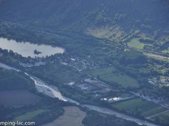
Saint-Auban-d'Oze, Hautes-Alpes: Best trails, routes and walks

1 comments

Saint-Auban-d'Oze: Discover the best trails: 11 hiking trails. All these trails, routes and outdoor activities are available in our SityTrail applications for smartphones and tablets.


The best trails (11)

Trail Running Saint-Auban-d'Oze - Trail 01 - Le Cirque de Villauret - Photo
Running 9.57
Km
GUIDE+

Running

Difficult
Saint-Auban-d'Oze, Provence-Alpes-Côte d'Azur, Hautes-Alpes, France
9.6 km | 19.9 km-effort
2h 0min
778 m
779 m
Yes
Camping Les Rives du Lac

Trail Walking Saint-Auban-d'Oze - R02 oule depuis saint auban - Photo
Walking 5.862
Km
GUIDE+

Walking

Medium
(1)
Saint-Auban-d'Oze, Provence-Alpes-Côte d'Azur, Hautes-Alpes, France
5.9 km | 13.9 km-effort
2h 44min
606 m
606 m
Yes
Camping Les Rives du Lac

• A nice hike on a southern slope, to do in the morning. Rise quite steep on the end, it is more interesting to climb t...
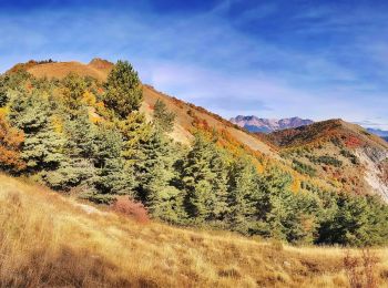
Trail Walking Saint-Auban-d'Oze - Montage d'Oule Via Saint Auban d'OZ - Photo
Walking 6.155
Km

Walking

Difficult
Saint-Auban-d'Oze, Provence-Alpes-Côte d'Azur, Hautes-Alpes, France
6.2 km | 14.4 km-effort
3h 2min
620 m
622 m
Yes
PapouBertrand

Trail Walking Saint-Auban-d'Oze - trek3 - Photo
Walking 8.314
Km

Walking

Very easy
Saint-Auban-d'Oze, Provence-Alpes-Côte d'Azur, Hautes-Alpes, France
8.3 km | 16.9 km-effort
Unknown
631 m
676 m
No
legris

Trail Walking Saint-Auban-d'Oze - Montagne d'Oule - Photo
Walking 7.282
Km

Walking

Difficult
Saint-Auban-d'Oze, Provence-Alpes-Côte d'Azur, Hautes-Alpes, France
7.3 km | 16 km-effort
3h 58min
657 m
655 m
Yes
Jean-AlainVorgeat

Trail Walking Saint-Auban-d'Oze - Lac de Peyssier depart Villauret - Photo
Walking 8.316
Km

Walking

Difficult
Saint-Auban-d'Oze, Provence-Alpes-Côte d'Azur, Hautes-Alpes, France
8.3 km | 15.8 km-effort
3h 19min
635 m
335 m
No
claude nier

Trail Walking Saint-Auban-d'Oze - Montagne d'Oule par Saint Auban - Photo
Walking 8.533
Km

Walking

Difficult
Saint-Auban-d'Oze, Provence-Alpes-Côte d'Azur, Hautes-Alpes, France
8.5 km | 17.8 km-effort
2h 53min
693 m
699 m
Yes
jlv05

Trail Walking Saint-Auban-d'Oze - col de Villauret 1425 mts - Photo
Walking 4.252
Km

Walking

Easy
Saint-Auban-d'Oze, Provence-Alpes-Côte d'Azur, Hautes-Alpes, France
4.3 km | 9 km-effort
3h 0min
355 m
356 m
Yes
claude nier

Trail Walking Saint-Auban-d'Oze - Côte Belle - Photo
Walking 11.483
Km

Walking

Medium
Saint-Auban-d'Oze, Provence-Alpes-Côte d'Azur, Hautes-Alpes, France
11.5 km | 20 km-effort
3h 10min
649 m
647 m
Yes
jlv05

Trail Walking Saint-Auban-d'Oze - Saint Auban - Photo
Walking 7.83
Km

Walking

Easy
Saint-Auban-d'Oze, Provence-Alpes-Côte d'Azur, Hautes-Alpes, France
7.8 km | 16.1 km-effort
2h 32min
622 m
624 m
Yes
jlv05

Trail Walking Saint-Auban-d'Oze - boucle abbaye de Clausonne - Photo
Walking 15.08
Km

Walking

Difficult
Saint-Auban-d'Oze, Provence-Alpes-Côte d'Azur, Hautes-Alpes, France
15.1 km | 24 km-effort
3h 50min
632 m
634 m
Yes
BLANCHET

11 trails displayed on 11

FREE GPS app for hiking

Logo SityTrail SityTrail

IGN / Geographical institutes

Download SityTrail from the App Store Download SityTrail from Google Play

Logo SityTrail SityTrail World

The world is yours!

Download SityTrail from the App Store Download SityTrail from Google Play Download SityTrail on Huawei AppGallery

Activities

Close
My subscriptions