Villar-d'Arêne, Hautes-Alpes: Best trails, routes and walks

7 comments

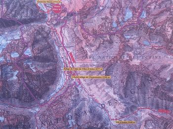
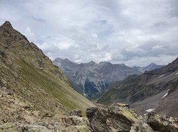
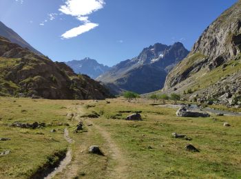
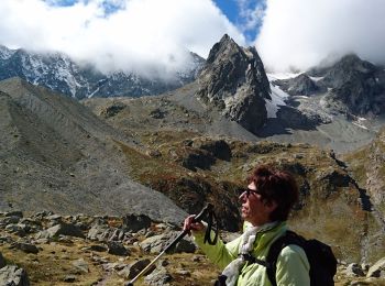
Villar-d'Arêne: Discover the best trails: 104 hiking trails and 4 bike and mountain-bike routes. All these trails, routes and outdoor activities are available in our SityTrail applications for smartphones and tablets.


The best trails (135)

Trail Walking Villar-d'Arêne - Lac d'Arsine  - Photo
Walking 17.175
Km
GUIDE

Walking

Difficult
Villar-d'Arêne, Provence-Alpes-Côte d'Azur, Hautes-Alpes, France
17.2 km | 28 km-effort
5h 37min
786 m
785 m
Yes
nadinebondoux

Trail Walking Villar-d'Arêne - SityTrail - Lac du pontet et l'Aiguillon - Photo
Walking 5.24
Km

Walking

Medium
(1)
Villar-d'Arêne, Provence-Alpes-Côte d'Azur, Hautes-Alpes, France
5.2 km | 8.6 km-effort
1h 56min
249 m
249 m
Yes
GCRS Randonnée Pédestre

• Très chouette balade familiale au départ du Lac du Pontet, idéal pour un pic-nic. A faire en été. On traverse des pât...

Trail Walking Villar-d'Arêne - le refuge de l'alpe de Villard d’arène  - Photo
Walking 10.007
Km
GUIDE

Walking

Easy
(1)
Villar-d'Arêne, Provence-Alpes-Côte d'Azur, Hautes-Alpes, France
10 km | 15.3 km-effort
3h 28min
398 m
403 m
Yes
amiral13

Trail Touring skiing Villar-d'Arêne - Roc noir de Combeynot - Photo
Touring skiing 8.239
Km

Touring skiing

Medium
Villar-d'Arêne, Provence-Alpes-Côte d'Azur, Hautes-Alpes, France
8.2 km | 19.6 km-effort
3h 5min
854 m
861 m
No
nadd73

Trail Walking Villar-d'Arêne - Lac d’arcane - Photo
Walking 17.623
Km
GUIDE

Walking

Very difficult
Villar-d'Arêne, Provence-Alpes-Côte d'Azur, Hautes-Alpes, France
17.6 km | 28 km-effort
7h 2min
787 m
777 m
Yes
Roger Philippe Wallez

Trail Touring skiing Villar-d'Arêne - col de la grande ruine  - Photo
Touring skiing 22.216
Km

Touring skiing

Difficult
Villar-d'Arêne, Provence-Alpes-Côte d'Azur, Hautes-Alpes, France
22 km | 44 km-effort
5h 56min
1621 m
1615 m
Yes
tchoua

Trail Touring skiing Villar-d'Arêne - chamoissiere  - Photo
Touring skiing 17.328
Km

Touring skiing

Very difficult
Villar-d'Arêne, Provence-Alpes-Côte d'Azur, Hautes-Alpes, France
17.3 km | 36 km-effort
5h 3min
1393 m
1392 m
Yes
tchoua

Trail Touring skiing Villar-d'Arêne - couloir laurichard - Photo
Touring skiing 7.808
Km

Touring skiing

Difficult
Villar-d'Arêne, Provence-Alpes-Côte d'Azur, Hautes-Alpes, France
7.8 km | 18.3 km-effort
1h 56min
788 m
789 m
Yes
tchoua

Trail Touring skiing Villar-d'Arêne - sous la brèche de la plate des agneaux  - Photo
Touring skiing 21.347
Km

Touring skiing

Very easy
Villar-d'Arêne, Provence-Alpes-Côte d'Azur, Hautes-Alpes, France
21 km | 39 km-effort
5h 14min
1313 m
1315 m
Yes
tchoua

Trail Walking Villar-d'Arêne - Col laurichard - Photo
Walking 6.037
Km
GUIDE

Walking

Easy
Villar-d'Arêne, Provence-Alpes-Côte d'Azur, Hautes-Alpes, France
6 km | 14.2 km-effort
2h 58min
610 m
610 m
Yes
amiral13

Trail Walking Villar-d'Arêne - 05 - Col du Lautaret  - Photo
Walking 22.433
Km

Walking

Medium
Villar-d'Arêne, Provence-Alpes-Côte d'Azur, Hautes-Alpes, France
22 km | 32 km-effort
8h 50min
740 m
739 m
Yes
AndreLACOMBE

Trail Walking Villar-d'Arêne - traversée du Col d'Arsine - Photo
Walking 20.337
Km
GUIDE

Walking

Medium
Villar-d'Arêne, Provence-Alpes-Côte d'Azur, Hautes-Alpes, France
20 km | 30 km-effort
7h 44min
590 m
1115 m
No
amiral13

Trail Walking Villar-d'Arêne - COL DU LAUTARET - Photo
Walking 6.508
Km

Walking

Medium
Villar-d'Arêne, Provence-Alpes-Côte d'Azur, Hautes-Alpes, France
6.5 km | 14.7 km-effort
5h 47min
613 m
611 m
Yes
AndreLACOMBE

Trail Walking Villar-d'Arêne - Oisans : pont d'Arsine au Lac du Pavé.crea - Photo
Walking 20.043
Km

Walking

Very difficult
(1)
Villar-d'Arêne, Provence-Alpes-Côte d'Azur, Hautes-Alpes, France
20 km | 36 km-effort
5h 37min
1199 m
1199 m
Yes
PatDev

Trail Walking Villar-d'Arêne - le col d'Arsine et le lac du glacier d'Arsine - Photo
Walking 17.577
Km
GUIDE

Walking

Very easy
Villar-d'Arêne, Provence-Alpes-Côte d'Azur, Hautes-Alpes, France
17.6 km | 29 km-effort
5h 37min
825 m
826 m
Yes
amiral13

Trail Walking Villar-d'Arêne - Lac d'Arsine - Photo
Walking 21.078
Km

Walking

Medium
Villar-d'Arêne, Provence-Alpes-Côte d'Azur, Hautes-Alpes, France
21 km | 31 km-effort
6h 16min
622 m
1146 m
No
BLANCHET

Trail Walking Villar-d'Arêne - L'Aiguillon et Lac du Pontet 28.8.22  - Photo
Walking 6.017
Km

Walking

Very easy
(1)
Villar-d'Arêne, Provence-Alpes-Côte d'Azur, Hautes-Alpes, France
6 km | 9.4 km-effort
2h 0min
256 m
244 m
Yes
fredetpascale

Trail Walking Villar-d'Arêne - Lac de goelon  - Photo
Walking 15.934
Km

Walking

Very difficult
Villar-d'Arêne, Provence-Alpes-Côte d'Azur, Hautes-Alpes, France
15.9 km | 30 km-effort
5h 14min
1050 m
1050 m
Yes
nialaville

Trail Walking Villar-d'Arêne - Oisans 2020 : pont d'Arsine -  lac et glacier d'Arsine.ori - Photo
Walking 21.006
Km

Walking

Medium
Villar-d'Arêne, Provence-Alpes-Côte d'Azur, Hautes-Alpes, France
21 km | 35 km-effort
6h 10min
1035 m
1043 m
Yes
PatDev

Trail Walking Villar-d'Arêne - lac darsine - Photo
Walking 17.065
Km

Walking

Medium
Villar-d'Arêne, Provence-Alpes-Côte d'Azur, Hautes-Alpes, France
17.1 km | 27 km-effort
4h 56min
774 m
772 m
Yes
Bugeat

20 trails displayed on 135

FREE GPS app for hiking

Logo SityTrail SityTrail

IGN / Geographical institutes

Download SityTrail from the App Store Download SityTrail from Google Play

Logo SityTrail SityTrail World

The world is yours!

Download SityTrail from the App Store Download SityTrail from Google Play Download SityTrail on Huawei AppGallery

Activities

Close
My subscriptions