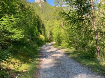
Champcella, Hautes-Alpes: Best trails, routes and walks

3 comments

Champcella: Discover the best trails: 20 hiking trails and 1 bike and mountain-bike routes. All these trails, routes and outdoor activities are available in our SityTrail applications for smartphones and tablets.


The best trails (28)
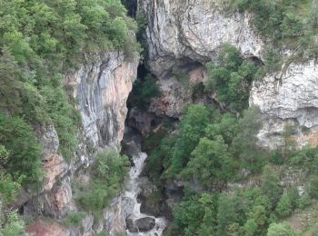
Trail Walking Champcella - Gouffre de Gourfouran - Photo
Walking 5.117
Km

Walking

Easy
(2)
Champcella, Provence-Alpes-Côte d'Azur, Hautes-Alpes, France
5.1 km | 8.1 km-effort
2h 2min
225 m
224 m
Yes
CYCLOHC

Trail Walking Champcella - FRESSINIERES - SEYES 16.3KM - Photo
Walking 16.316
Km

Walking

Medium
(1)
Champcella, Provence-Alpes-Côte d'Azur, Hautes-Alpes, France
16.3 km | 28 km-effort
5h 44min
881 m
882 m
Yes
jpb83

Trail Touring skiing Champcella - Bienvenue à la citadelle de Roche Charnière au Ponteil - Photo
Touring skiing 10.084
Km

Touring skiing

Difficult
Champcella, Provence-Alpes-Côte d'Azur, Hautes-Alpes, France
10.1 km | 22 km-effort
2h 46min
923 m
922 m
Yes
tchoua

Trail Walking Champcella - 2020-09-10 Balade Gouffre du Gourfouran - Photo
Walking 4.803
Km
GUIDE

Walking

Very easy
Champcella, Provence-Alpes-Côte d'Azur, Hautes-Alpes, France
4.8 km | 7.8 km-effort
1h 14min
223 m
223 m
Yes
holtzv

Trail Walking Champcella - Seyes - Col de Tramouillon - Photo
Walking 16.301
Km

Walking

Easy
Champcella, Provence-Alpes-Côte d'Azur, Hautes-Alpes, France
16.3 km | 28 km-effort
5h 35min
883 m
884 m
Yes
th.feur

Trail Walking Champcella - col de tramouillon depuis Champcella - Photo
Walking 15.744
Km

Walking

Medium
Champcella, Provence-Alpes-Côte d'Azur, Hautes-Alpes, France
15.7 km | 29 km-effort
5h 50min
1005 m
1008 m
Yes
margotte

Trail Walking Champcella - col de Tramouillon depuis Champcella - Photo
Walking 15.743
Km

Walking

Medium
Champcella, Provence-Alpes-Côte d'Azur, Hautes-Alpes, France
15.7 km | 29 km-effort
3h 46min
1004 m
1007 m
Yes
margotte

Trail Walking Champcella - seyes-col de troumaillon - Photo
Walking 12.936
Km

Walking

Medium
Champcella, Provence-Alpes-Côte d'Azur, Hautes-Alpes, France
12.9 km | 25 km-effort
4h 55min
868 m
869 m
Yes
herve.feurprier

Trail Mountain bike Champcella - Espace VTT FFC Pays des Ecrins - Circuit n°10 - Circuit de Rame - Photo
Mountain bike 4.099
Km

Mountain bike

Easy
Champcella, Provence-Alpes-Côte d'Azur, Hautes-Alpes, France
4.1 km | 4.6 km-effort
19min
35 m
32 m
Yes
tracegps

Trail Snowshoes Champcella - raquettes dans les Écrin  - Photo
Snowshoes 12.585
Km

Snowshoes

Medium
Champcella, Provence-Alpes-Côte d'Azur, Hautes-Alpes, France
12.6 km | 23 km-effort
6h 40min
752 m
762 m
Yes
Robert Jousset

Trail Walking Champcella - biaisse 090921 - Photo
Walking 55.996
Km
GUIDE

Walking

Very easy
Champcella, Provence-Alpes-Côte d'Azur, Hautes-Alpes, France
56 km | 67 km-effort
4h 9min
835 m
722 m
No
David25400

Trail Walking Champcella - Col de Tramouillon - Photo
Walking 17.793
Km

Walking

Difficult
Champcella, Provence-Alpes-Côte d'Azur, Hautes-Alpes, France
17.8 km | 35 km-effort
4h 55min
1378 m
1003 m
No
djrem971

Trail Touring skiing Champcella - crête des Rougnoux - Photo
Touring skiing 15.776
Km

Touring skiing

Medium
Champcella, Provence-Alpes-Côte d'Azur, Hautes-Alpes, France
15.8 km | 35 km-effort
6h 9min
1437 m
1438 m
Yes
orsel

Trail Walking Champcella - col de tramouillon - Photo
Walking 11.917
Km

Walking

Medium
Champcella, Provence-Alpes-Côte d'Azur, Hautes-Alpes, France
11.9 km | 0 m-effort
5h 56min
0 m
0 m
Yes
mayaud

Trail Touring skiing Champcella - lac trouble  - Photo
Touring skiing 10.518
Km

Touring skiing

Very easy
Champcella, Provence-Alpes-Côte d'Azur, Hautes-Alpes, France
10.5 km | 22 km-effort
5h 16min
886 m
922 m
No
CABERMAT

Trail sport Champcella - Tricotage crête de Prenetz départ du Ponteil - Photo
sport 16.466
Km

sport

Very easy
Champcella, Provence-Alpes-Côte d'Azur, Hautes-Alpes, France
16.5 km | 36 km-effort
Unknown
1472 m
1475 m
Yes
mjjcuenoud

Trail Walking Champcella - Tour de la tête de Gaulent et Aiguillas  - Photo
Walking 14.953
Km

Walking

Medium
Champcella, Provence-Alpes-Côte d'Azur, Hautes-Alpes, France
15 km | 28 km-effort
12h 1min
1002 m
1040 m
Yes
orsel

Trail Touring skiing Champcella - crête des Rougnoux - Photo
Touring skiing 17.296
Km

Touring skiing

Difficult
Champcella, Provence-Alpes-Côte d'Azur, Hautes-Alpes, France
17.3 km | 37 km-effort
7h 29min
1455 m
1451 m
Yes
orsel

Trail Walking Champcella - gouffre de Gourfouran + col de l Aiguille  - Photo
Walking 9.354
Km

Walking

Difficult
Champcella, Provence-Alpes-Côte d'Azur, Hautes-Alpes, France
9.4 km | 16.4 km-effort
5h 13min
529 m
529 m
Yes
jmgeffrin

Trail Walking Champcella - 2021-11-19 Champcella - Photo
Walking 11.05
Km

Walking

Very difficult
Champcella, Provence-Alpes-Côte d'Azur, Hautes-Alpes, France
11.1 km | 19.2 km-effort
4h 47min
614 m
614 m
Yes
guyverot

20 trails displayed on 28

FREE GPS app for hiking

Logo SityTrail SityTrail

IGN / Geographical institutes

Download SityTrail from the App Store Download SityTrail from Google Play

Logo SityTrail SityTrail World

The world is yours!

Download SityTrail from the App Store Download SityTrail from Google Play Download SityTrail on Huawei AppGallery

Activities

Close
My subscriptions