Aosta Valley, Italy: Best trails, routes and walks

11 comments

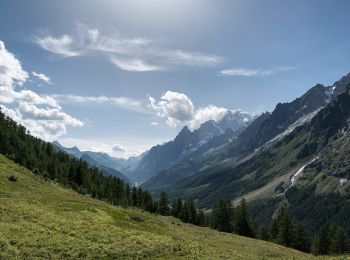
Aosta Valley: Discover the best trails: 584 hiking trails and 17 bike and mountain-bike routes. All these trails, routes and outdoor activities are available in our SityTrail applications for smartphones and tablets.


The best trails (695)

Trail On foot Pontboset - Alta Via n. 2 della Valle d'Aosta - Tappa 14 - Photo
On foot 14
Km
GUIDE+

On foot

Medium
(0)
Pontboset, Aosta Valley, Unknown, Italy
14.3 km | 31 km-effort
6h 56min
1012 m
1834 m
No
SityTrail - Marked Routes

• Crest - Donnas Alte Vie Website: http://www.lovevda.it/it/banca-dati/7/alte-vie/valle-d-aosta/crest-donnas/2978

Trail On foot Valsavarenche - Alta Via n. 2 della Valle d'Aosta - Tappa 8 - Photo
On foot 17
Km
GUIDE+

On foot

Difficult
(0)
Valsavarenche, Aosta Valley, Unknown, Italy
17.2 km | 36 km-effort
8h 15min
1668 m
741 m
No
SityTrail - Marked Routes

• Eaux-Rousses - Rifugio Vittorio Sella Alte Vie Website: http://www.lovevda.it/it/banca-dati/7/alte-vie/-valle-d-aos...

Trail On foot Cogne - Alta Via n. 2 della Valle d'Aosta - Tappa 9 - Photo
On foot 8.18
Km
GUIDE+

On foot

Easy
(0)
Cogne, Aosta Valley, Unknown, Italy
8.2 km | 11.8 km-effort
2h 40min
13 m
1046 m
No
SityTrail - Marked Routes

• Rifugio Vittorio Sella - Cogne Alte Vie Website: http://www.lovevda.it/it/banca-dati/7/alte-vie/valle-d-aosta/rifug...

Trail On foot Valgrisenche - Alta Via n. 2 della Valle d'Aosta - Tappa 6 - Photo
On foot 7.33
Km
GUIDE+

On foot

Easy
(0)
Valgrisenche, Aosta Valley, Unknown, Italy
7.3 km | 15.9 km-effort
3h 36min
481 m
1129 m
No
SityTrail - Marked Routes

• Rifugio Chalet de l'Epée - Rhêmes-Notre-Dame Alte Vie Website: http://www.lovevda.it/it/banca-dati/7/alte-vie/valle...

Trail On foot Rhêmes-Notre-Dame - Alta Via n. 2 della Valle d'Aosta - Tappa 7 - Photo
On foot 16
Km
GUIDE+

On foot

Difficult
(0)
Rhêmes-Notre-Dame, Aosta Valley, Unknown, Italy
15.7 km | 33 km-effort
7h 26min
1269 m
1323 m
No
SityTrail - Marked Routes

• Rhêmes-Notre-Dame - Eaux-Rousses Alte Vie Website: http://www.lovevda.it/it/banca-dati/7/alte-vie/valle-d-aosta/rhe...

Trail On foot Arvier - Alta Via n. 2 della Valle d'Aosta - Tappa 5 - Photo
On foot 12
Km
GUIDE+

On foot

Medium
(0)
Arvier, Aosta Valley, Unknown, Italy
12.1 km | 23 km-effort
5h 14min
1028 m
214 m
No
SityTrail - Marked Routes

• Planaval - Rifugio Chalet de l'Epée Alte Vie Website: http://www.lovevda.it/it/banca-dati/7/alte-vie/-valle-d-aosta...

Trail On foot La Thuile - Alta Via n. 2 della Valle d'Aosta - Tappa 4 - Photo
On foot 16
Km
GUIDE+

On foot

Difficult
(0)
La Thuile, Aosta Valley, Unknown, Italy
15.6 km | 34 km-effort
7h 47min
1169 m
2089 m
No
SityTrail - Marked Routes

• Rifugio Alberto Deffeyes - Planaval Alte Vie Website: http://www.lovevda.it/it/banca-dati/7/alte-vie/valle-d-aosta/...

Trail On foot La Thuile - Alta Via n. 2 della Valle d'Aosta - Tappa 3 - Photo
On foot 8.93
Km
GUIDE+

On foot

Easy
(0)
La Thuile, Aosta Valley, Unknown, Italy
8.9 km | 19.8 km-effort
4h 30min
1071 m
55 m
No
SityTrail - Marked Routes

• La Thuile - Rifugio Alberto Deffeyes Alte Vie Website: http://www.lovevda.it/it/banca-dati/7/alte-vie/-valle-d-aost...

Trail On foot Courmayeur - Alta Via n. 2 della Valle d'Aosta - Tappa 2 - Photo
On foot 18
Km
GUIDE+

On foot

Medium
(0)
Courmayeur, Aosta Valley, Unknown, Italy
17.9 km | 27 km-effort
6h 10min
515 m
1228 m
No
SityTrail - Marked Routes

• Rifugio Elisabetta Soldini - La Thuile Alte Vie Website: http://www.lovevda.it/it/banca-dati/7/alte-vie/valle-d-aos...

Trail On foot Courmayeur - Alta Via n. 2 della Valle d'Aosta - Tappa 1 - Photo
On foot 15
Km
GUIDE+

On foot

Difficult
(0)
Courmayeur, Aosta Valley, Unknown, Italy
15.2 km | 32 km-effort
7h 15min
1508 m
513 m
No
SityTrail - Marked Routes

• Courmayeur - Rifugio Elisabetta Soldini Alte Vie Website: http://www.lovevda.it/it/banca-dati/7/alte-vie/-valle-d-a...

Trail On foot Saint-Rhémy-en-Bosses - Alta Via n. 1 della Valle d'Aosta - Tappa 16 - Photo
On foot 7.48
Km
GUIDE+

On foot

Easy
(0)
Saint-Rhémy-en-Bosses, Aosta Valley, Unknown, Italy
7.5 km | 14.5 km-effort
3h 17min
408 m
881 m
No
SityTrail - Marked Routes

• Rifugio Frassati - Rifugio Walter Bonatti Alte Vie Website: http://www.lovevda.it/it/banca-dati/7/alte-vie/valle-d-...

Trail On foot Courmayeur - Alta Via n. 1 della Valle d'Aosta - Tappa 17 - Photo
On foot 12
Km
GUIDE+

On foot

Easy
(0)
Courmayeur, Aosta Valley, Unknown, Italy
11.9 km | 18.2 km-effort
4h 8min
269 m
1086 m
No
SityTrail - Marked Routes

• Rifugio Walter Bonatti - Courmayeur Alte Vie Website: http://www.lovevda.it/it/banca-dati/7/alte-vie/valle-d-aosta/...

Trail On foot Ayas - Alta Via n. 1 della Valle d'Aosta - Tappa 8 - Photo
On foot 8.77
Km
GUIDE+

On foot

Easy
(0)
Ayas, Aosta Valley, Unknown, Italy
8.8 km | 16.3 km-effort
3h 42min
312 m
1320 m
No
SityTrail - Marked Routes

• Rifugio Grand Tournalin - Valtournenche Alte Vie Website: http://www.lovevda.it/it/banca-dati/7/alte-vie/valle-d-ao...

Trail On foot Valtournenche - Alta Via n. 1 della Valle d'Aosta - Tappa 9 - Photo
On foot 4.50
Km
GUIDE+

On foot

Easy
(0)
Valtournenche, Aosta Valley, Unknown, Italy
4.5 km | 11.2 km-effort
2h 32min
658 m
21 m
No
SityTrail - Marked Routes

• Valtournenche - Rifugio Barmasse Alte Vie Website: http://www.lovevda.it/it/banca-dati/7/alte-vie/valle-d-aosta/val...

Trail On foot Fontainemore - Alta Via n. 1 della Valle d'Aosta - Tappa 4 - Photo
On foot 14
Km
GUIDE+

On foot

Medium
(0)
Fontainemore, Aosta Valley, Unknown, Italy
14 km | 30 km-effort
6h 43min
1049 m
1534 m
No
SityTrail - Marked Routes

• Trail created by Regione Autonoma Valle d'Aosta. Website: http://www.lovevda.it/it/banca-dati/7/alte-vie/-valle-d-...

Trail On foot Gaby - Alta Via n. 1 della Valle d'Aosta - Tappa 5 - Photo
On foot 18
Km
GUIDE+

On foot

Difficult
Gaby, Aosta Valley, Unknown, Italy
18 km | 33 km-effort
7h 27min
1065 m
1239 m
No
SityTrail - Marked Routes

• Niel - Gressoney-Saint-Jean Alte Vie Website: http://www.lovevda.it/it/banca-dati/7/alte-vie/valle-d-aosta/niel-gre...

Trail On foot Donnas - Alta Via n. 1 della Valle d'Aosta - Tappa 1 - Photo
On foot 13
Km
GUIDE+

On foot

Medium
(0)
Donnas, Aosta Valley, Unknown, Italy
12.6 km | 30 km-effort
6h 45min
1551 m
503 m
No
SityTrail - Marked Routes

• Donnas - Sassa Alte Vie Website: http://www.lovevda.it/it/banca-dati/7/alte-vie/valle-d-aosta/donnas-sassa/2977

Trail On foot Valsavarenche - IT-3A - Photo
On foot 3.43
Km
GUIDE+

On foot

Easy
(0)
Valsavarenche, Aosta Valley, Unknown, Italy
3.4 km | 10 km-effort
2h 16min
660 m
0 m
No
SityTrail - Marked Routes

• 2017/07/07, collapsed bridge (altitude 2322m) temporary closed, possible bypass for the upstream bridge at an altitud...

Trail Walking Valgrisenche - 7 Refuge Bezzi Col du rocher blanc (Col Vaudet) 2882 m Le Monal  Ste Foy 650 m -1400 m - Photo
Walking 15
Km
GUIDE

Walking

Very difficult
Valgrisenche, Aosta Valley, Unknown, Italy
15.5 km | 26 km-effort
5h 52min
604 m
1310 m
No
jouans

Trail Walking Rhêmes-Notre-Dame - 6 Refuge Benevolo Col Bassac Déré Pointe de la Traversière 3338 m refuge Bezzi + 1180 m - 1180 m - Photo
Walking 13
Km
GUIDE

Walking

Very difficult
Rhêmes-Notre-Dame, Aosta Valley, Unknown, Italy
13.4 km | 27 km-effort
6h 9min
1024 m
1028 m
No
jouans

20 trails displayed on 695

FREE GPS app for hiking

Logo SityTrail SityTrail

IGN / Geographical institutes

Download SityTrail from the App Store Download SityTrail from Google Play

Logo SityTrail SityTrail Plus

The world is yours!

Download SityTrail from the App Store Download SityTrail from Google Play Download SityTrail on Huawei AppGallery

Activities

Nearby regions

Close
My subscriptions