Point of interest Vollore-Ville - 1 - Photo

1

Description

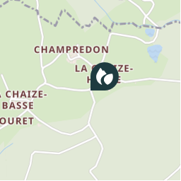
1 - Traverser la Chaize-Haute (vue sur le grün de Chignore) et prendre un chemin dans les bois. Monter par la voie pavée ; plus haut, franchir un ruisseau. Aux deux carrefours suivants, continuer en face, puis tourner à droite vers Rochemulet (vue sur la plaine de la Limagne, la Chaîne des Puys et le massif du Sancy). Prendre la route à gauche, puis la première piste à droite.

Photos

1 can be discovered in the following trails...
Trail Other activity Vollore-Ville - Sans titre - Photo
Other activity
Zeugma13

Other activity

Very easy
Vollore-Ville, Auvergne-Rhône-Alpes, Puy-de-Dôme, France
15.8 km | 25 km-effort
Unknown
Yes
 Zeugma13
Zeugma13

User

© OpenStreetMap contributors

Positioning

Country:
France
Region :
Auvergne-Rhône-Alpes
Department/Province :
Puy-de-Dôme
Municipality :
Vollore-Ville
Location:
Unknown
Creation date :
2019-01-15 13:58:19.162
Updated on
2019-01-15 13:58:19.162

(0 Reviews)


Points of interest nearby

Point of interest Vollore-Ville - START - Photo
gpstracks
VOLLORE-VILLE 
Point of interest Sainte-Agathe - 2 - Photo
Zeugma13
SAINTE-AGATHE 
Point of interest Vollore-Ville - D - Photo
Zeugma13
VOLLORE-VILLE 
Point of interest Vollore-Ville - 4 - Photo
Zeugma13
VOLLORE-VILLE 
Point of interest Vollore-Ville - Begraafplaats - Photo
gpstracks
VOLLORE-VILLE 
Point of interest Vollore-Ville - Vollore-Ville Centre - Photo
gpstracks
VOLLORE-VILLE 
Point of interest Vollore-Ville - Chateau Vollore - Photo
gpstracks
VOLLORE-VILLE 
Point of interest Vollore-Ville - 3 - Photo
Zeugma13
VOLLORE-VILLE 


Close
My subscriptions