Home
World
NEW
Premium
Shop
Trails
Articles
Help and support
Français
English
Nederlands
Español
Italiano
Deutsch
Log in
Home
World
Premium
Shop
Trails
Articles
Help and support
SityTrail
>
Points of interest
>
Chemin difficile
SityTrail
>
Points of interest
>
Chemin difficile
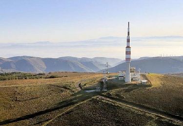
Chemin difficile
Description
Photos
Chemin difficile can be discovered in the following trails...
jpipacific
Ballade dans le parc du haut languedoc
Moto cross
Medium
Réalmont, Occitania, Tarn, France
275 km | 358 km-effort
7h 43min
No
jpipacific
User
©
OpenStreetMap
contributors
Positioning
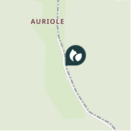
Country:
France
Region :
Occitania
Department/Province :
Tarn
Municipality :
Roquecourbe
Location:
Unknown
Positioning
43.690686931903485 / 2.2865194986545627
Creation date :
2021-06-23 10:00:13.214
Updated on
2021-06-23 10:32:08.979
(0 Reviews)
Danger
Comments
Please log in to post a review or rate the element
Points of interest nearby
jpipacific
Début du chemin
ROQUECOURBE
jpipacific
Chemin perdu
ROQUECOURBE
jpipacific
Barrière fermée
ROQUECOURBE
jpipacific
Entrée tunel
LACROUZETTE
guiller
Point 10
BURLATS
CANON2
Mon point
MONTREDON-LABESSONNIÉ
CANON2
Mon point
MONTREDON-LABESSONNIÉ
abemar75
OR-2512168:Castres-Revel 33...
CASTRES
Close
My subscriptions