Home
World
NEW
Premium
Shop
Trails
Articles
Help and support
Français
English
Nederlands
Español
Italiano
Deutsch
Log in
Home
World
Premium
Shop
Trails
Articles
Help and support
SityTrail
>
Points of interest
>
GCY40P
SityTrail
>
Points of interest
>
GCY40P
GCY40P
Description
Yzeron et Crêt de la Madone by
Photos
GCY40P can be discovered in the following trails...
tracegps
Col du Souffre et Lacs Mont-Coua
Walking
Difficult
(1)
Les Allues, Auvergne-Rhône-Alpes, Savoy, France
25 km | 41 km-effort
7h 0min
Yes
tracegps
User
©
OpenStreetMap
contributors
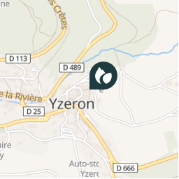
Positioning
Country:
France
Region :
Auvergne-Rhône-Alpes
Department/Province :
Rhône
Municipality :
Yzeron
Location:
Unknown
Positioning
45.708450023 / 4.591717030999999
Creation date :
2018-04-09 12:23:02.17
Updated on
2018-04-09 12:23:02.17
(0 Reviews)
Comments
Please log in to post a review or rate the element
Points of interest nearby
tracegps
GCY40P
YZERON
tracegps
GCY40P
YZERON
tracegps
GCY40P
YZERON
tracegps
GCY40P
YZERON
tracegps
GCY40P
YZERON
chuck
Cascade
YZERON
tracegps
GCTKN9
YZERON
tracegps
GCTKN9
YZERON
Close
My subscriptions