Home
World
NEW
Premium
Shop
Trails
Articles
Help and support
Français
English
Nederlands
Español
Italiano
Deutsch
Log in
Home
World
Premium
Shop
Trails
Articles
Help and support
SityTrail
>
Points of interest
>
GCYQX3
SityTrail
>
Points of interest
>
GCYQX3
GCYQX3
Description
Roche de la Poipe by Rockley,
Photos
GCYQX3 can be discovered in the following trails...
tracegps
Col du Souffre et Lacs Mont-Coua
Walking
Difficult
(1)
Les Allues, Auvergne-Rhône-Alpes, Savoy, France
25 km | 41 km-effort
7h 0min
Yes
tracegps
User
©
OpenStreetMap
contributors
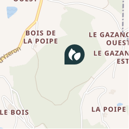
Positioning
Country:
France
Region :
Auvergne-Rhône-Alpes
Department/Province :
Rhône
Municipality :
Saint-Martin-en-Haut
Location:
Unknown
Positioning
45.68184997 / 4.578416962
Creation date :
2018-04-09 12:22:59.819
Updated on
2018-04-09 12:22:59.819
(0 Reviews)
Comments
Please log in to post a review or rate the element
Points of interest nearby
tracegps
GCYQX3
SAINT-MARTIN-EN-HAUT
tracegps
GCYQX3
SAINT-MARTIN-EN-HAUT
tracegps
GCYQX3
SAINT-MARTIN-EN-HAUT
tracegps
GCYQX3
SAINT-MARTIN-EN-HAUT
tracegps
GCYQX3
SAINT-MARTIN-EN-HAUT
tracegps
GC1CVE5
SAINT-MARTIN-EN-HAUT
tracegps
GCTKN9
YZERON
tracegps
GCTKN9
YZERON
Close
My subscriptions